Motorhome day fifteen: Wellington to Richmond
We had to set an early alarm today – an unusual experience by recent standards, but we had been warned that the early morning traffic into Wellington would be heavy and slow, and so it proved. We were accompanied in the traffic jam by several other vehicles just like ours, clearly heading for the InterIslander ferry.
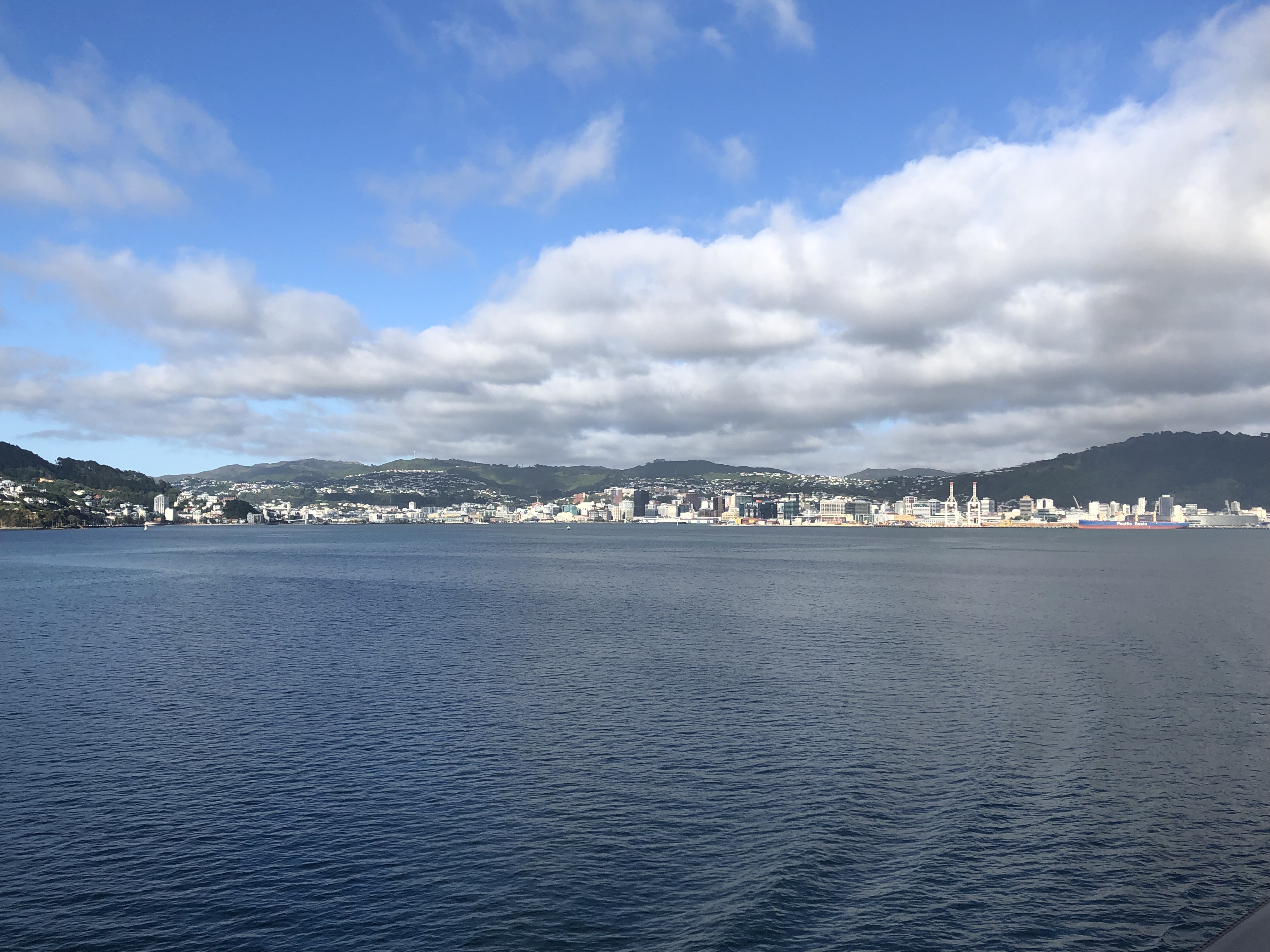
Check-in for the ferry was so efficient that our plan to make breakfast while waiting in the queue had to be shelved. We were ushered on board Kaitaki, our ferry, and found ourselves an excellent viewpoint in a glass atrium towards the stern. After a cloudy start to the day the sun was emerging as we pulled away from the quay, and there were some very good retrospective views as we sailed across Wellington’s harbour and into Cook Strait (in Māori: Te Moana-o-Raukawa).
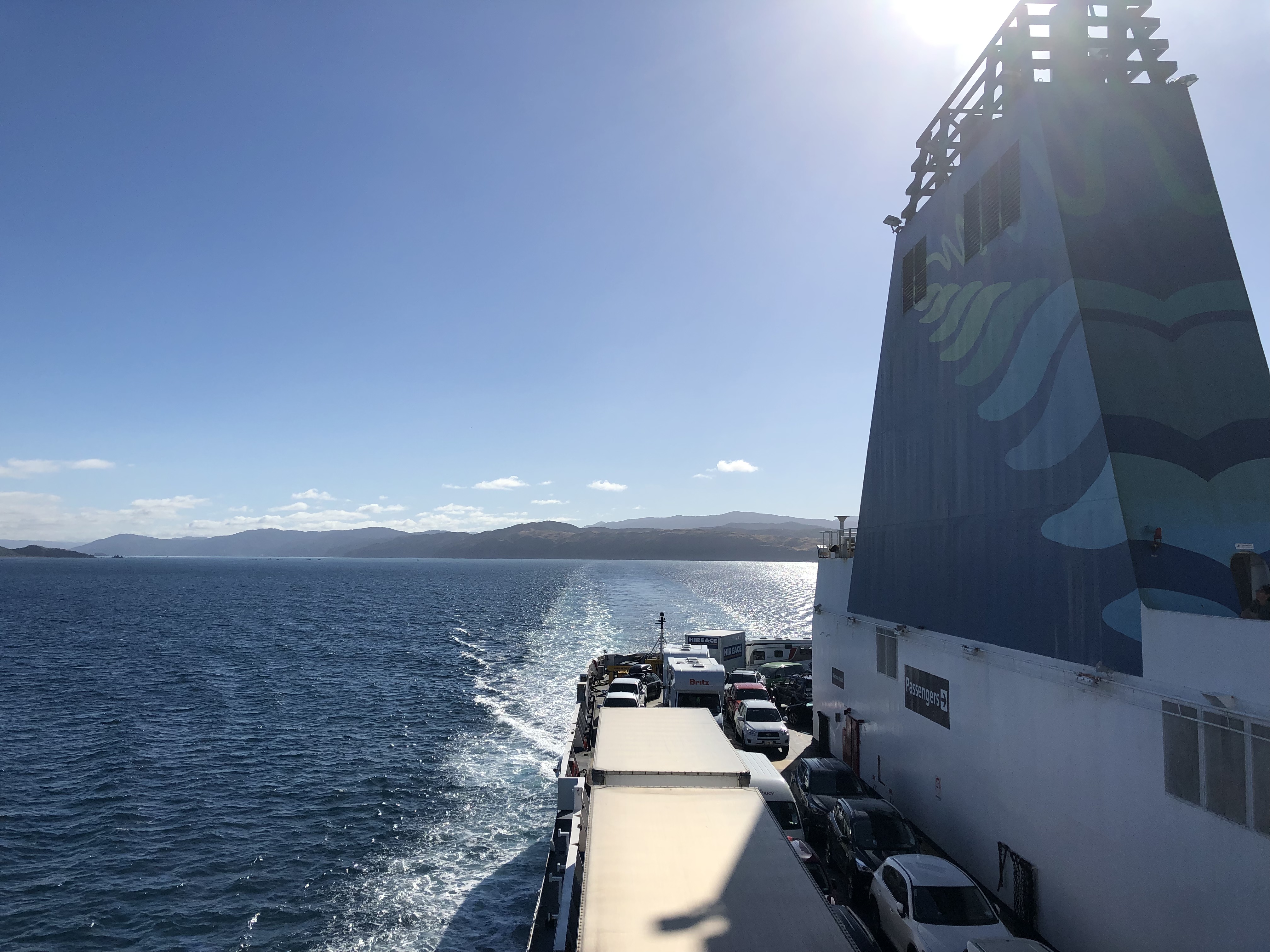
With the sun behind us and a very calm sea we headed along the coast of the North Island and then out into the strait.
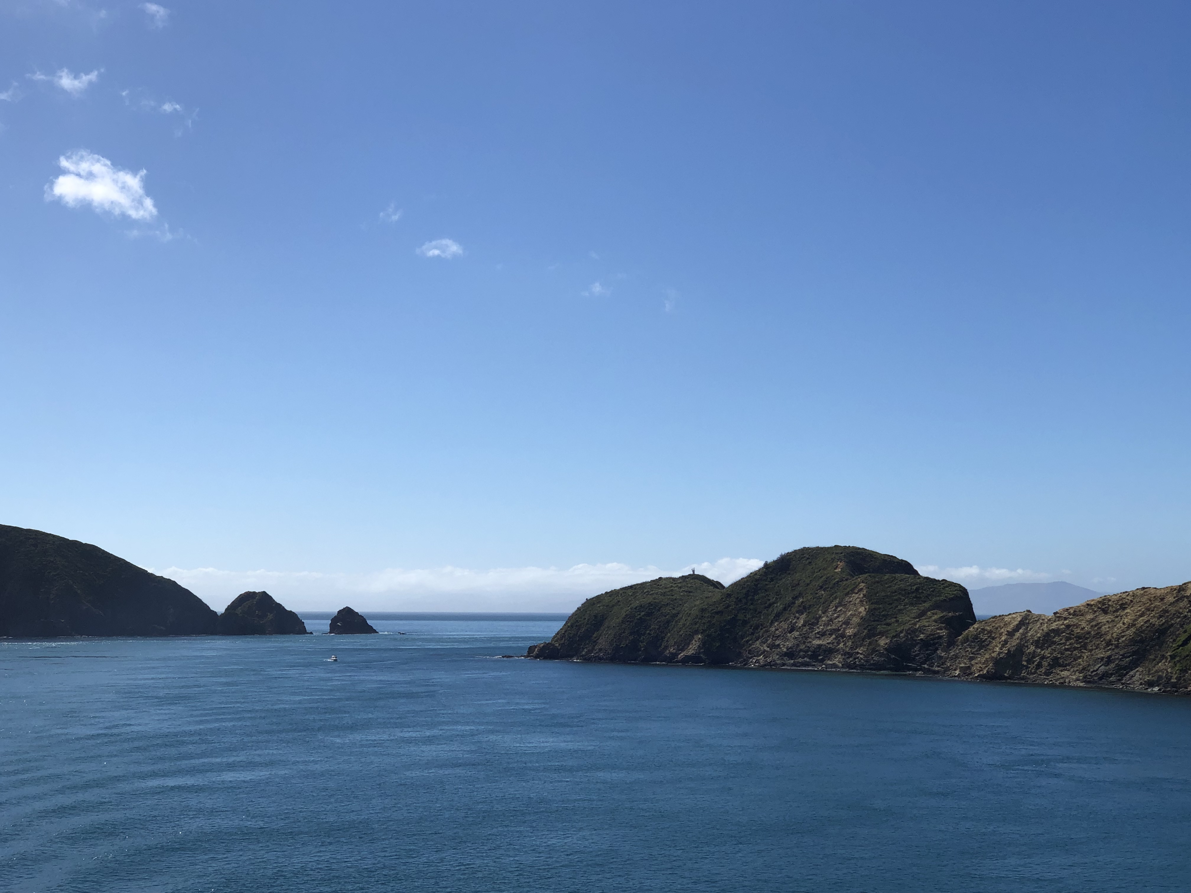
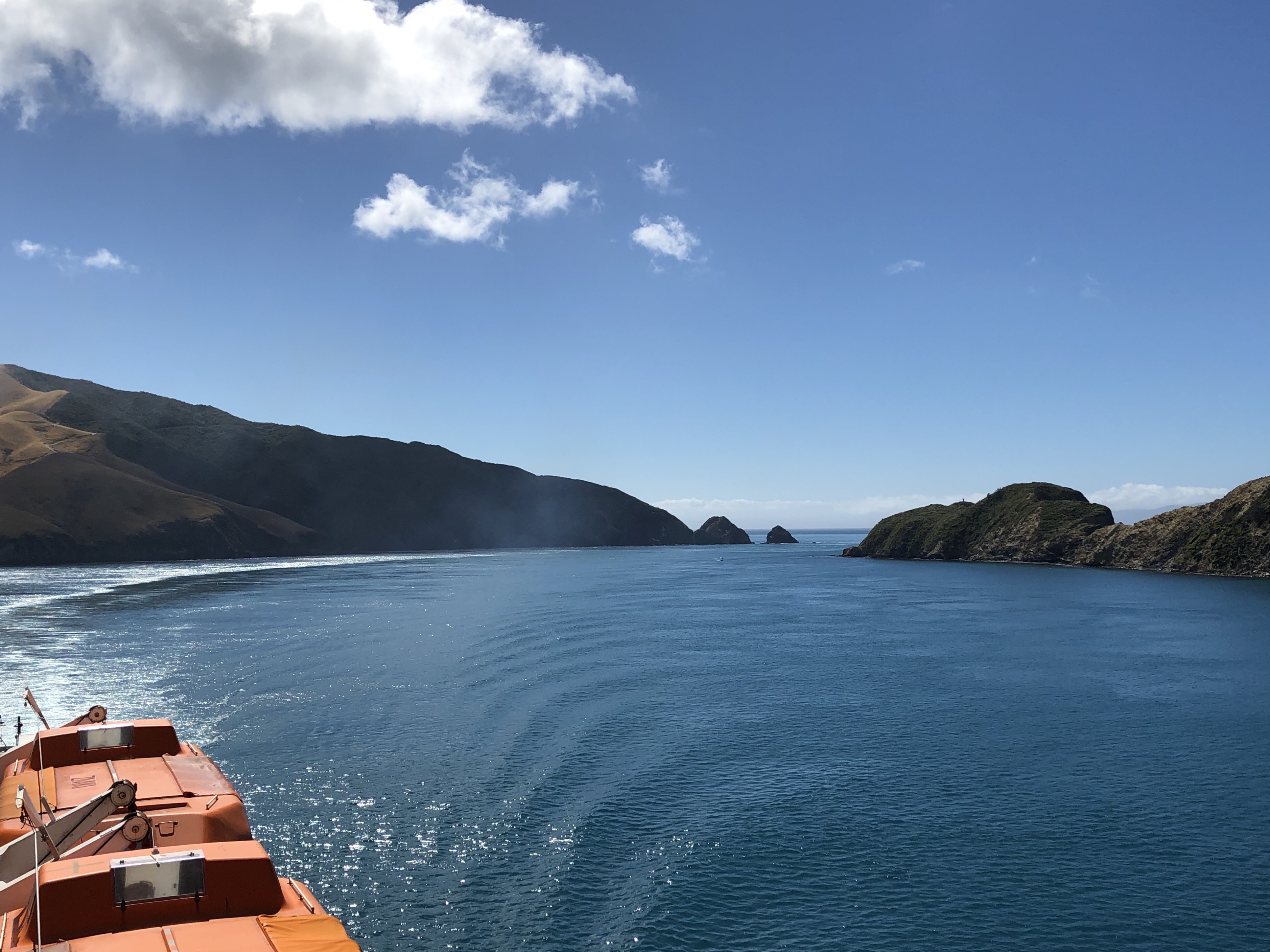
What an entrance to the South Island. We could see it in the distance, and seemed to be heading directly for the shore. Then the ferry slowed right down as we turned a tricky corner into the narrow inlet next to Arapawa Island.
The observation deck was mobbed; I almost had to employ sharp elbows to get into position on the railings for a long sequence of beautiful views as we sailed down the narrow twisty passage towards Picton. I’ll shut up now and let the views speak for themselves.
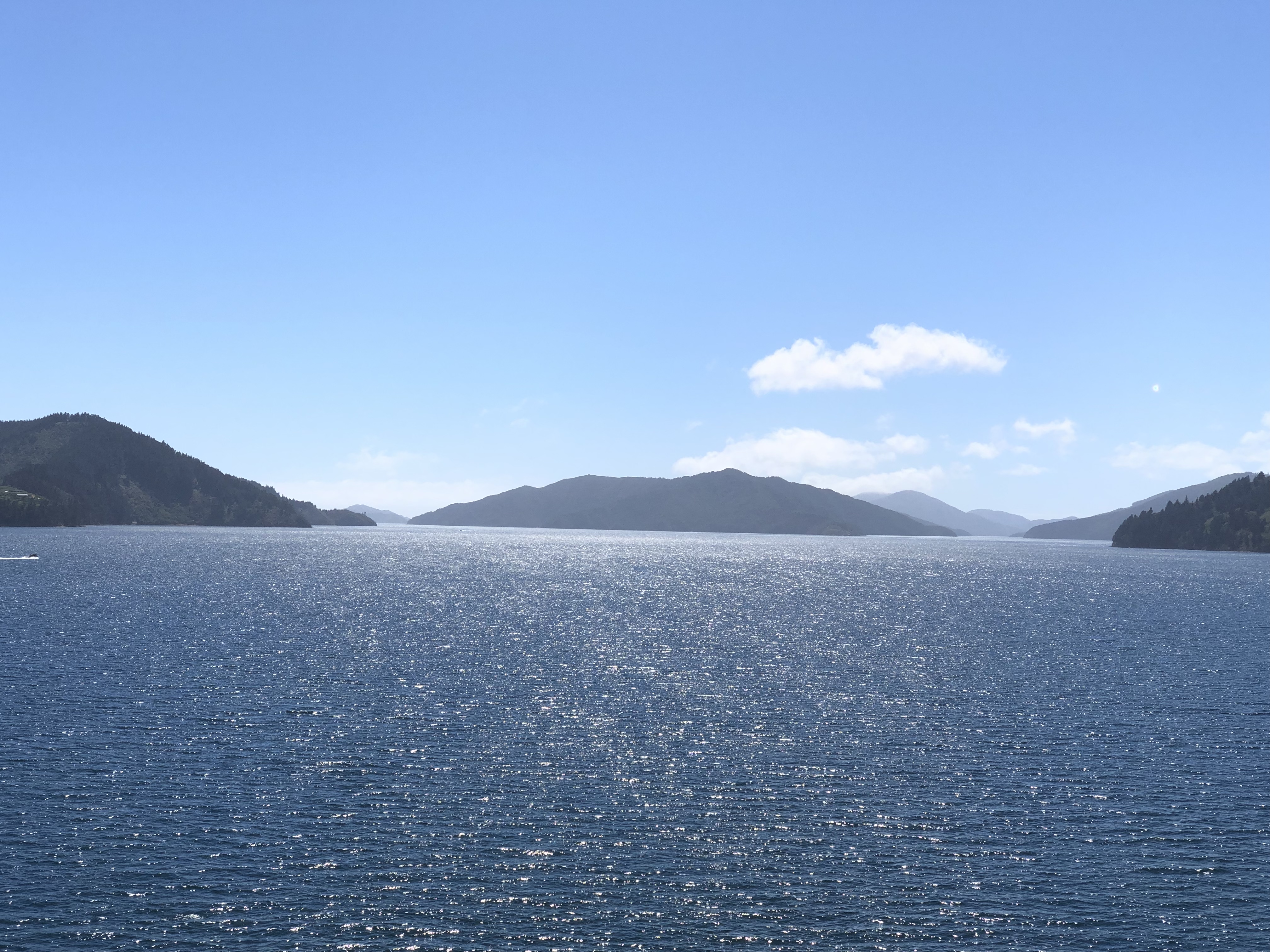
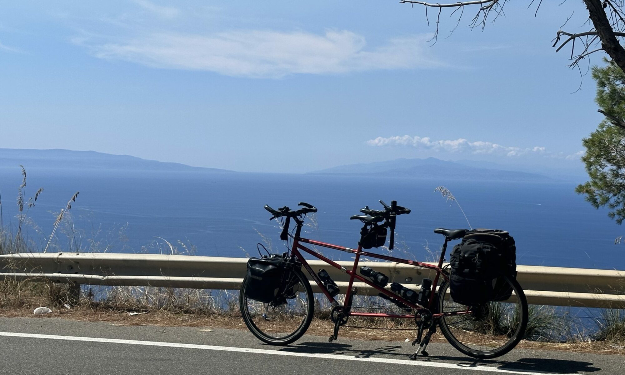
The unloading process was rapid, and we were soon on our way. The TomTom GPS device we were given with the motorhome is set up to choose roads suitable for larger vehicles, and on this occasion it really worked to our advantage. Instead of heading directly south onto State Highway 1 we were directed to Queen Charlotte Drive, a fabulous coastal road which wove in and out of the fjords in a westerly direction. It was utterly glorious – as usual our photography will fail to do justice to what we saw, but it looked something like this.
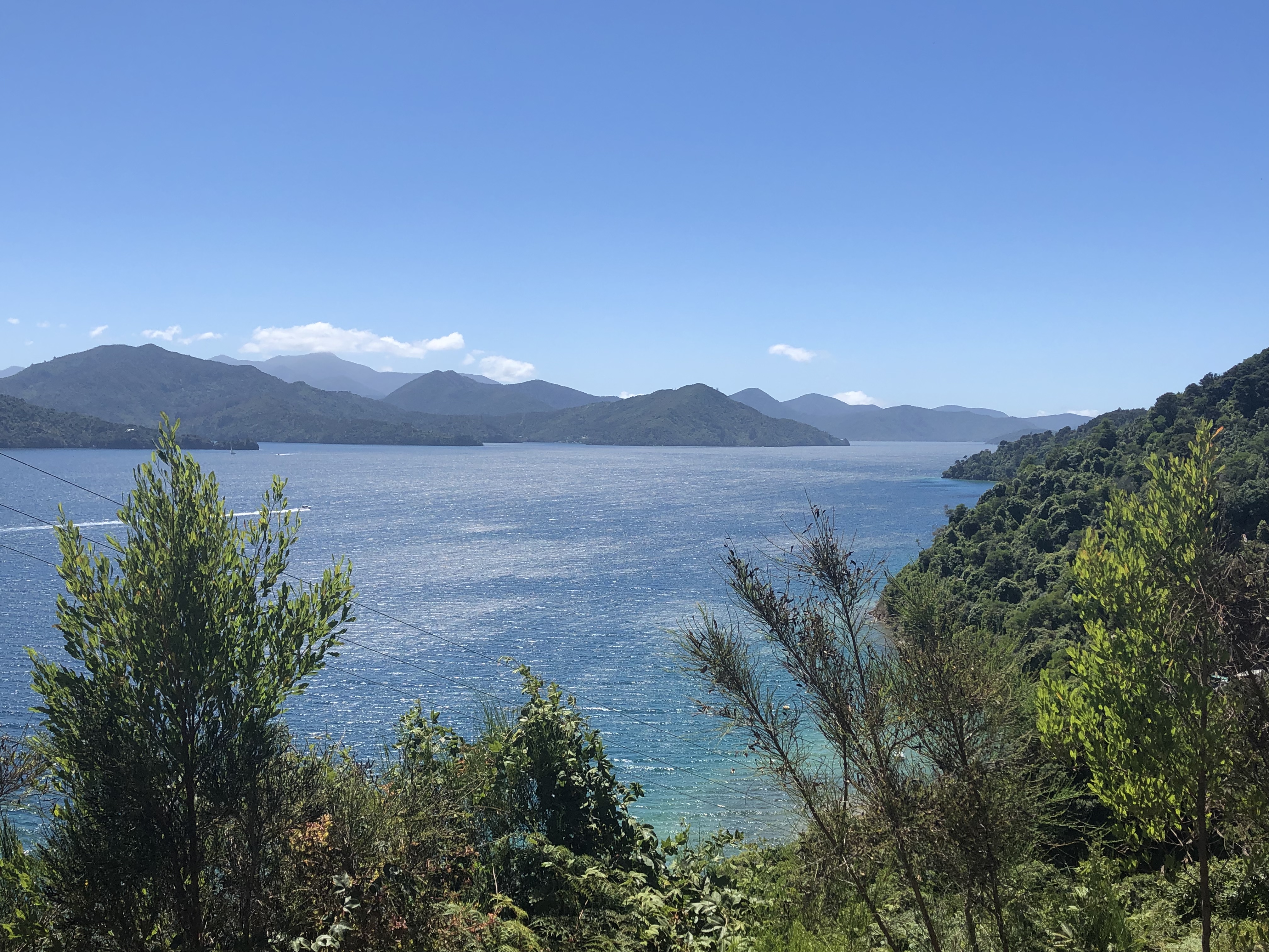
This amazing road continued for kilometre after kilometre, until we reached Havelock. Thereafter we turned inland, into an area of higher mountains, somewhat spoiled by mono-species planting of conifers. The contrast between managed and more natural woodland was stark – where there was unmanaged terrain we saw lush forest with huge variations in height, colour and appearance of the tree cover. The managed conifers were in rectilinear plantations, row upon row, as dull as ditchwater.
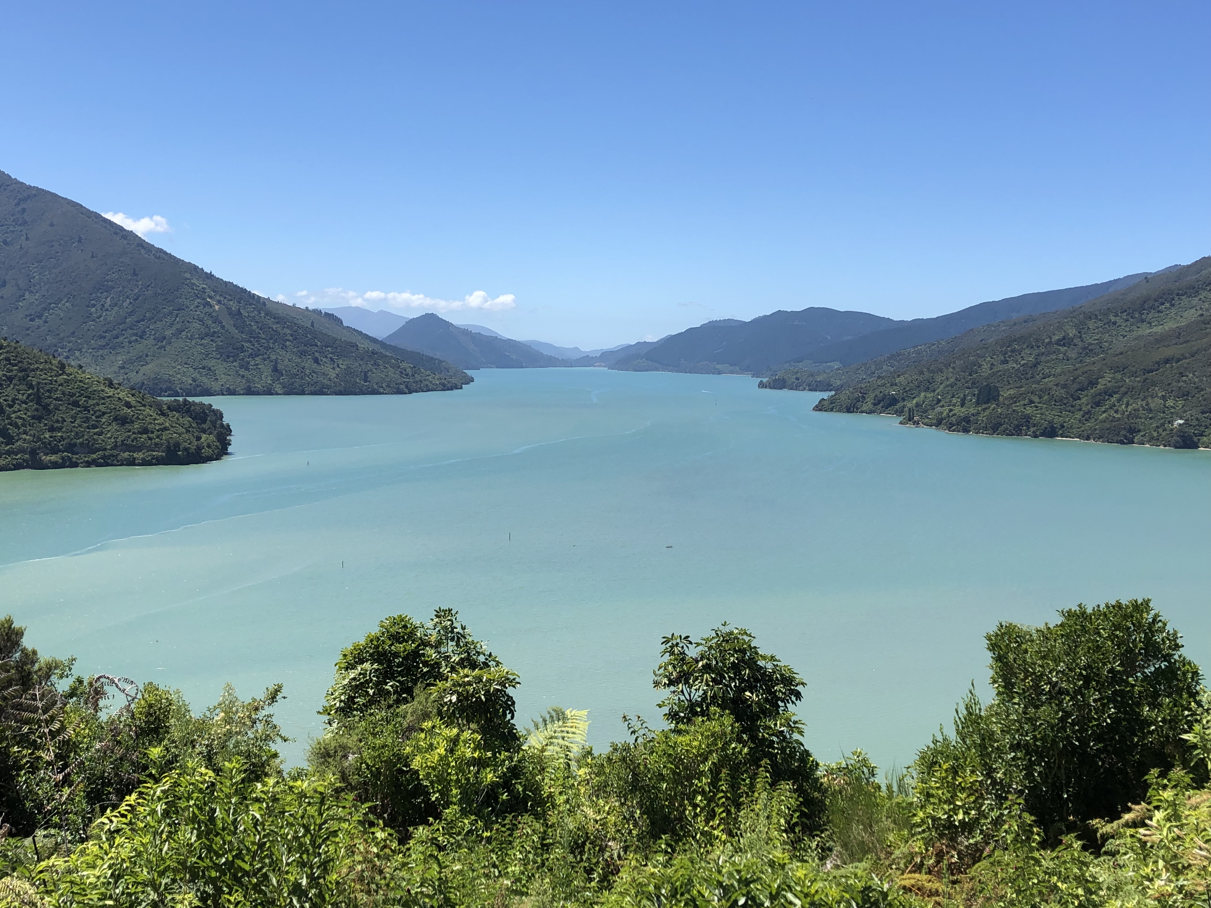
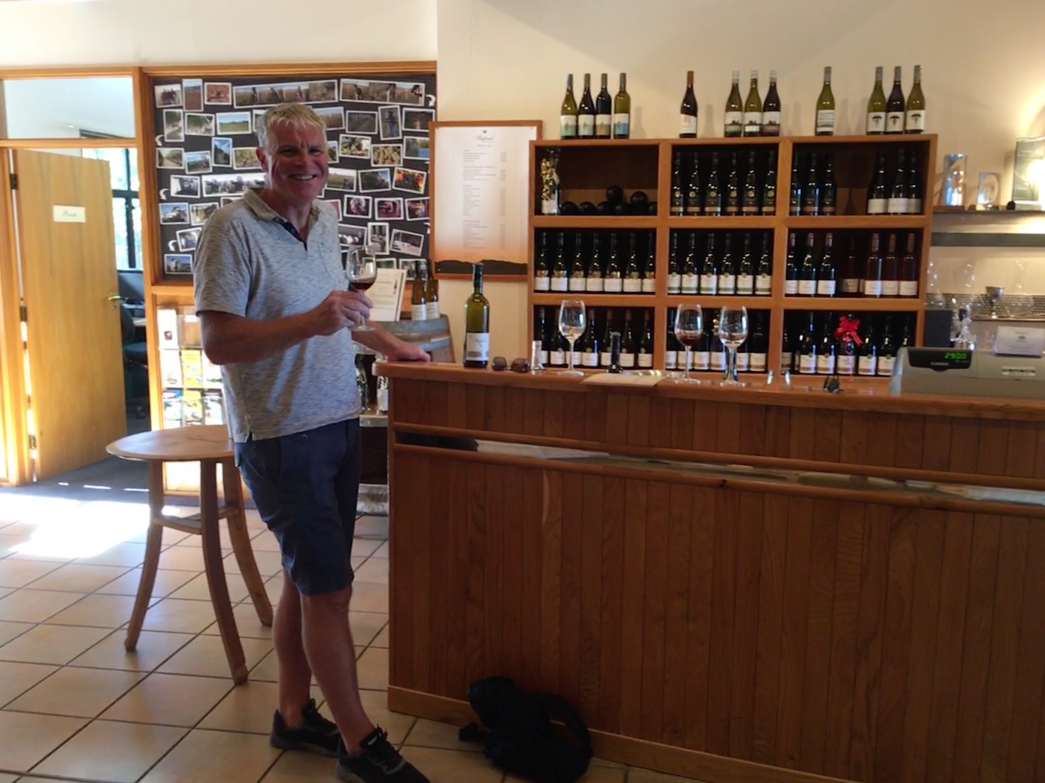
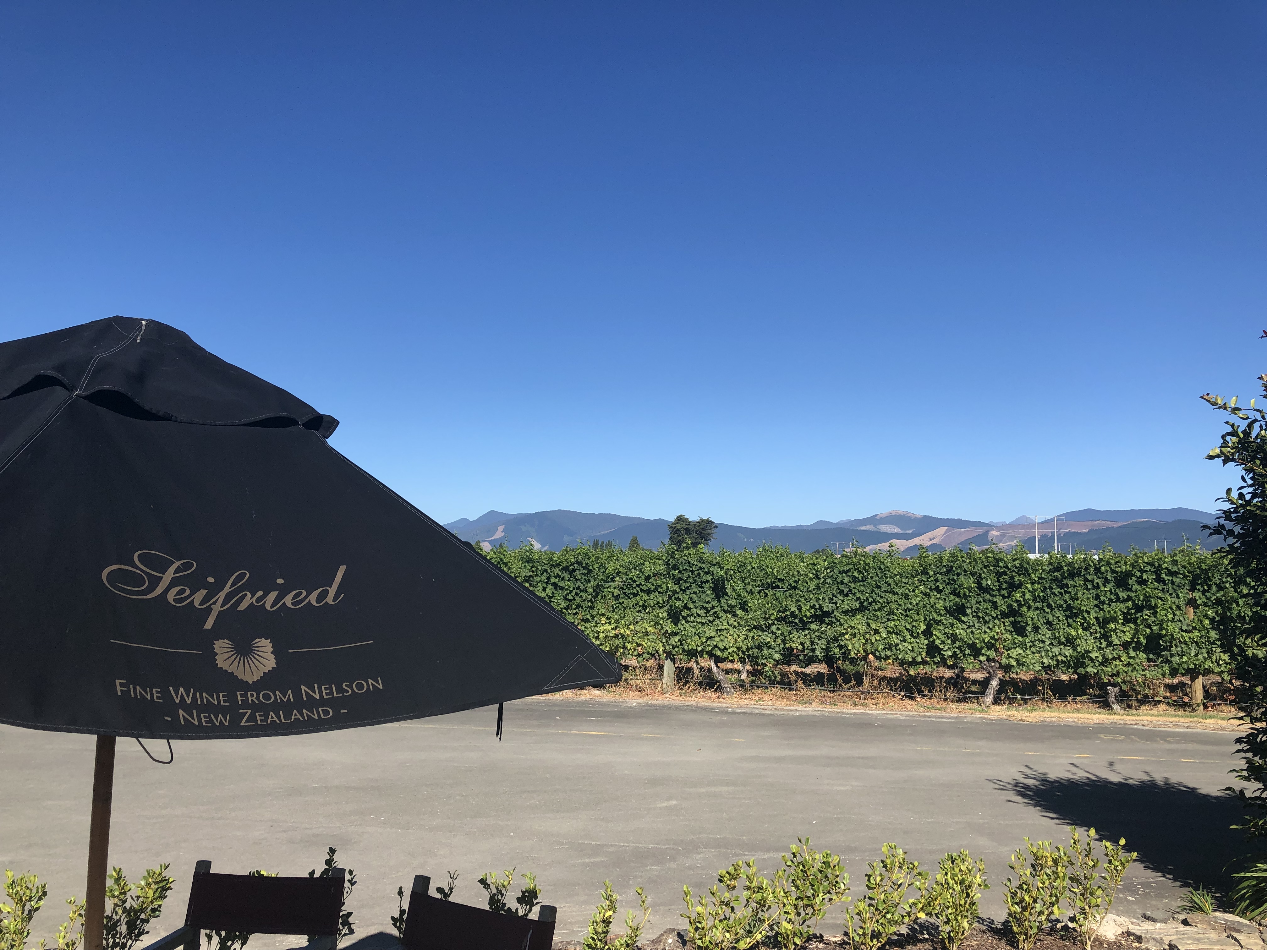
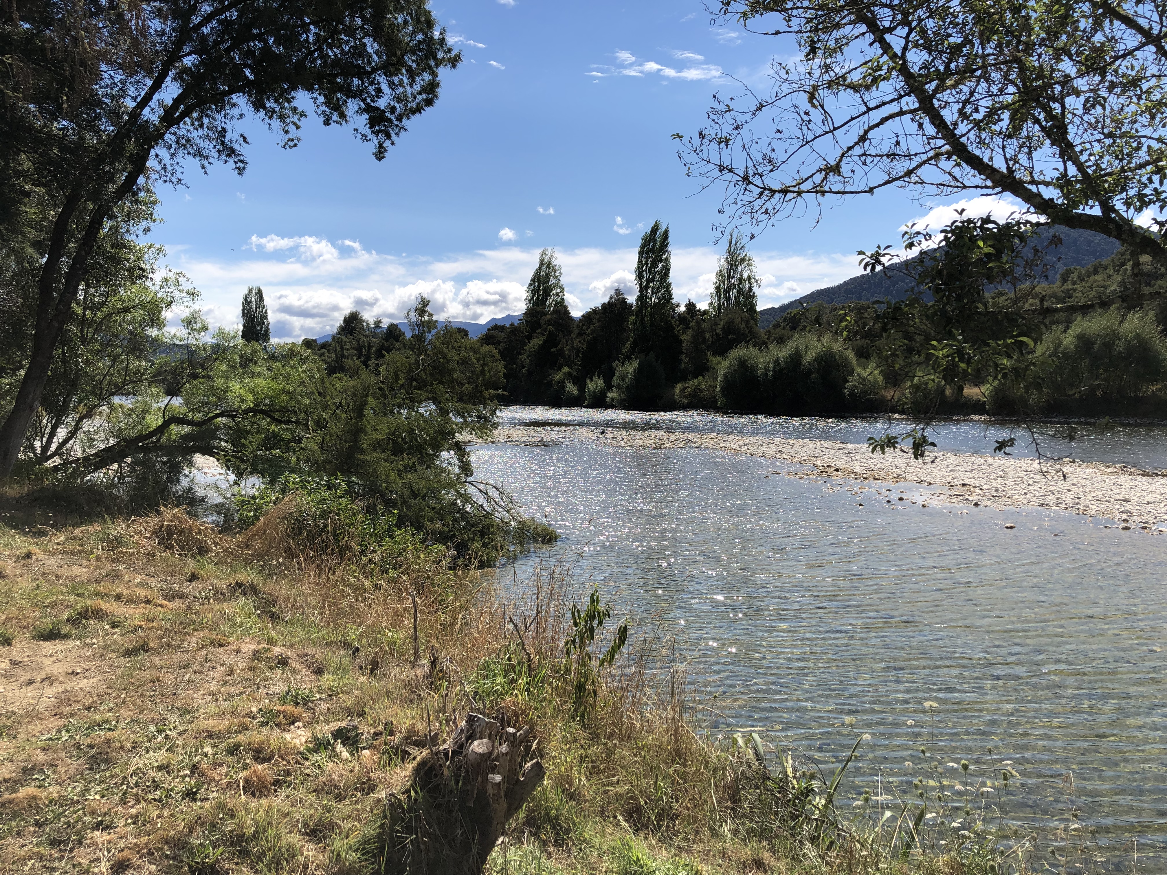
The road was still winding and varied, and soon enough we turned south towards Nelson. We were trying hard to make good time, as today was our day for tasting Seifried wines. When we had our “practice” week in a motorhome in Britain, we popped into Marks & Spencer in Malvern on our penultimate day. We opted to buy a New Zealand Pinot Noir, in order to whet our appetites for the journey ahead. It was a Seifried wine (sadly no longer stocked by M&S), and it was delicious. When, some weeks later, we visited Jenny and Chris we mentioned this wine, and Chris revealed that, purely by chance, we had selected a wine imported by his employer, John E Fells & Sons Ltd. So he got in touch with Marie at Seifried and organised a tasting for us!
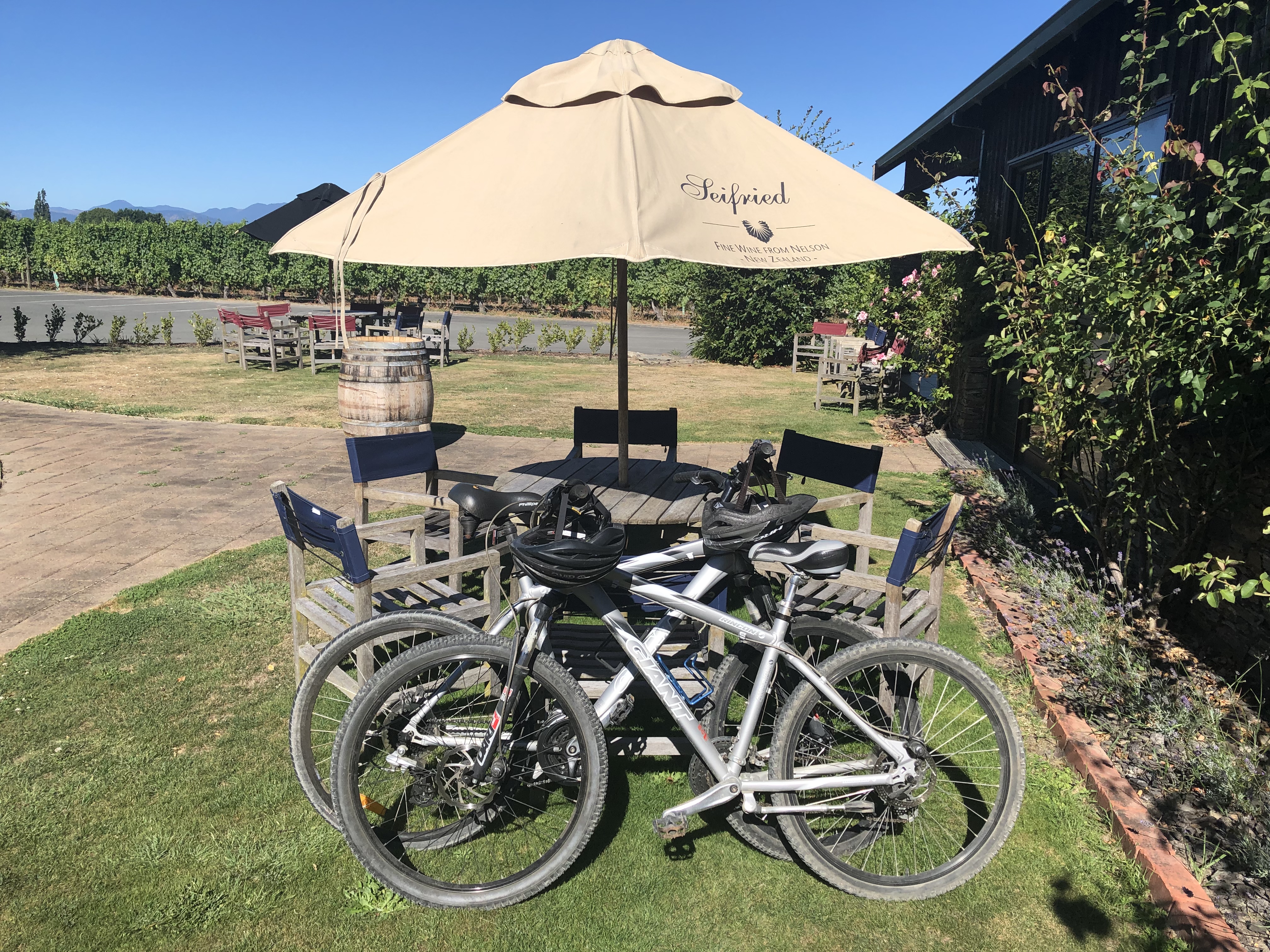
We had to get there first, though, and our campsite at Richmond was ten kilometres or so from the vineyard, and naturally we didn’t want to drive! Thinking ahead we had arranged with the campsite owners to borrow a couple of bikes (with helmets too, of course). We set off on a mixture of busy tarmac and quiet gravel roads, and only got lost a couple of times.
It was well worth it though, as Eliza at Seifried took us through a tasting of their Aotera and Seifried ranges – Sauvignon Blanc, Pinot Gris, Riesling, two different Pinot Noirs, a Zweigelt and finally a “Sweet Agnes” Reisling. It was fascinating, and we resolved to return the following day in the motorhome to purchase a bottle or two. Or ten.
Back to the campsite on the bikes, then, for a relaxing evening in the sun. Tomorrow’s destination, up in the hills between here and the west coast, is Murchison. The South Island is already living up to its advance billing.
Motorhome day sixteen: Richmond to Murchison
There was no need for an early start this morning, but a fairly noisy campsite meant that we were both awake by eight. We were able to enjoy a lazy breakfast (featuring both traditional and “gold” kiwi fruit!) before setting off at just after ten. We returned to the Seifried Cellar Door, with a list of our favourites from last night’s tasting, and secured eight more bottles for our “wine cellar”, which now looks like this:
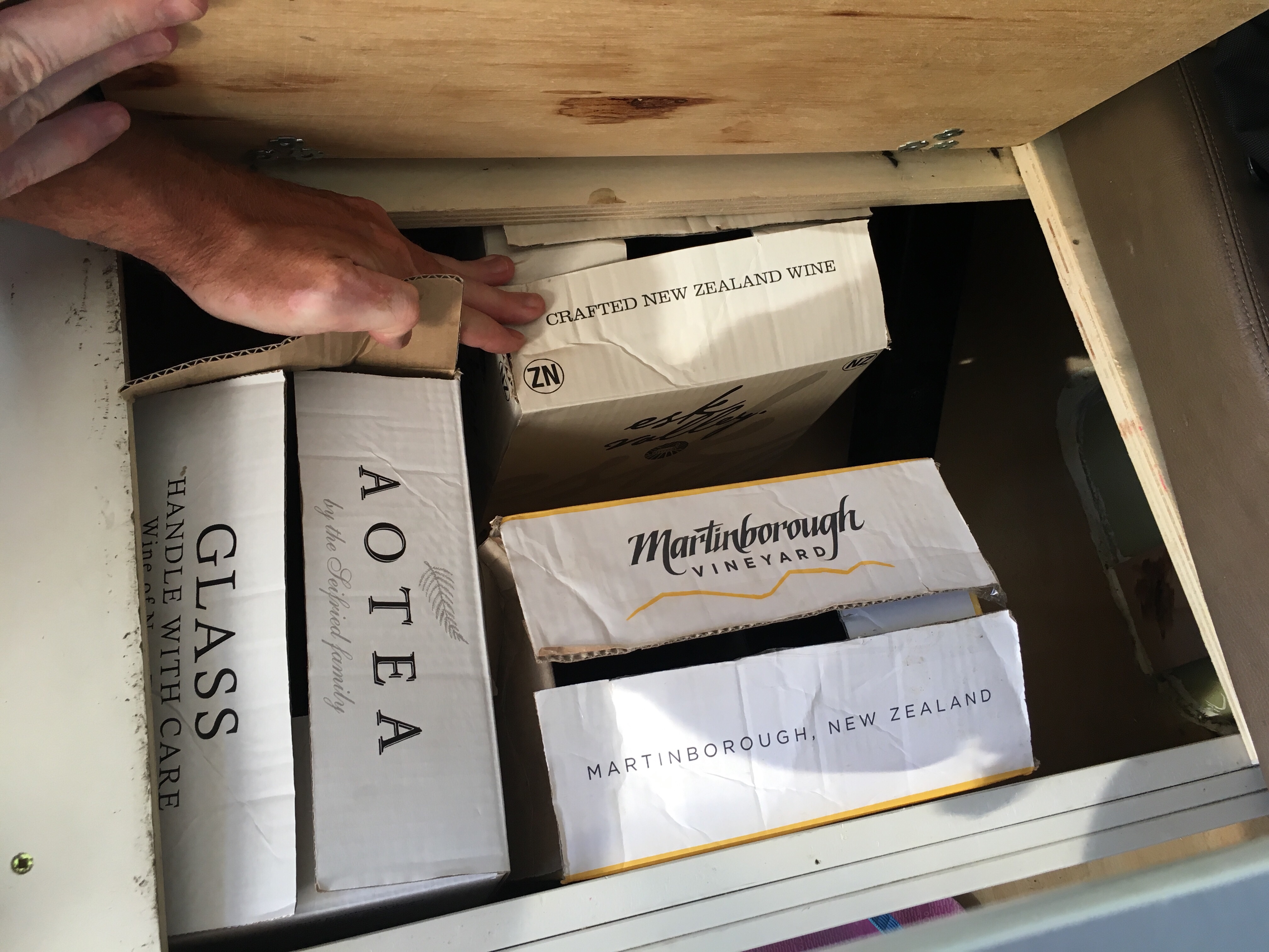
I don’t think we need to buy much more wine! Eliza at Seifried recommended a small detour via the coastal road to Motueka. This had the dual benefit of avoiding the road through Wakefield, which has been the scene of fierce forest fires in the last few days, now believed to be under control.
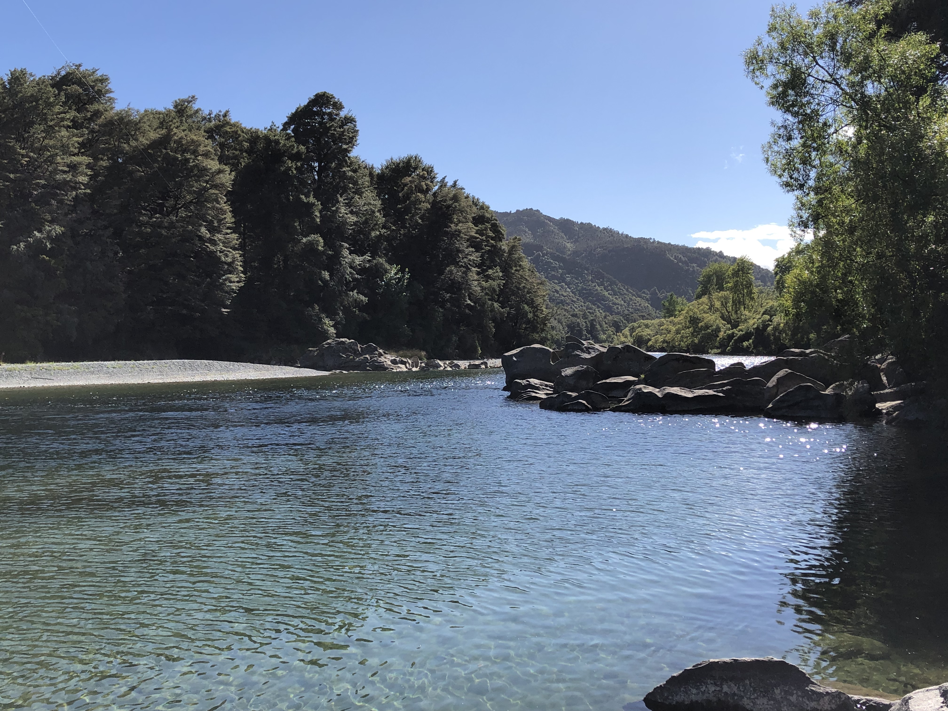
Today’s driving only really occupied a couple of hours, but for the duration we were driving through higher mountains than we’ve yet encountered in New Zealand. We followed the River Motueka for many miles, and then transferred allegiance to the River Buller. Stopping to take pictures was tricky, as there were few safe stopping places, but we did our best. Clouds in the north gave way to clear blue skies as we headed south, and all was vivid blue and green. The rivers are absolutely crystal clear here.
We stopped for lunch at a lookout, but they had a bit of a problem with wasps, so we were forced to eat inside the van. Then it was a long downhill stretch to Murchison, where we shopped in the supermarket, refuelled the van and examined our options for dinner. A combined pizza and tapas place called the Cow Shed seemed to be the best option.
We had high hopes for the Riverside Holiday Park, and we were not let down. It occupies a green and pleasant area at the side of the Buller river, and features a wonderful “swimming hole”. It being a very hot day we wasted no time in availing ourselves of this opportunity. Though slightly cold at first, we soon acclimatised and spent a happy forty minutes swimming across and around in the beautifully clear water – such a treat.

After our swim we sat overlooking the river, and enjoyed a friendly visit from one of the campsite regulars, a Weka. Later we walked into Murchison, a walk of about a mile, for a meal at the Cow Shed. The pizzas there were excellent, and we enjoyed eating them in the garden, at least until it started to rain. At first we sheltered under the umbrella above our table. When that shelter became inadequate we sought refuge in a nearby gazebo. After about forty minutes the downpour subsided, and we walked back up to the campsite in light rain.
Motorhome day seventeen: Murchison to Punakaiki
We were awoken by dripping noises in the middle of the night and had to leap out to shut the skylights – insufficient forethought there! When we next awoke at about eight thirty the skies were clearing to blue. We had a last wander around the campsite, and down to the river to capture the morning sun on the water.
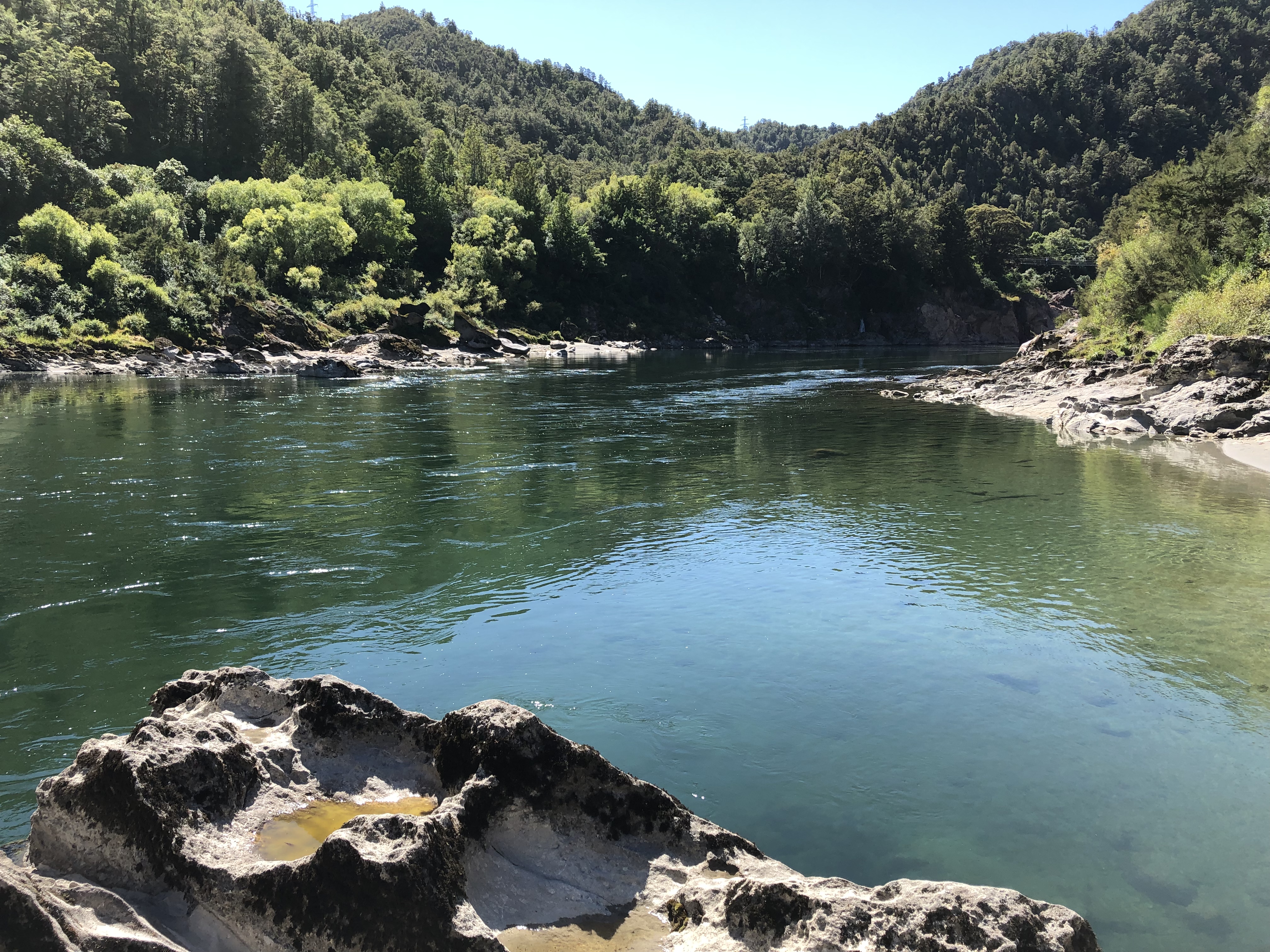
Today’s short transfer from Murchison to Punakaiki, one hundred and thirty kilometres or so, took us ages. Not because of the traffic, or roadworks, or anything like that. No, we kept finding things to see and do. For most of the day we were following the Buller river towards its mouth near Westport. In the process it grew enormously, as creek after creek joined it on its journey.
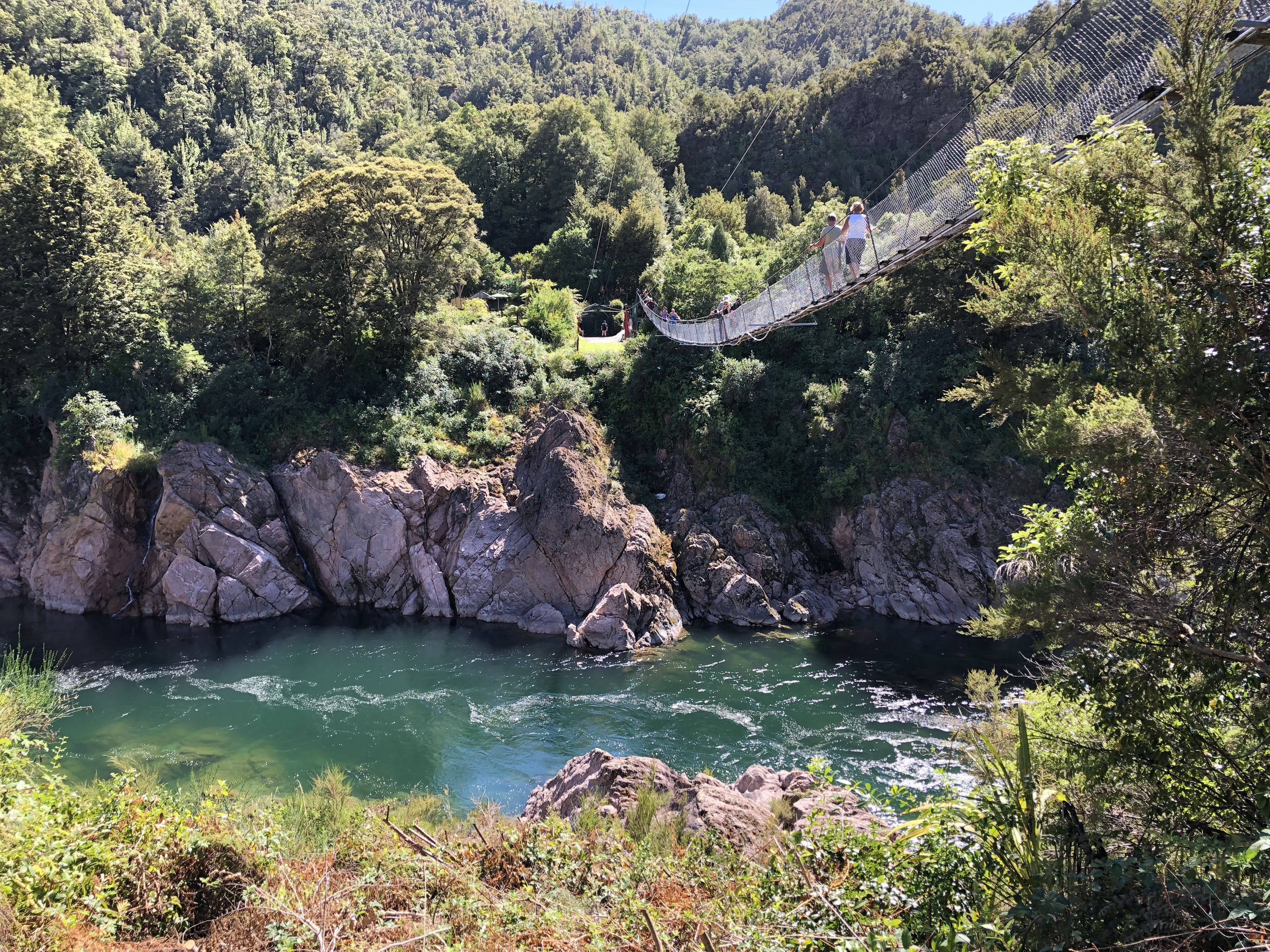
Our first stop was at the upper Buller Gorge. At this point a combination of geomorphological and seismic events had resulted in a deep gorge cut through pink granite.
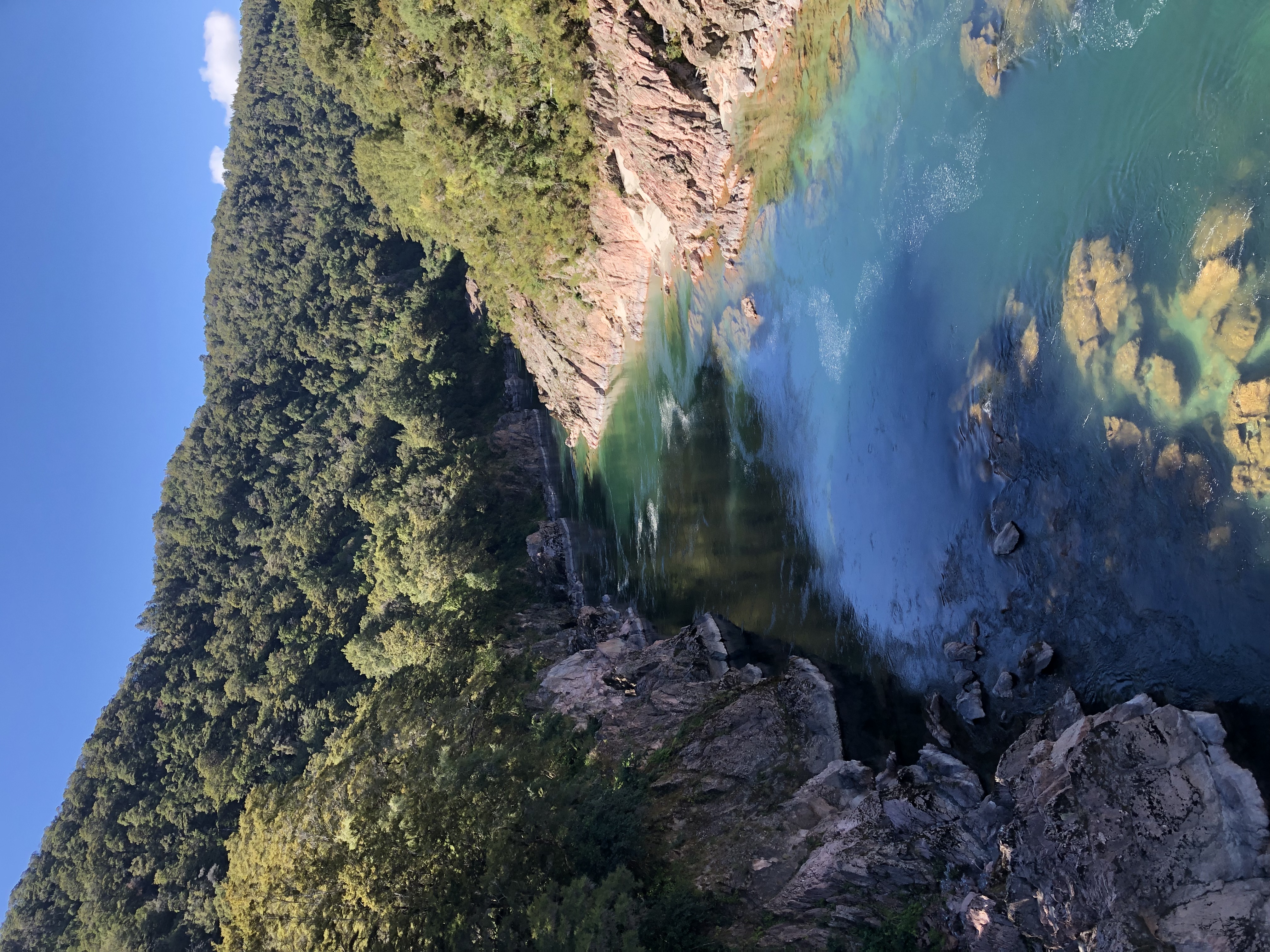
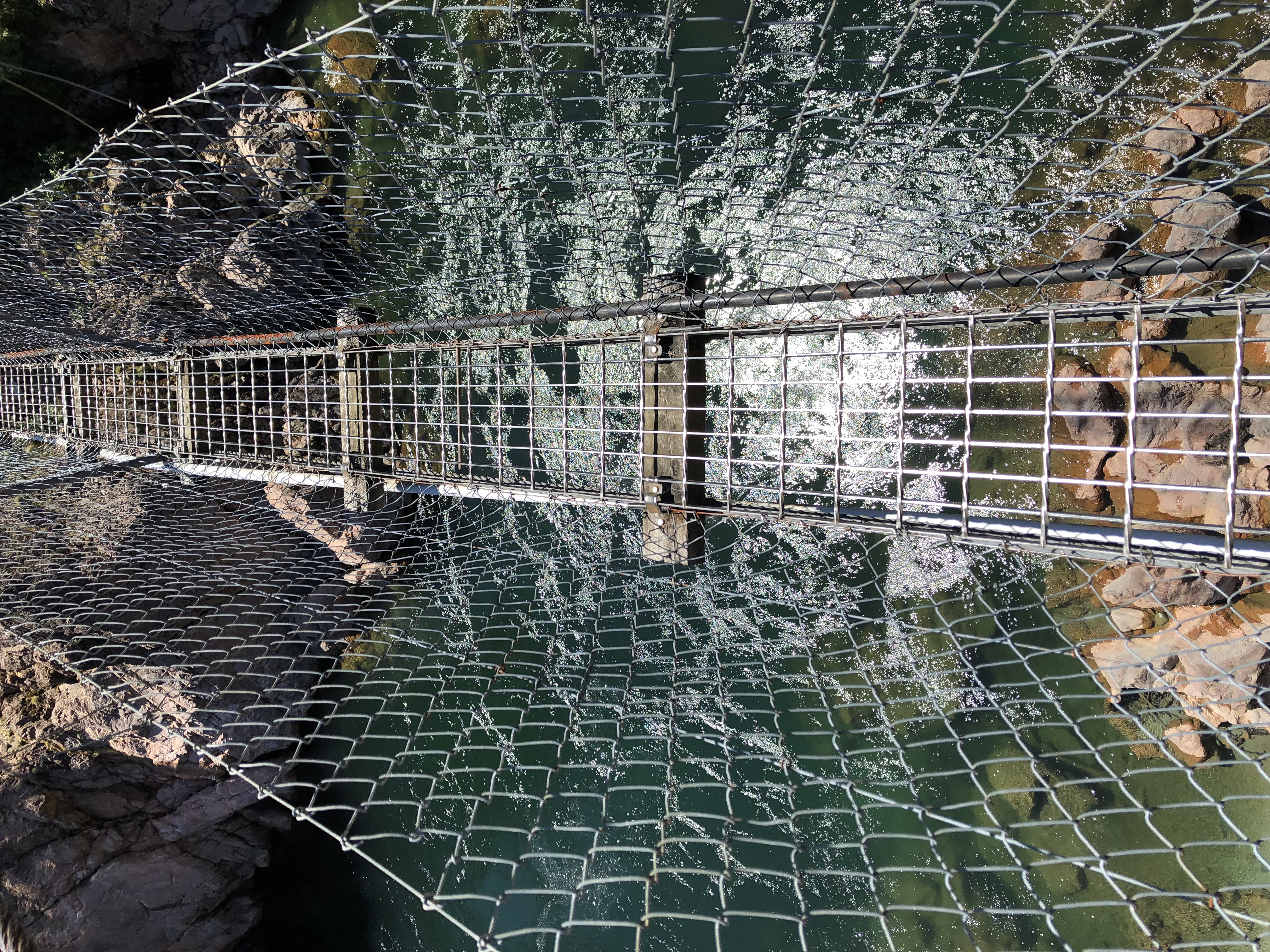
We parked up and paid our entrance fee, shunning the opportunities for zip-wires and jet boats. Instead we had to cross a one hundred and ten metre swing bridge to the other side of the gorge, and “swing” was definitely the word. It was suspended on two rusty-coloured steel cables, with a see-through walkway just wide enough for one person. When anybody came the other way we had to negotiate a tortuous series of manoeuvres in order to pass. Taking one’s phone out of a pocket for photography purposes was a risky and perilous act. Nevertheless we both made it safely to the other side, knowing that we had to repeat the whole process on the way back.
We then undertook a loop walk through the bush, with occasional diversions down to the river side.
This was former gold mining territory, and some vestiges of the equipment could be seen in the clearings. In the branches of the (very tall) trees we could hear cicadas; tuis; bell-birds.
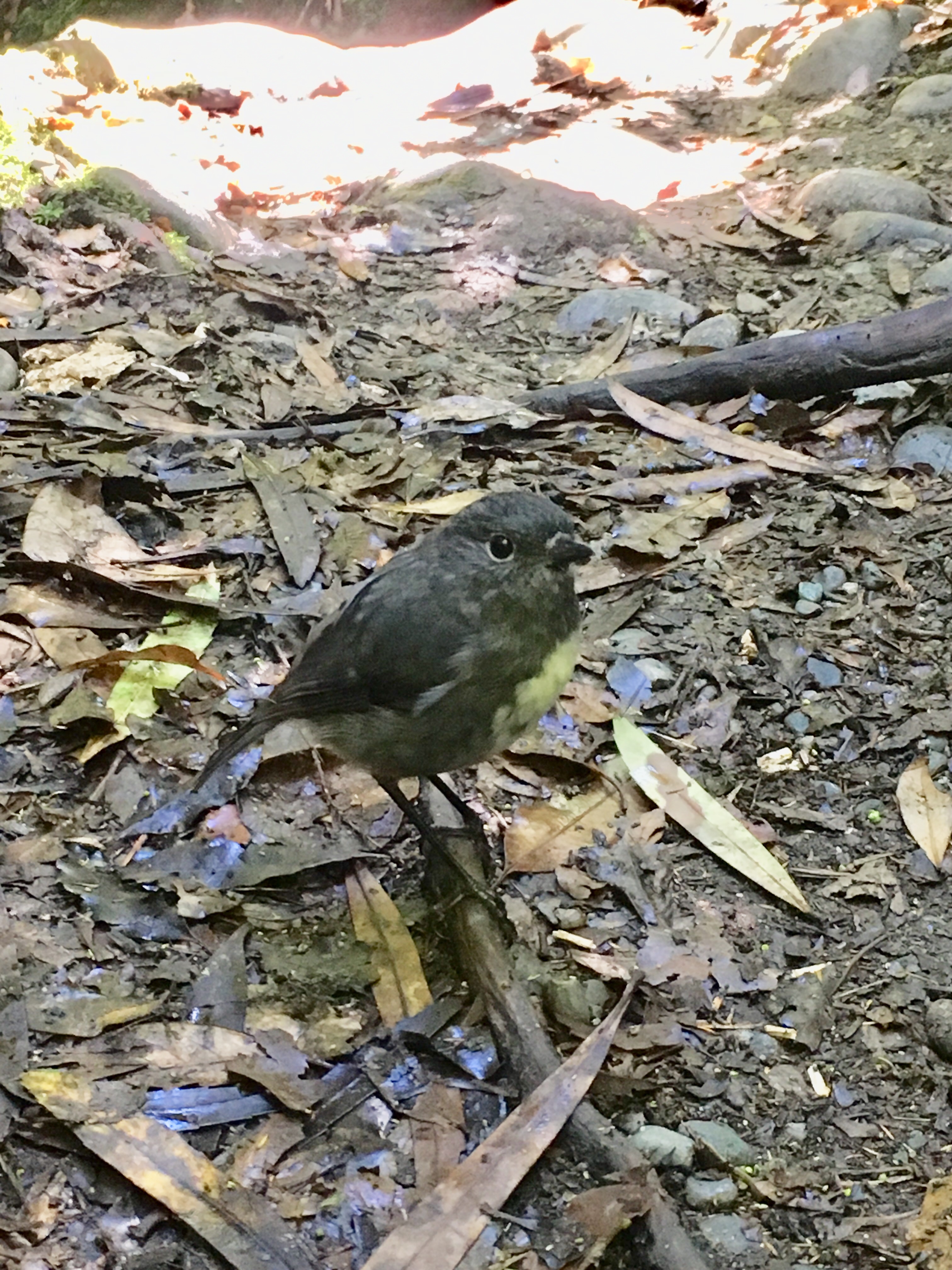
A friendly little bellbird hopped back and forth across the path in front of us.
We took a branch away from the main loop to the tallest white pine (or Kahikatea in Māori) in the forest – this involved a slippy, narrow path to which our footwear was ill-suited.
On our way back we passed the zip-wire again. Much to the operator’s disappointment we declined this excellent opportunity for a second time, before braving the swing-bridge back over to the entrance and recommencing our journey.
There were endless photo-opportunities available during our continued descent alongside the Buller; we attempted to select the juiciest ones. Some were signalled in advance by roadside signs, some were indicated by the surplus of motorhomes parked by the side of the road. We lunched high above the river, enjoying the vista and cursing the sand-flies. Later we stopped again, near a massive u-bend in the river.
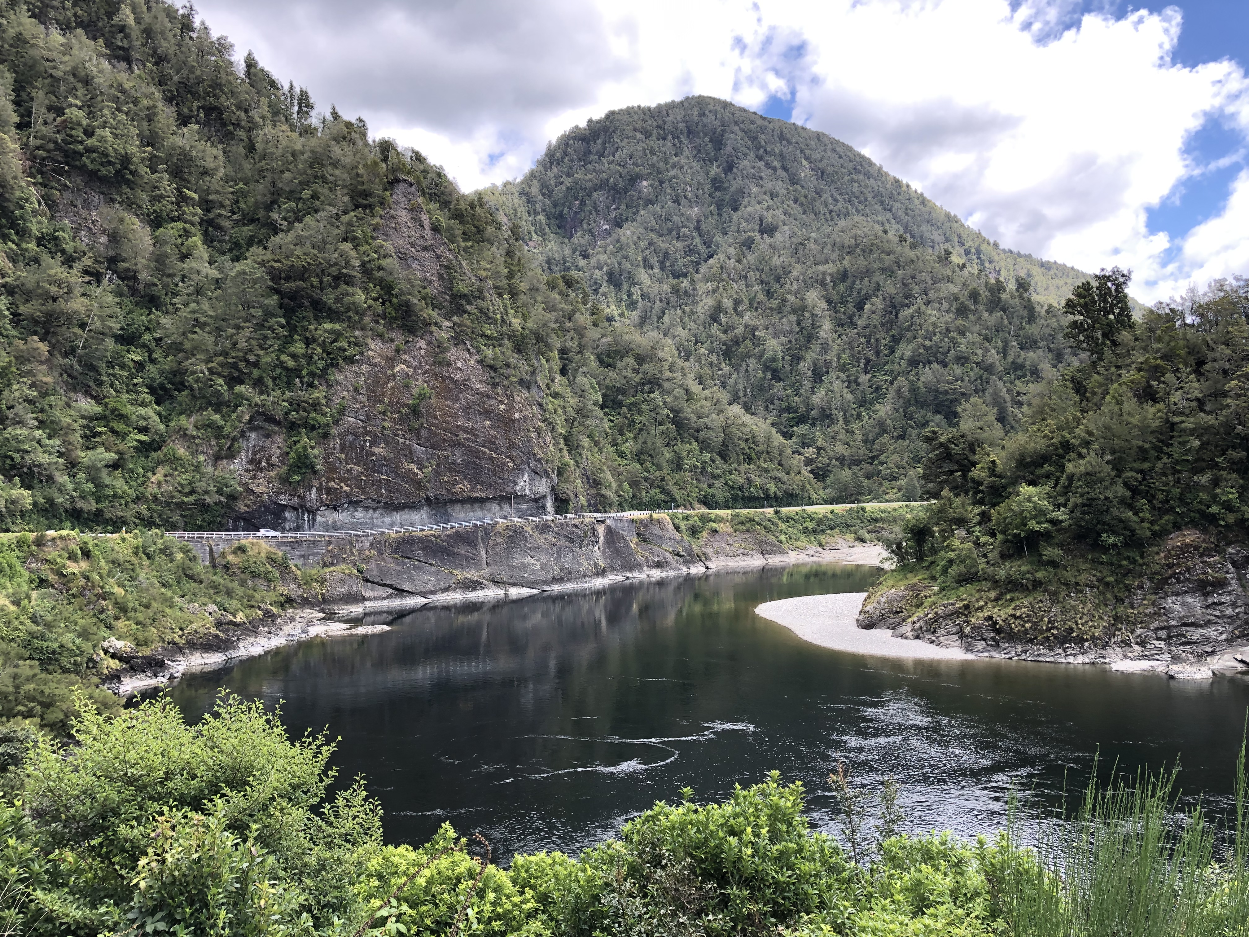
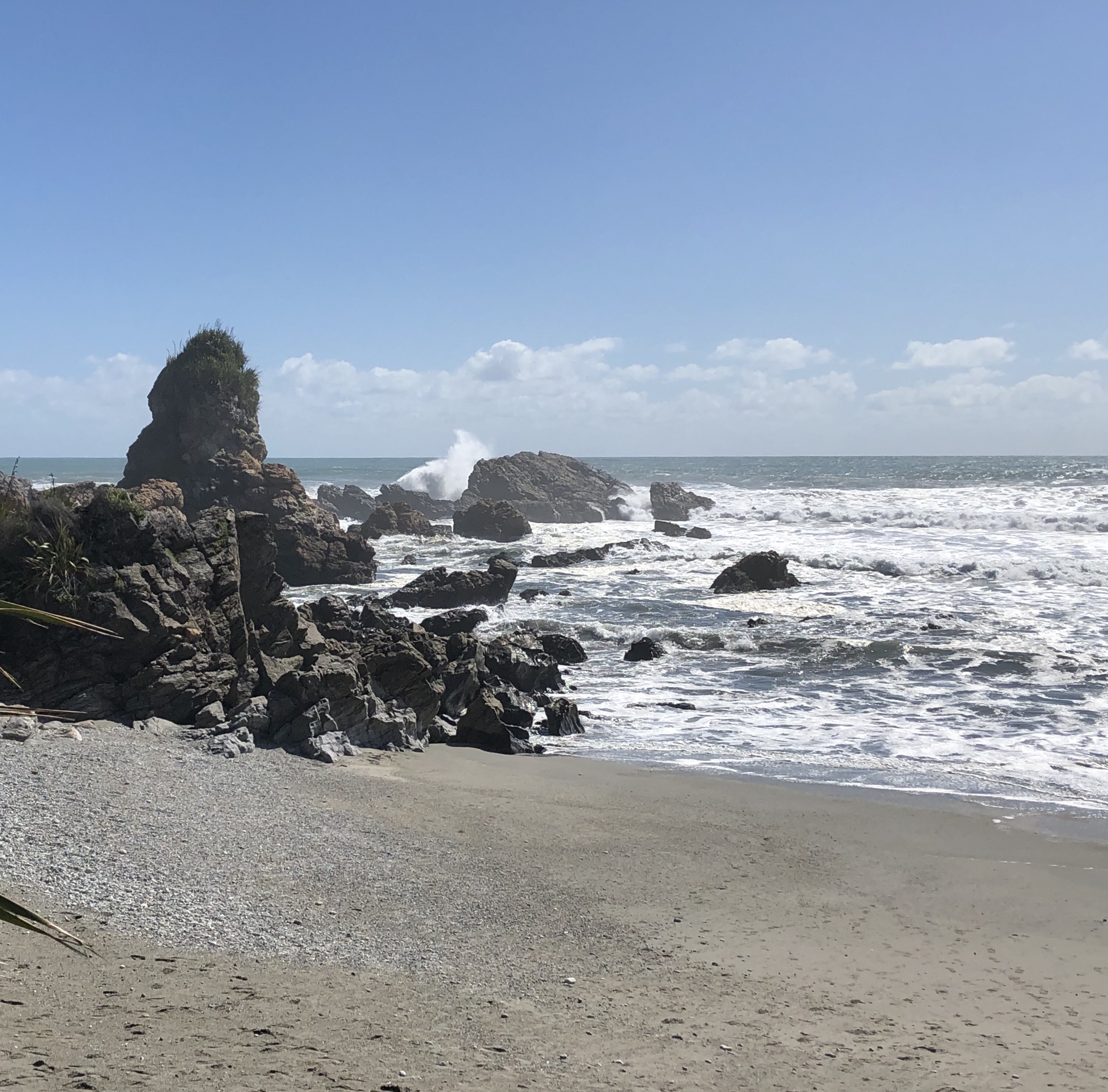
Eventually the scenery changed as we approached Westport and the sea. We had to divert into Westport in search of provisions and a cash-machine. Thereafter we headed back south, eventually arriving at the sea. To our left, cliffs as far as the eye could see, framed by a whole spectrum of greens. To our right, though, was even more impressive. Despite the seeming flat-calm out to see, breakers in serried rows were pounding the shoreline. It was a hugely impressive vista, and we stopped at each viewpoint to take it all in.
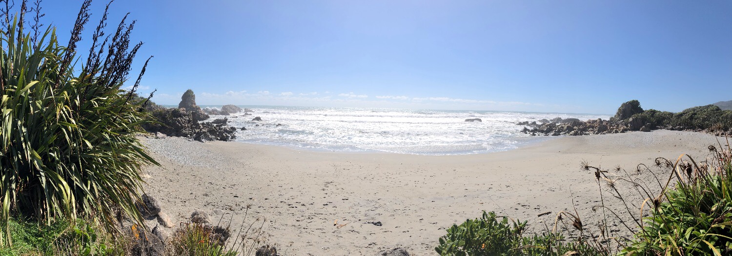
Punakaiki beckoned, now, and in particular the Punakaiki Beach Camp, sandwiched between the sandy limestone cliffs and the sea. Our impressively large pitch backed on to the sea, and we could hear it roaring. Nosy seagulls hopped around the site in search of titbits. What a lovely place, although it did lack both a workable phone signal and anything resembling decent WiFi – oh, the trials of a modern lifestyle.
Outside the site office there was a notice of the next high tide. This was crucial information for anyone wanting to visit the blowholes at Punakaiki’s “Pancake Rocks”. Tonight’s sunset was at 8:40, and the high tide at 8:00. So we had the choice of visiting the blowholes late in the evening or early the following morning at the next high tide. It will surprise nobody who knows us both that we opted for the evening viewing. Firstly, though, Ravioli with butter and sage (the latter picked from the campsite in Wellington) and a glass or two of delicious fizz from Seifried, while we sat outside and listened to the waves crashing onto the shore.
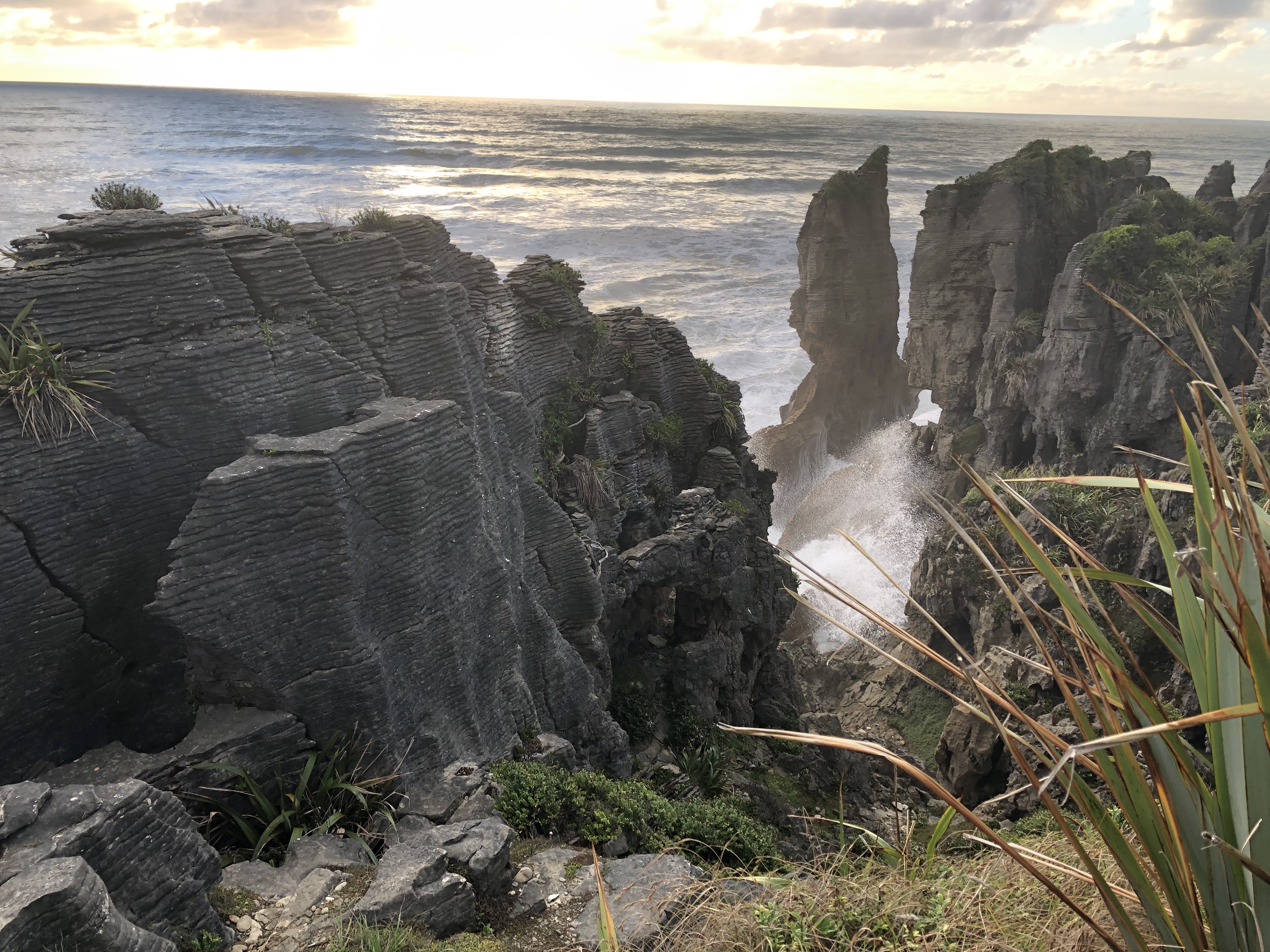
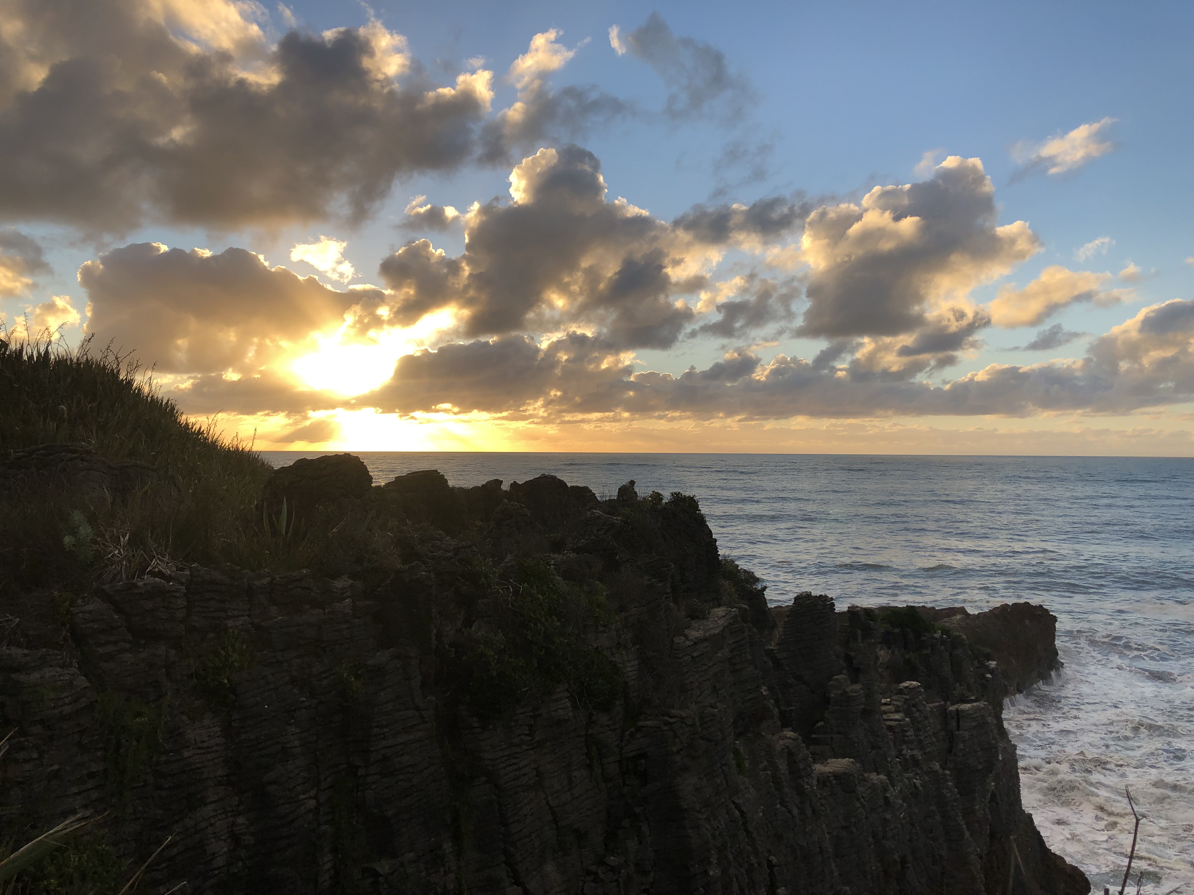
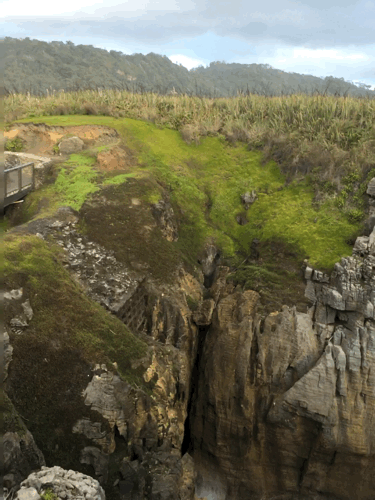
The sun was low in the sky as we walked south on the main road, with the huge cliffs to our left. A ten minute stride brought us to the walkway at Pancake Rocks. These curious phenomena are vertical blocks of limestone layers separated by thin mudstone layers, and they do indeed look like stacks of pancakes, albeit of the American form rather than the much nicer European variant. The waves had invaded the blocks and twice a day at each high tide would crash into the rocks, resulting in a loud booming noise and a burst of spray from one of the many blowholes. It all made for what Clare described as a multi-sensory experience – the smell and taste of the salt; the bass notes from the waves, the sensation of the spray on the face and of course the incredible visual spectacle. Add to that a glorious sunset and you’re left grasping for suitable adjectives.
On the way back we headed briefly into Punakaiki cavern, using our phone torches to light the way. We were in search of glowworms, but lacking local knowledge failed to find any. That mild disappointment was the only one of a spectacular day. We toasted it back at the campsite with a Martinborough Pinot Noir.
Motorhome day eighteen: Punakaiki
We’d originally planned to visit the Pancake Rocks today, but as we’ve already done so, we decided to award ourselves a day off! So no breathless prose today, you may be relieved to read. We took the opportunity to plan ahead, booking scenic flights over Mount Cook (for when we visit Lake Tekapo), a campsite in Queenstown and a return journey on the TranzAlpine railway (for when we’re in Christchurch). All of this was planned in the site kitchen, the only place with decent WiFi on the site.
Other than that, and a walk onto the beach to watch sunset, we had a most relaxing day, and caught up on some reading – I have just started reading “The Luminaries” by Eleanor Catton, which is set in Hokitika, through which we pass tomorrow.
Motorhome day nineteen: Punakaiki to Franz Josef
We opened the blinds to gloomy skies today. This has been a rare experience so far on this trip. Not to worry – we breakfasted, packed up and set off, leaving the delightful Punakaiki campsite behind us.
For the first forty minutes or so the vista was dominated by steep wooded cliffs to the left and grey seas to the right. The wind having died down a little, the breakers were less impressive than in recent days. After an hour or so we arrived at Hokitika and struck out on a twenty-five kilometre detour to a gorge at the foot of the Southern Alps.
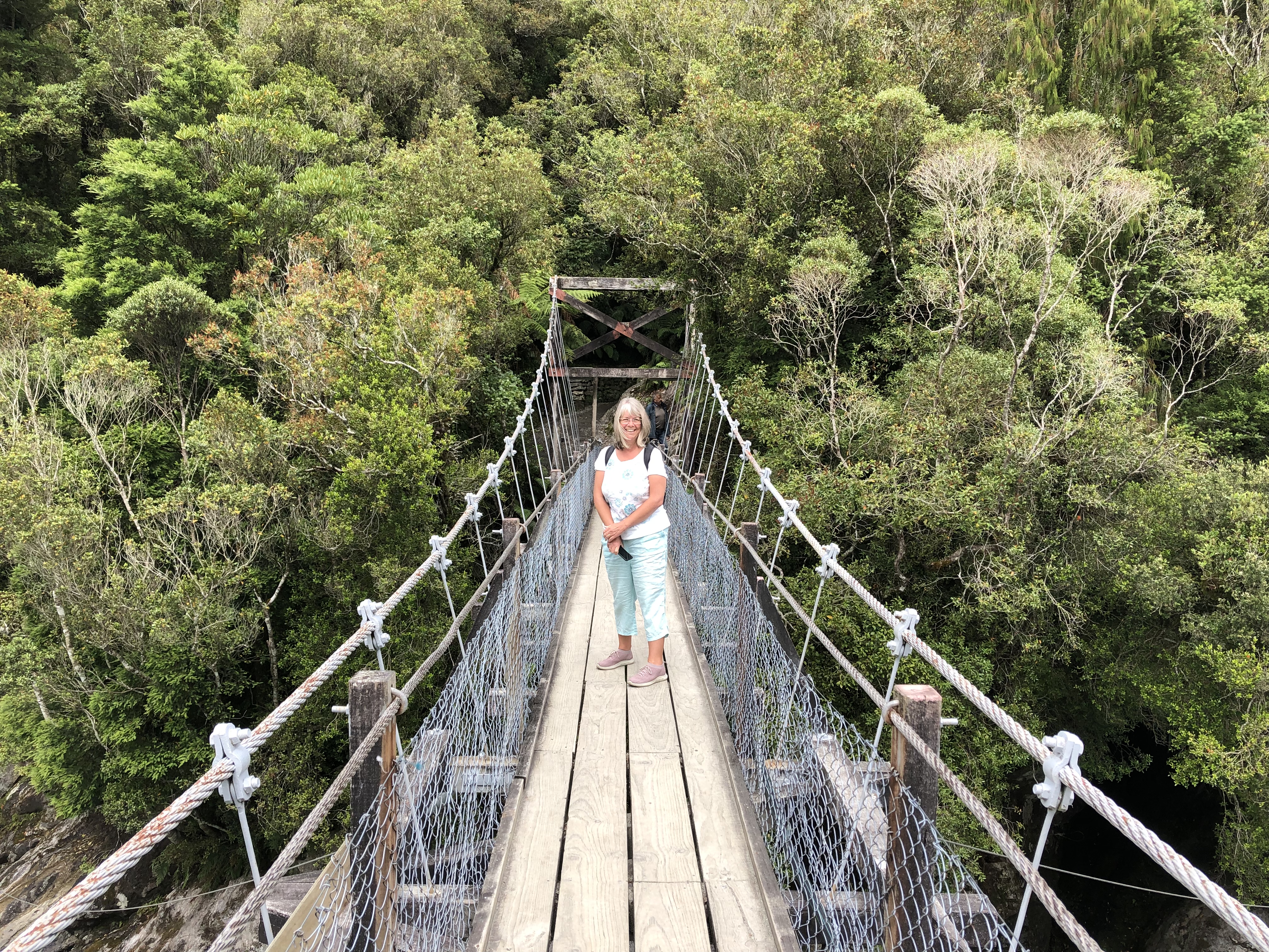
Parking up the motorhome we joined others on the path and crossed a small bridge. Here we were struck by the bright turquoise water. The colour comes from glacial flour – finely ground rock at the base and sides of a moving glacier, which eventually washes out into the glacial meltwater. We braved the second swing-bridge of recent days. This one was much shorter, but still capable of provoking fear. We were impressed by the resilience of one elderly gentleman who, having turned back on his first attempt, reporting vertigo, eventually crossed successfully, despite knowing that this would mean he had to repeat the experience in order to return to the car park.
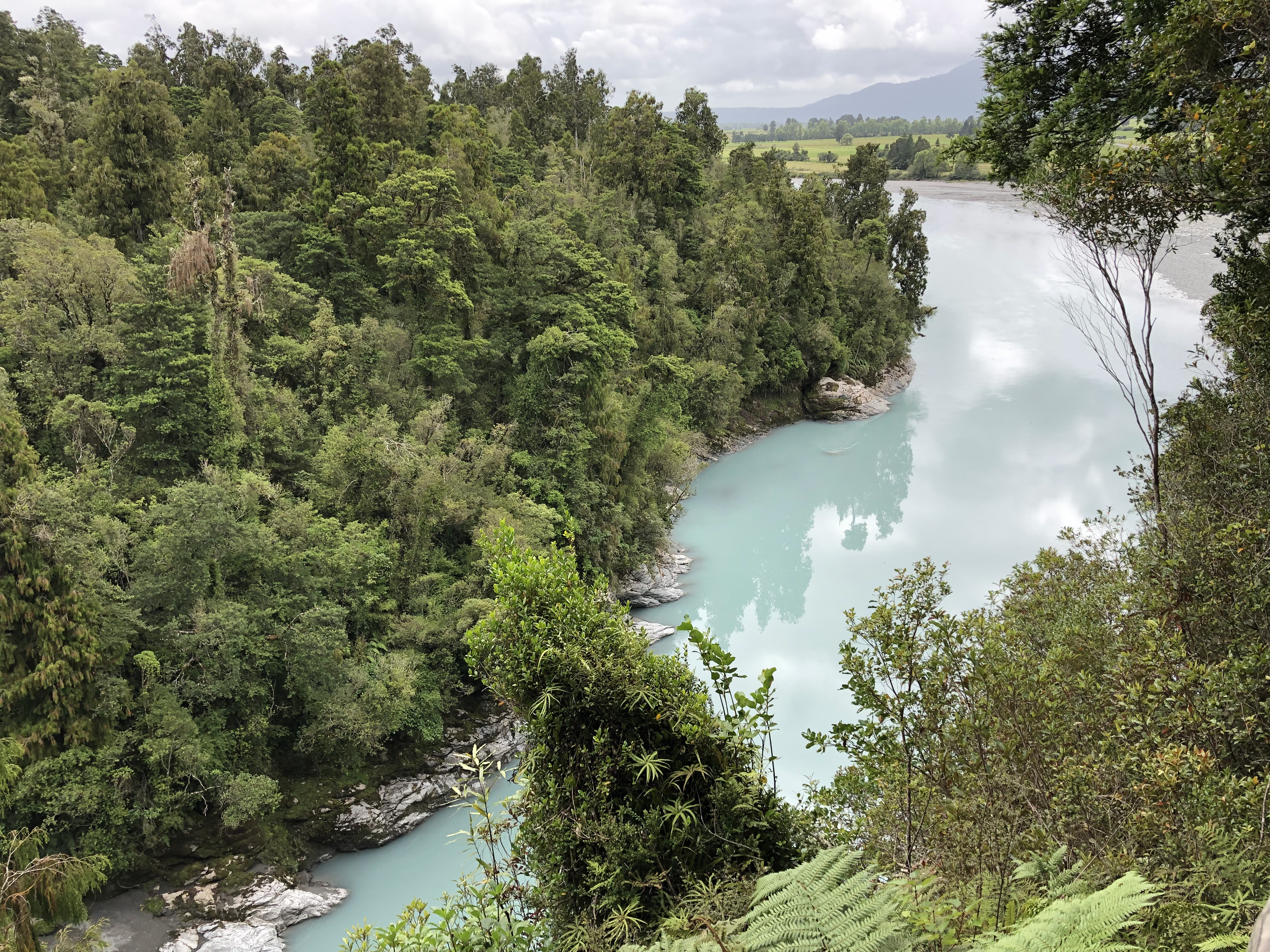
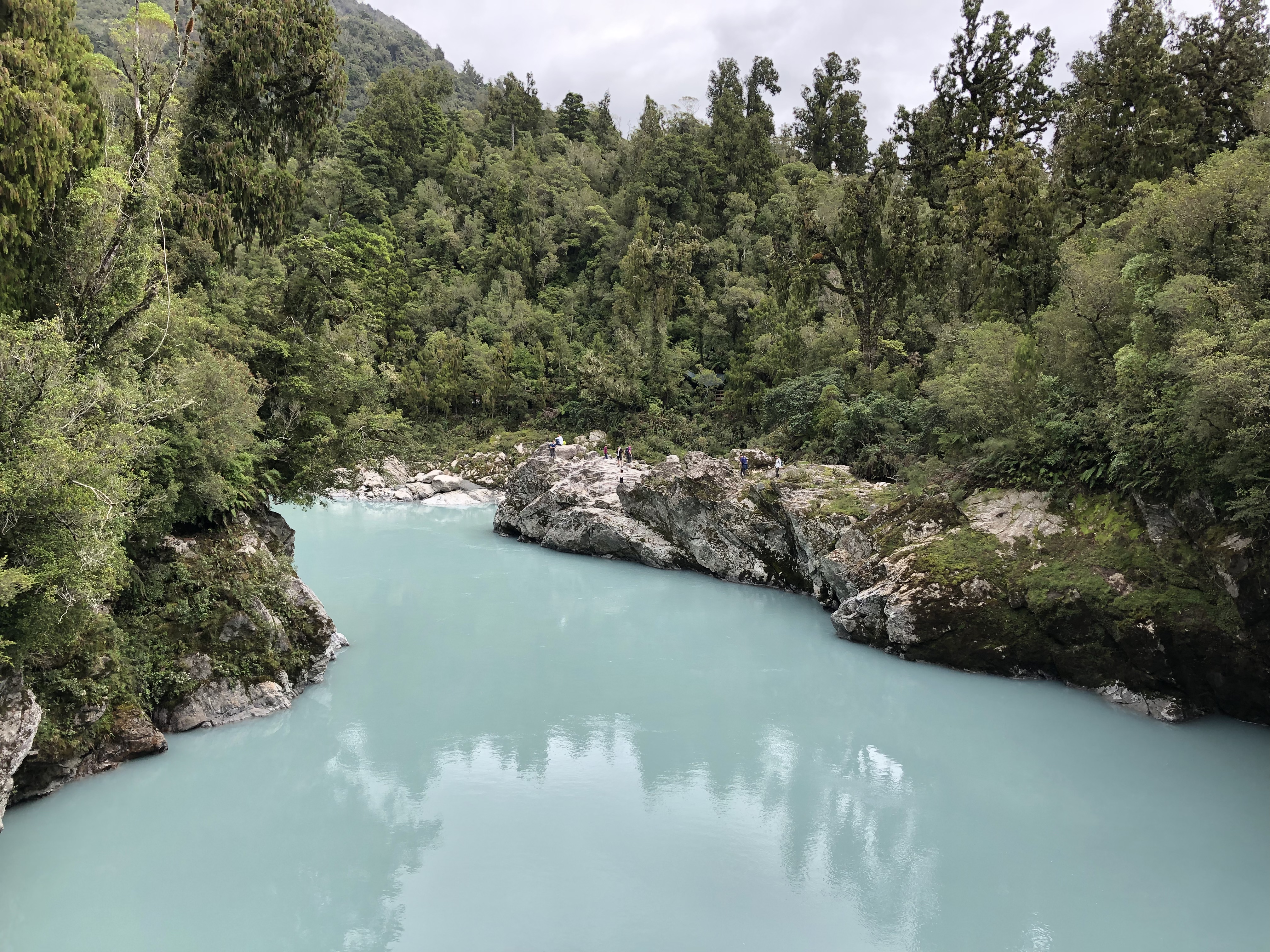
It was only a short walk of fifteen minutes or so each way, but we were able to capture remarkable images of granite rocks, turquoise waters and of course the bridge itself.
The journey back to Hokitika was quite short, and we decided to shop there. Whilst doing so we spotted the National Kiwi Centre. Now we had planned to try and see some Kiwis at some point, so this seemed like a good opportunity. The Kiwi, being a nocturnal bird, isn’t easily spotted in the wild, and it’s very vulnerable to predators – even dogs can cause havoc in Kiwi habitats.
The Kiwi centre, in common with several similar organisations, reverses the pattern of daylight for the kiwis, so that visitors can see them during daylight hours. In order so to do, we had to become accustomed to lower lighting. This was achieved by a glow-worm exhibit – while we were spotting the glow-worms our eyes were adjusting to the light. On moving to the next room, therefore, we were more readily able to see the Kiwis. Not easily at first, though – all I could see initially was a sense of movement. Gradually, though, things became clearer, and we were able to watch as two brown Kiwis scuttled around seeking food. What remarkable creatures, and what a treat to see them.
Afterwards we lunched on Hokitika’s seafront. Oh, and I broke a wine glass by opening a cupboard in an ill-advised manner. A quick supplementary shopping visit sorted out that problem. We had a drive down Hokitika’s wharf at my insistence, so that I could view the streets featuring in my current book, and then we struck south again for Franz Josef.
The mountains increase in height towards the south, and one could sense the proximity of glaciers and glaciation. To some extent it resembles the approach to Mont Blanc from Geneva, but the vegetation is entirely different. The Southern Alps, too, are much younger – only ten million years old, and still in a very active orogeny.
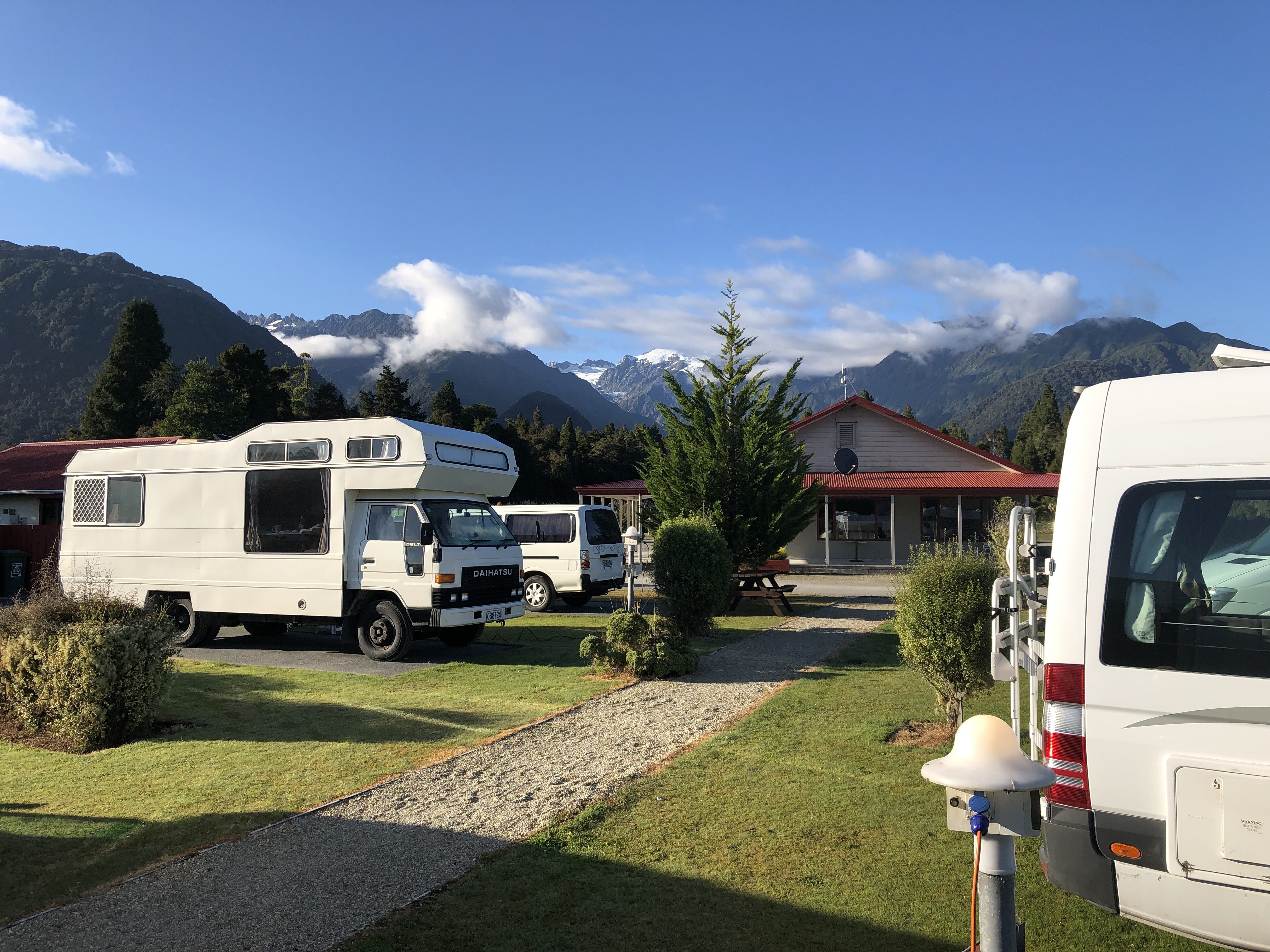
We arrived at our campsite at Franz Josef, and were relieved to have booked it in advance, as it seems to be full. Tomorrow we plan to walk to the terminal face of the Franz Josef Glacier.
Motorhome day twenty: Franz Josef and Fox glaciers
???? Two glaciers in one day ????
???? Sun shines on the tourists scrambling over the moraine ????
Now I realise that Neil Finn didn’t write these precise lyrics in the Crowded House song “Four Seasons In One Day”, but they’ve been going round in my head all afternoon.
Today we awoke early, to bright blue skies, which revealed a view we didn’t see on arrival yesterday, over the roofs of campervans towards the Franz Josef Glacier, so named by the Austrian explorer Julian Von Haast in honour of Franz Josef I of Austria.
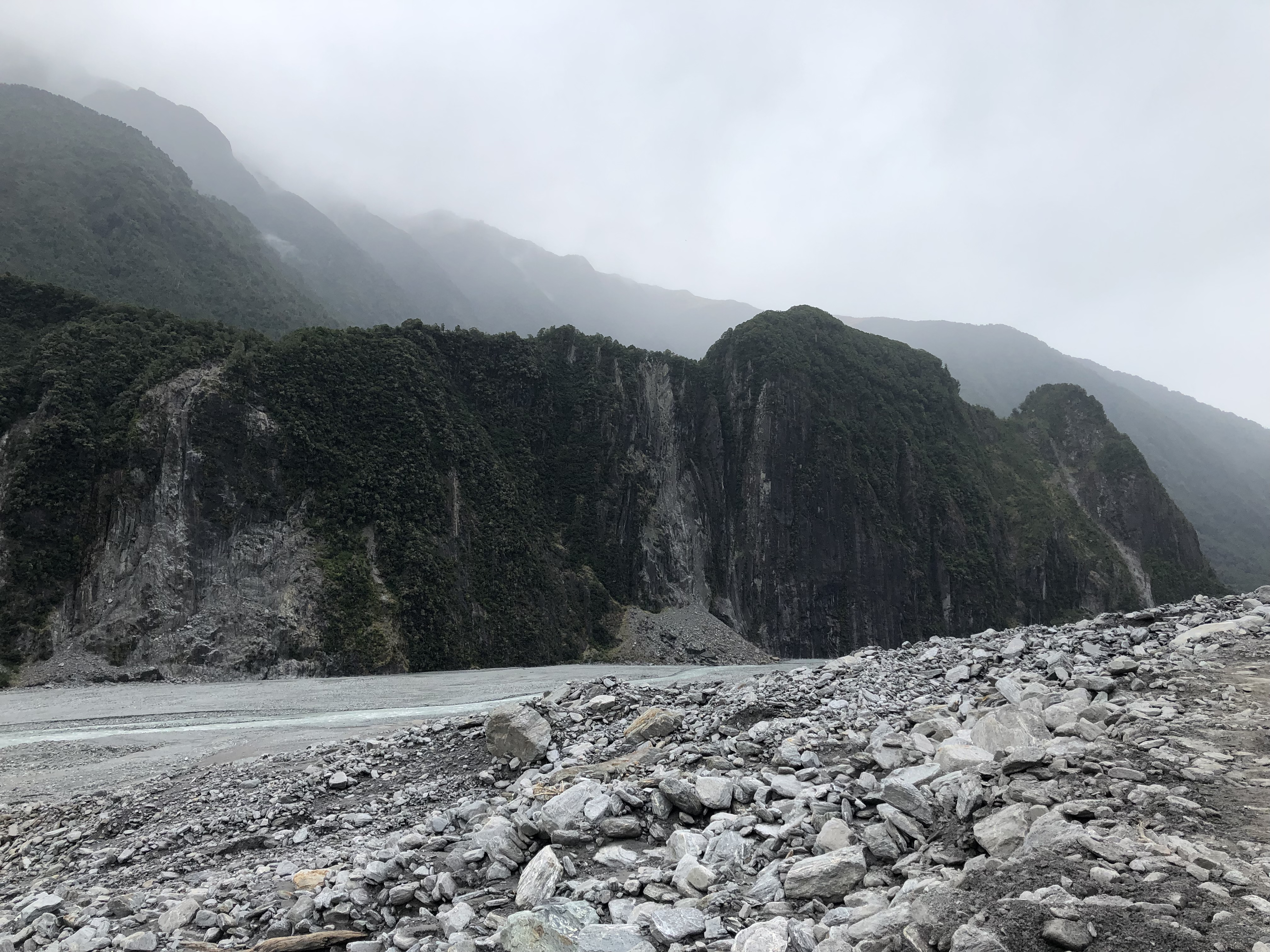
We’d been forewarned that the main bridge in Franz Josef town would be closed for a couple of hours today, so we had to get going fairly quickly. The drive to the car park at the foot of the glacier only took ten minutes or so, and as we arrived we could see a band of thick cloud threatening to head in and ruin the beautiful vistas we were anticipating.
So we parked up and struck out on the footpath through the various terminal moraines. I say various because sadly this glacier, like so many others, has retreated seriously in recent decades. The walk to the viewpoint was around two kilometres, but at frequent intervals there were signs posted, each indicating that in a particular year not too long ago the snout of the glacier reached the location of the sign. It was sobering, particularly when we reached a sign for 2009. Joshua was here around then, and we could see that the glacier was several hundred metres shorter than at the time of his visit.
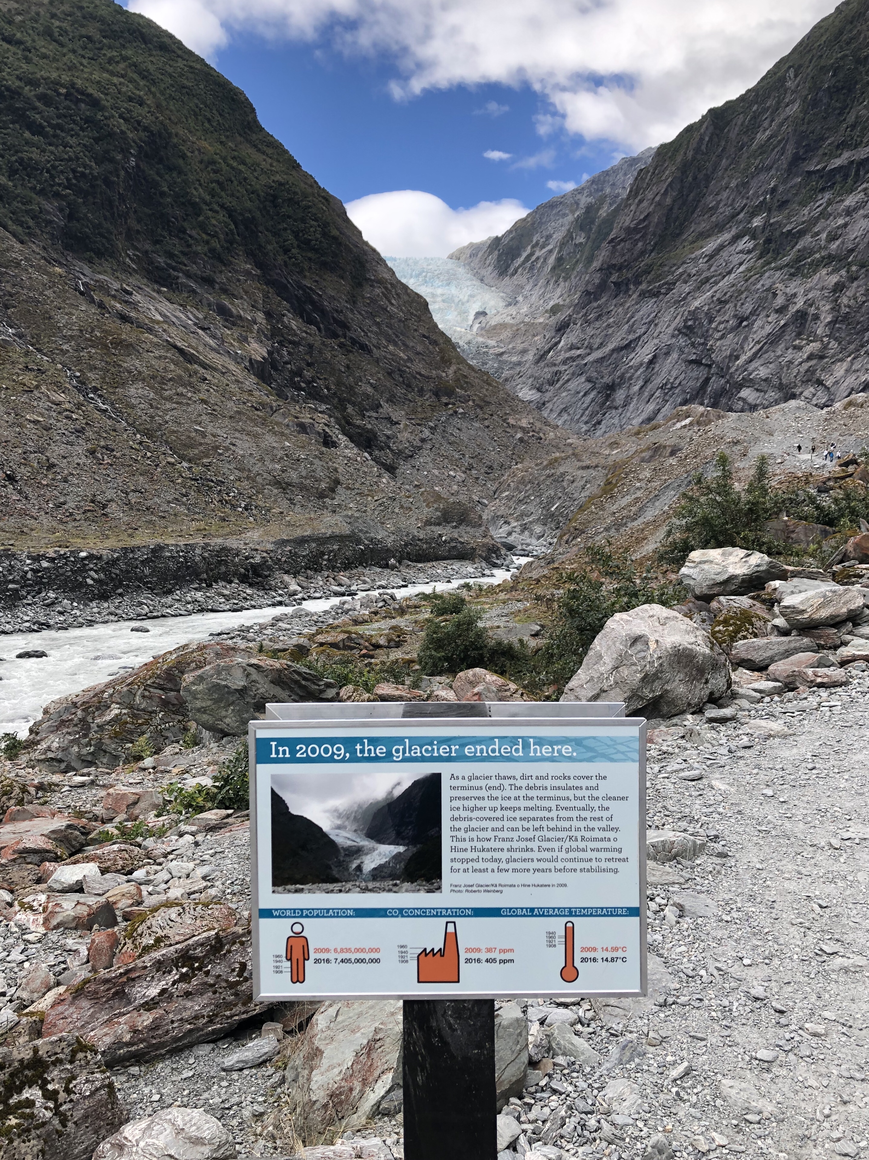
We were walking near the line of the Alpine fault, which marks the border between the Pacific and Australasian tectonic plates. Consequently the geology was sedimentary and metamorphic – greywackes and schists. The valley itself was suitable for a textbook geomorphology lesson – hanging valleys, waterfalls, moraines, U-shaped glacial valleys, alluvial fans – it was all there.
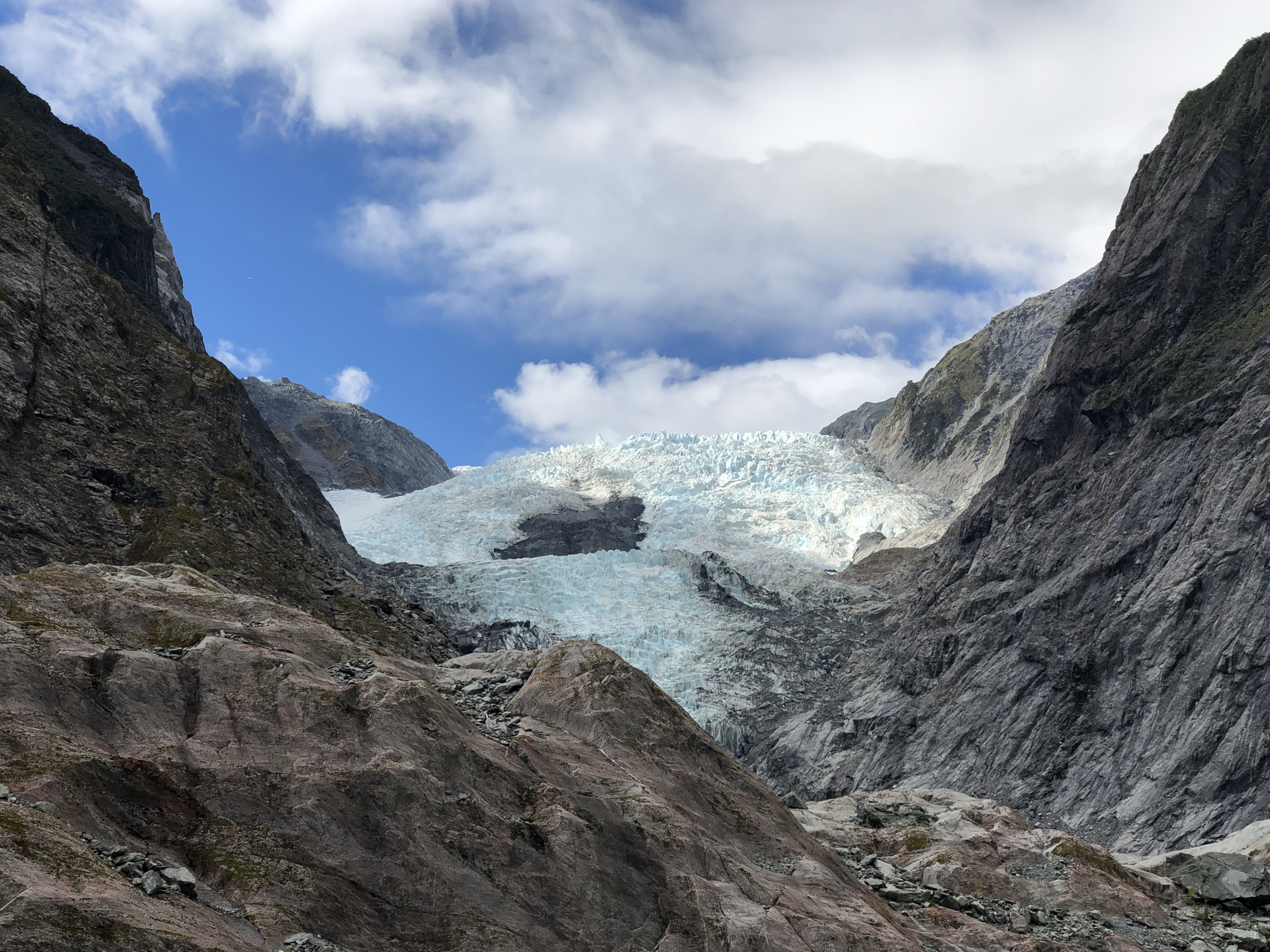
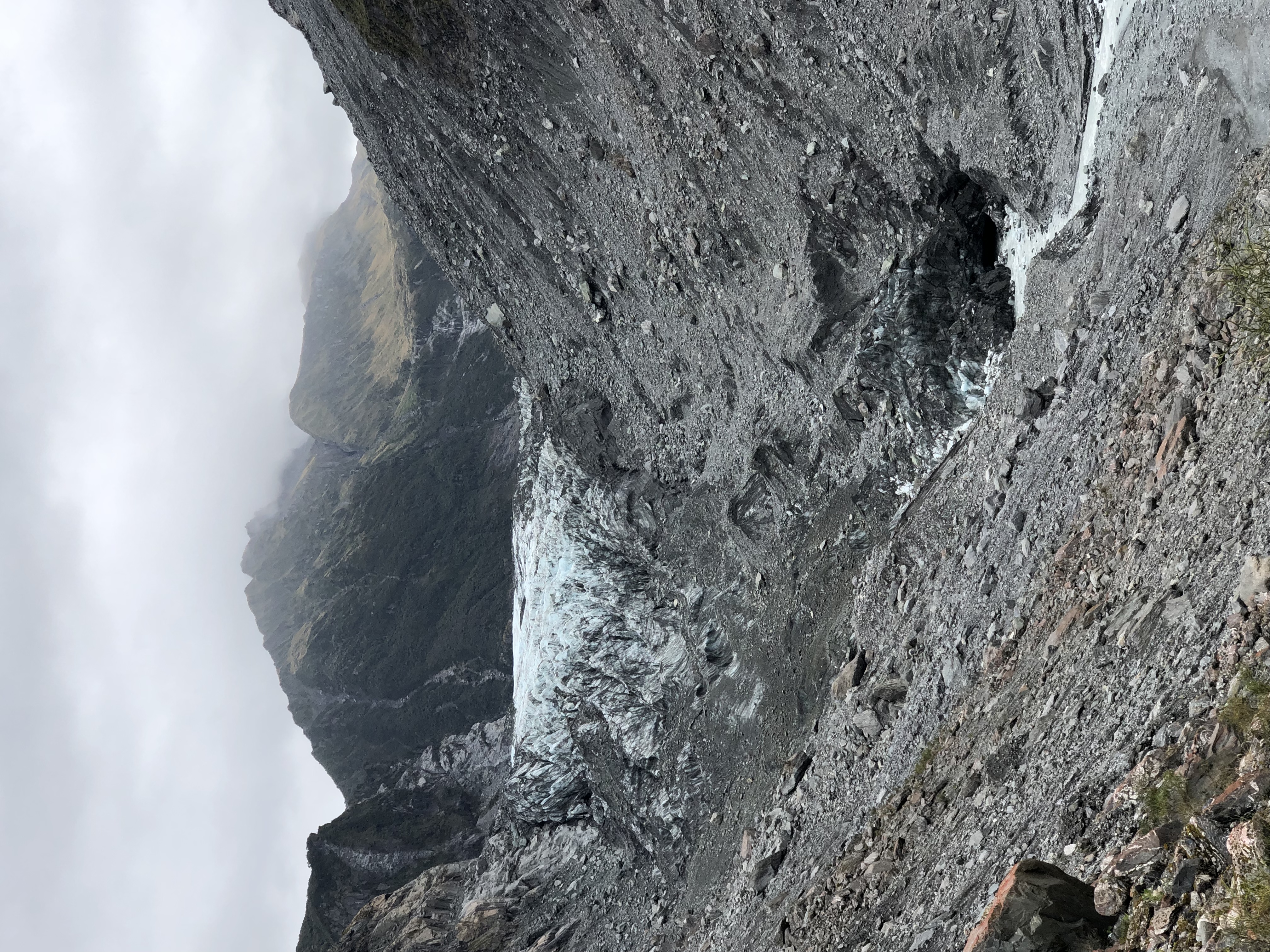
Of course it was breathtakingly magnificent. In summer the glacier is shown at its best, free of a covering of snow, and blue, so blue. We walked as far as possible – it is no longer permitted to walk onto the glacier, and an endless stream of helicopters passed overhead to deposit their clients high up above the ice fall.
We returned to the motorhome and decided (despite the gathering clouds) that we should drive twenty kilometres or so to the Fox Glacier. The exercise was doing us good, and the surroundings were stunning. We picked up three hitchhikers – two German, one Belgian, on long camping trips in New Zealand, and took them to the town of Fox Glacier. Only after setting off did we realise that we were perilously short of fuel. Thankfully we managed to limp as far as a petrol station.
The approach to Fox Glacier on foot was slightly shorter but equally impressive. If the glacier itself seemed smaller and further away, the dramatic cliffs of the valley gave us plenty to look at. Several sections of the footpath were marked “No stopping”, because of the severe risk of rockfalls in areas where the vegetation hadn’t yet caught up with the rapid retreat of the ice. Soberingly, a board at the viewpoint listed several fatalities amongst those who had become too inquisitive and strayed from the path. Again we gazed at the scenery, only noticing after a while that the glacier was longer than we had originally thought, as the last few hundred metres were entirely covered in moraine.
On our return it began to rain, and the clouds rolled in. We just about made it back to the van before a proper downpour set in.
Tomorrow we head inland, over the Haast Pass to Wanaka.