Distance: 50.34 km
Time: 2 hours 29 minutes
Speed: 20.3 km/h
Ascent: 111 metres
Total distance: 1072.3 km
Total time: 57 hours 12 minutes
Wordle scores: Captain 5, Stoker 6
Word of the day: “Galleria” (gal-a-ree-ah) – tunnel
The Captain writes:
We spent a quiet afternoon in Ortona. Quieter than planned, actually, as we managed to trip the electrical supply to our apartment again. In multi-occupancy buildings in Italy there seems to be a strict budget on maximum power used – in our case it took only two air-conditioning units and an oven to trip the breaker. Of course we didn’t know where the breaker was, so we had to ring the hosts and get them to reset it for us. You’d think we would have learned to preempt this by now, it has happened to us so many times!
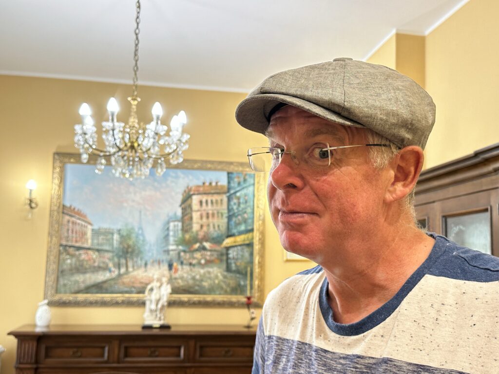
We also had a most exciting trip out to a clothing shop, as I had unwittingly packed my most disreputable swimwear for this trip, and frankly it was becoming indecent. We managed to find new swimming trunks for me (this is not easy in Italy, as I am not naturally snake-hipped!). We also each purchased a hat, for use when walking the streets in the hot sunshine. I am perhaps one of the few Yorkshiremen to have purchased a flat cap on the Adriatic coast.
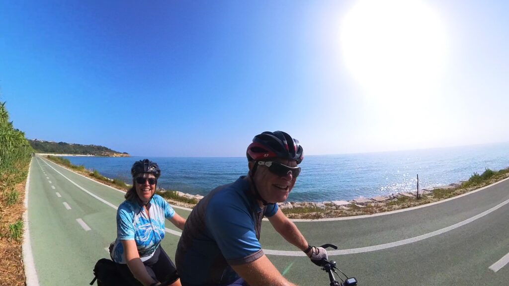
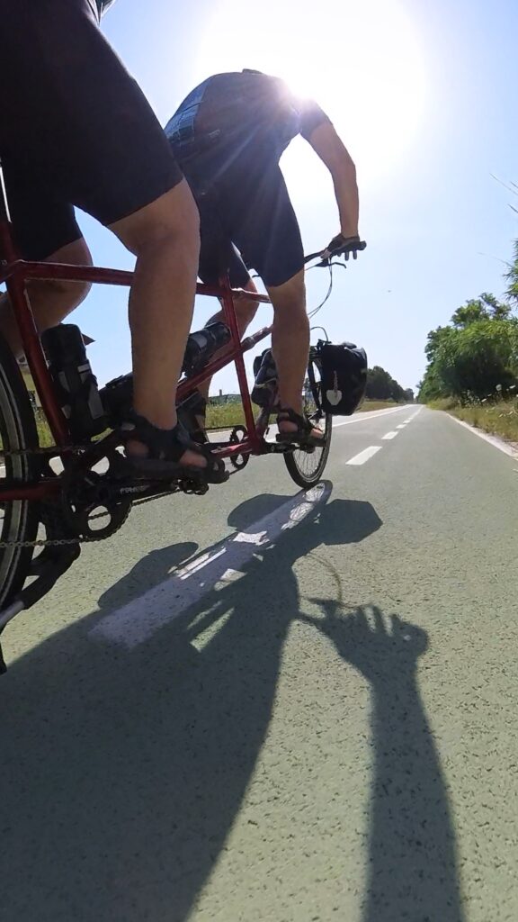
Another early start for us today, then, and after breakfast we descended the hairpins from the centre of Ortona down to the coastal path. Almost immediately we found ourselves on a broad, smooth, two-way cycle path. It is called the Via Verde Costa dei Trabocchi, and it is fabulous.
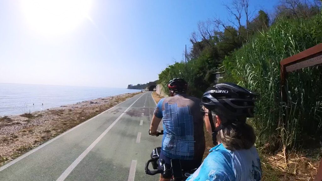
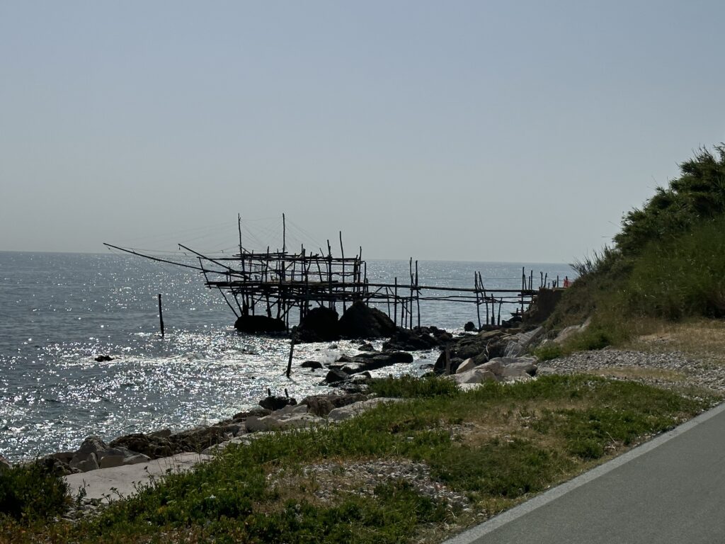
A trabocco is an old fishing machine, typical of this area – a large wooden platform jutting out into the sea. From the platform, two or more long arms stretch out above the water, supporting a huge, narrow-meshed, net (called a trabocchetto). We saw scores of them as we enjoyed our traffic-free travel along the cycle path.
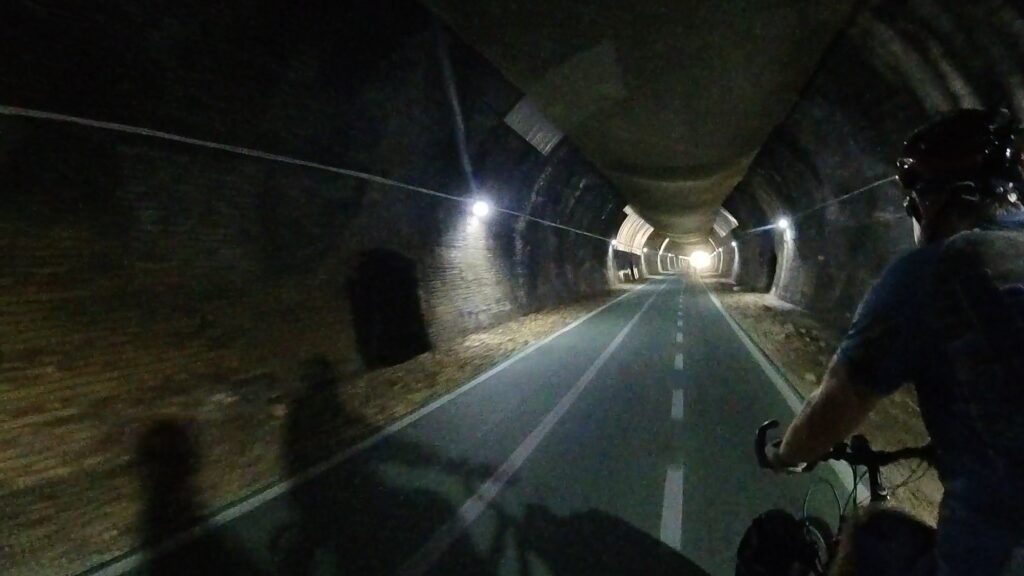
It was clear that the cycle path used to be a railway line, as we saw some of the old infrastructure. This meant we passed through several tunnels along the way. I can only describe this experience as sublime, as the air inside each tunnel was deliciously cold and refreshing.
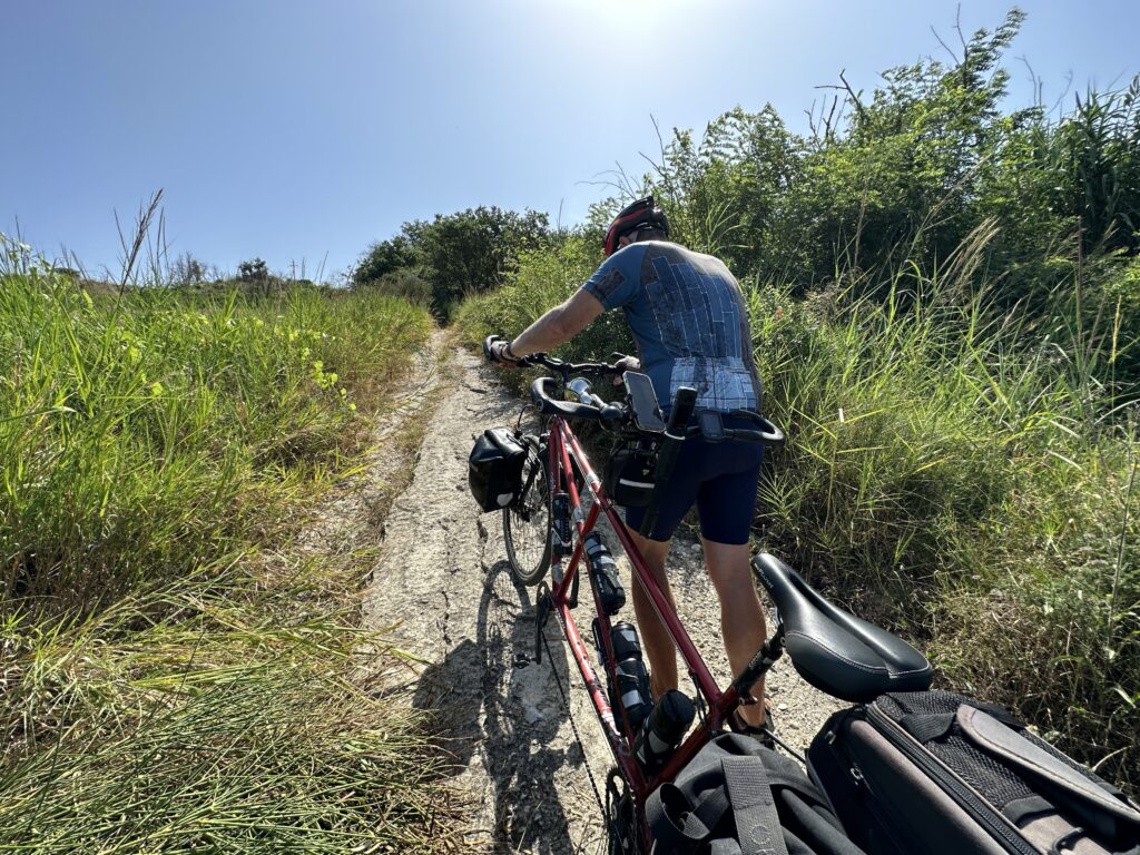
The cycle path kept us occupied for the first hour, after which we stopped at a fontanina in a beach-side campsite to refill bottles and cool off. It continued afterwards too, intermittently, until we came to the only significant climb of the day, up towards the town of Vasto. It didn’t look too problematic on the map, and we turned the corner to the start of the climb with some confidence. Oh dear. While marked as a road on our map it was a steep, narrow, rutted track, composed of gravel, grass and assorted rocks.
We couldn’t possibly ride the track. It would definitely have been achievable on a mountain bike, but definitely not on a fully-laden tandem. There was nothing for it but to push. So push we did, for twenty minutes or so, stopping in whatever shade we could find at regular intervals.
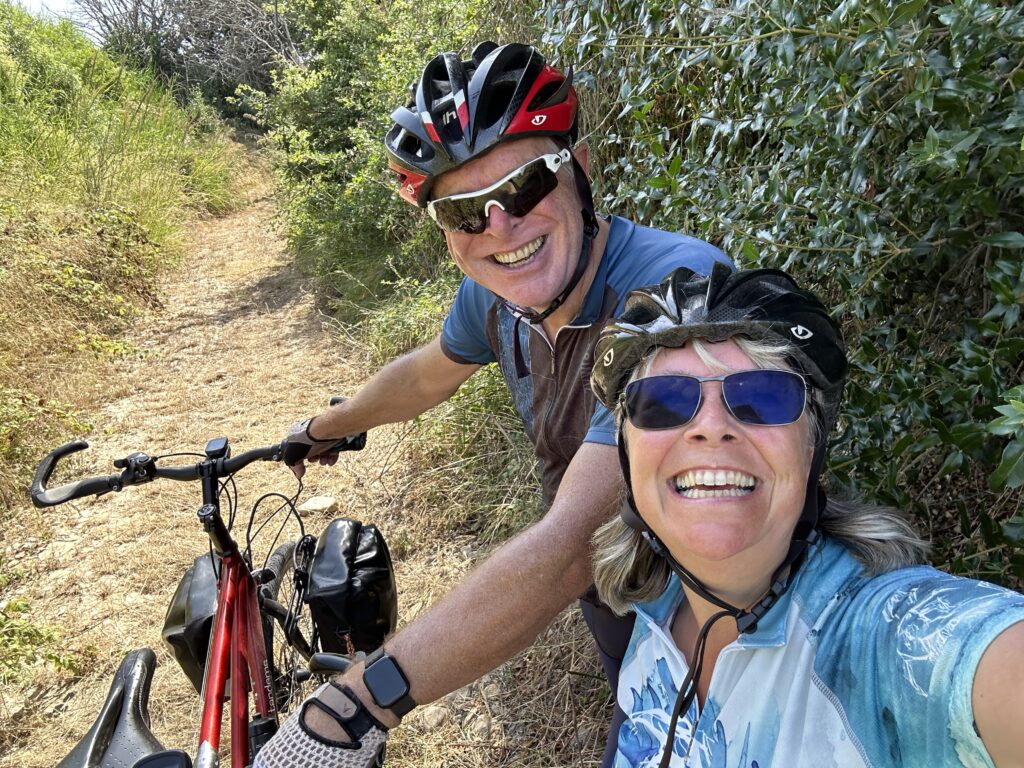
Finally we reached the top, expecting a similarly painful descent down the other side. Miraculously, after an unpromising start, the track became a ruined road, then a proper road, and before too long we were back on a beautifully smooth cycle path.
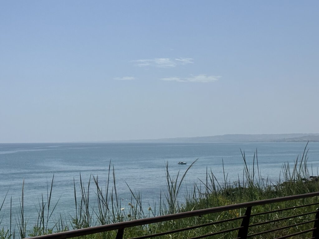
In the distance, beyond the curve of the bay, we could now see the next section of our route, where the coast turns east towards Lesina and the start of the Gargano Peninsula. It’s an exciting prospect!
The cycle path brought us all the way to Vasto Marina, and then to our lodgings at San Salvo. These are fairly anonymous but very comfortable. As I write this we’re in a beach-front café having enjoyed piadine and delicious cold water for lunch.
Tomorrow our destination is Lido Campomarino. We’re going to spend two nights here, as it will help us sit out most of the remaining heatwave in air-conditioned comfort!
Here’s today’s route and a short video