Motorhome day five: Paihia to Pahi Beach
On our last night at Paihia we had torrential rain – the first rain for thirty-eight days, according to the site staff, and it was still raining and fairly gloomy when we awoke. Still, it was time to leave, so we packed up the motorhome, bade farewell to the beautiful bay and headed into Paihia to do some shopping before setting off. The local liquor store supplied whisky and gin – these don’t seem to be on sale in supermarkets here. The large Countdown supermarket at the other end of Paihia provided the rest of our shopping needs before we set off for a long drive inland.
This initially involved impressive views to both sides but also dark skies and intermittent rain. We reached water again at the Omapere inlet. Just after Omapere the inlet reaches the sea. There are tranquil waters inside the inlet but the sea mouth is protected by turbulent and unpredictable waters caused by sandbanks – apparently these are almost impossible to negotiate in a boat. They made for an impressive sight, and we watched the breakers crashing against cliffs in the distance, forming a sort of sea fret at the bottom of the cliffs as they broke.
On, then, to Waipoua forest. Waipoua, and the adjoining forests of Mataraua and Waima, make up the largest remaining area (sixty-nine square kilometres) of unspoiled natural forest in Northland (New Zealand’s northernmost province). Not only that, but Waipuoa has two of the largest living Kauri trees in the country. In fact it took only a short walk of five minutes or so from the main road to the tallest of them, called “Tane Mahuta”, which means “Lord of the Forest” in Māori. It is huge, and hugely impressive. The only way of capturing it on camera was to use the “Panorama” feature of the camera and pan from the top to the bottom. It’s surrounded by dense forest, and only occasionally can you get a glimpse of a more distant vista through the trees.
A short drive later we parked up again, and walked into the forest on a marked trail. Incidentally, on all of these trails you have to scrape, scrub, inspect and wash your shoes on entry and on exit from the forest, in order to prevent the onward march of “Kauri dieback”, a pathogen which attacks a Kauri’s roots.
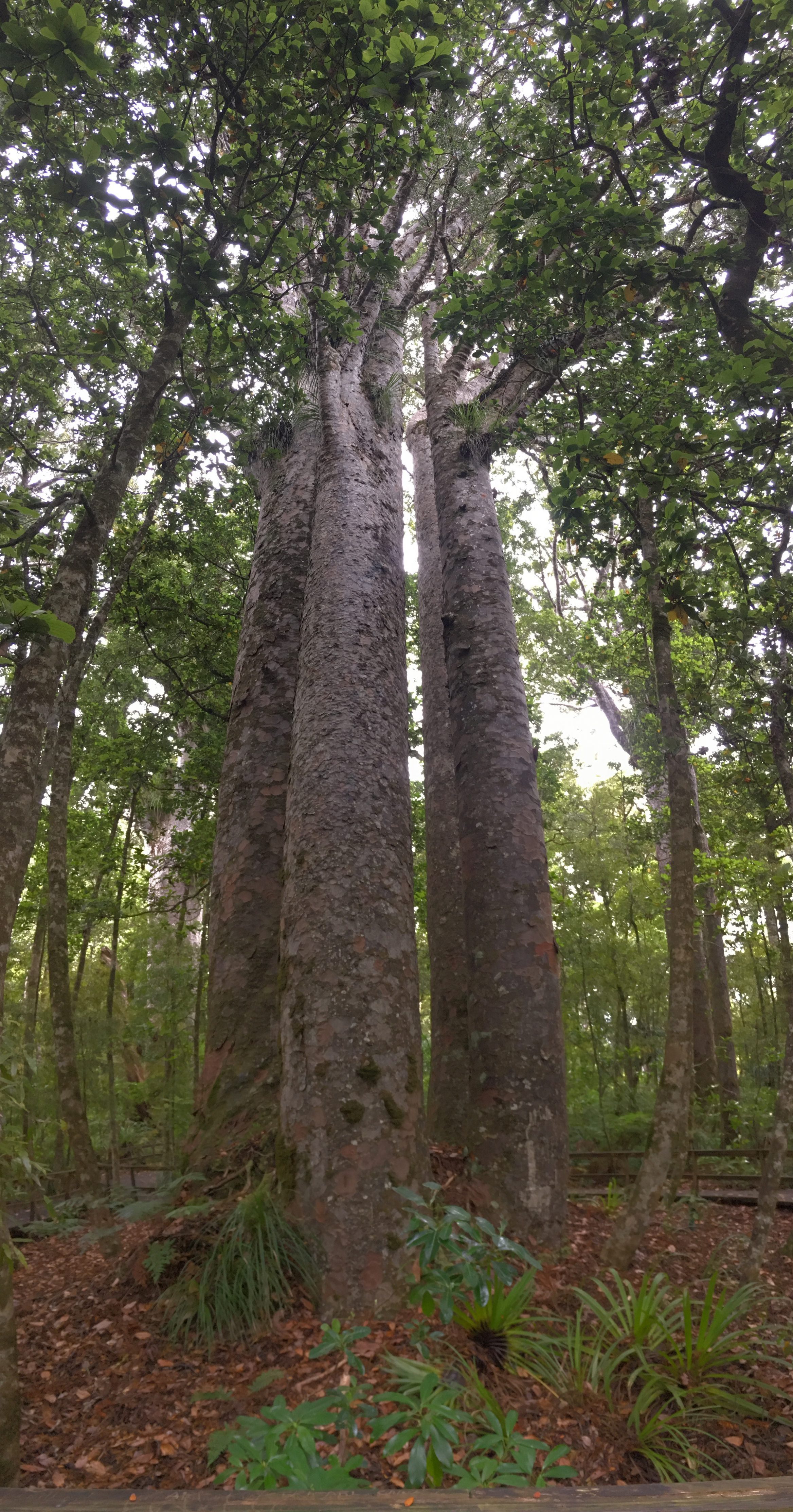
This time the walk was longer, with our first stop at the “Four Sisters” – four Kauri trees seemingly joined together at the base.
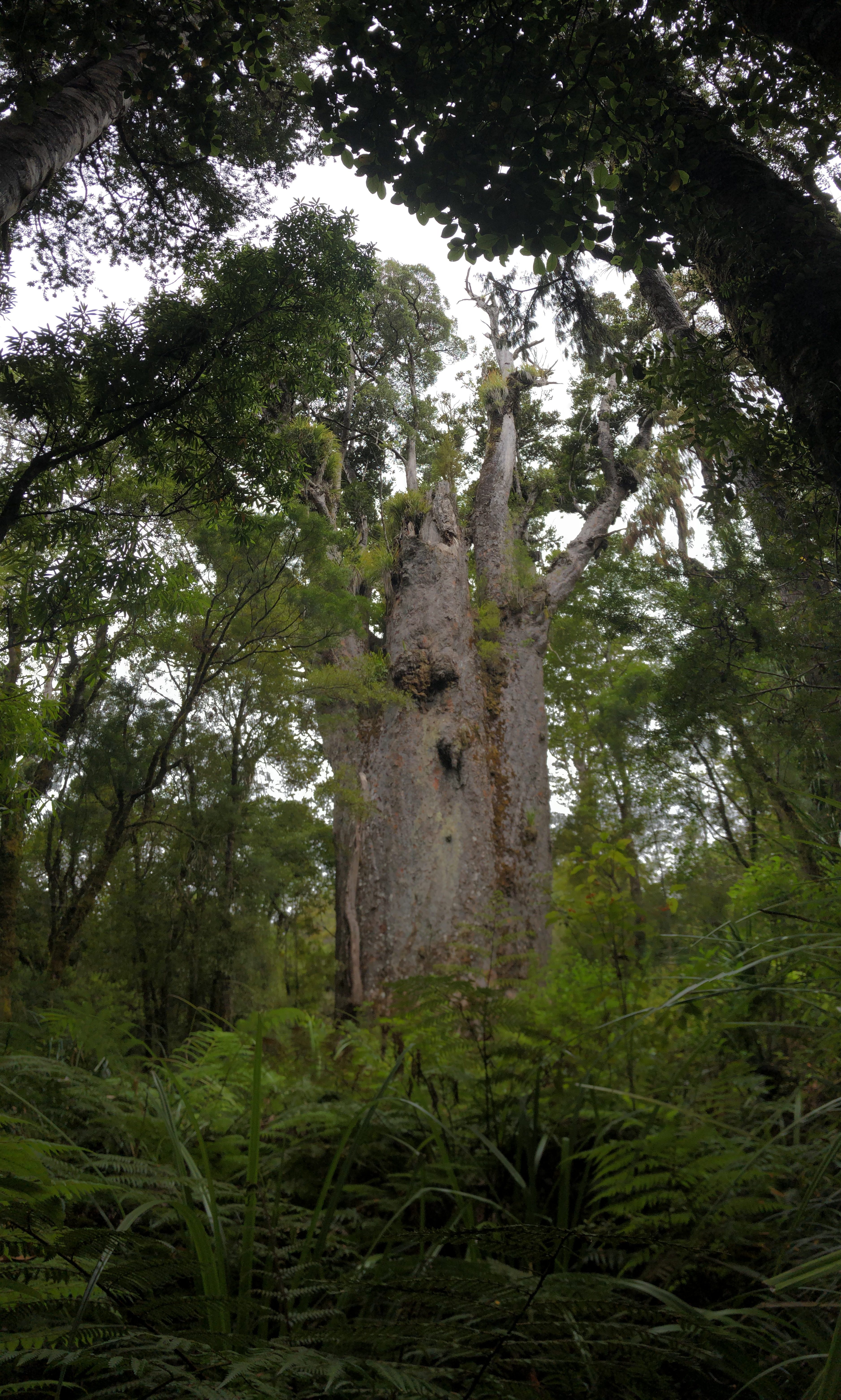
In this section of the forest there were numerous enormous Kauris, any one of which would be extremely impressive in isolation. Our target was the second largest tree, named “Te Matua Ngahere”, meaning “Father of the Forest”. This tree is not as tall as the first, but much older and hence much more girthy (it happens to us all!).

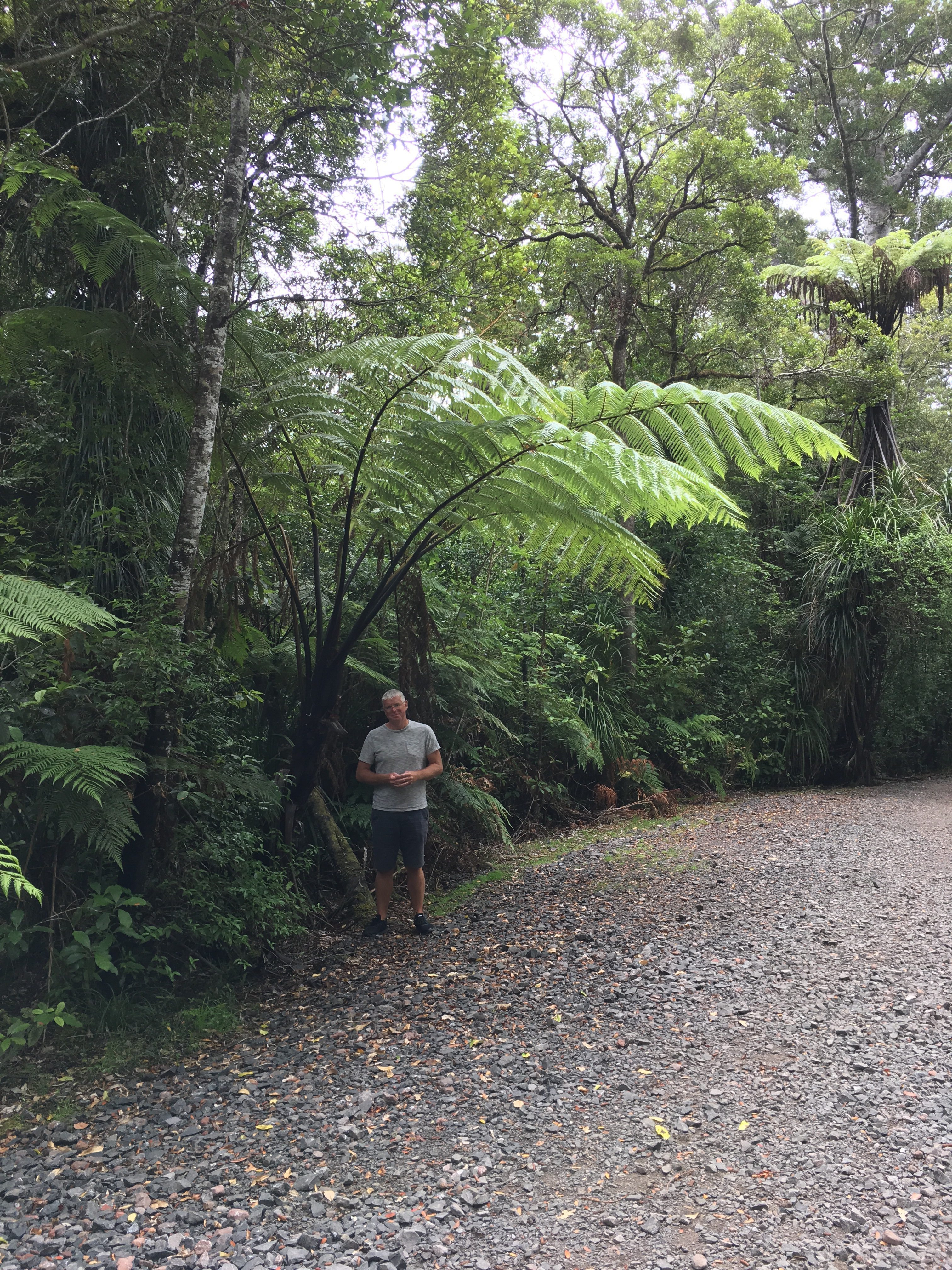
Again the forest was very dense, and there were many enormous tree ferns too, and an overall sense that it would be easy to get lost if you strayed too far from the marked path. We’ve really enjoyed exploring the Kauri forests – the sense of moving through ancient unchanged woodland has been magical.
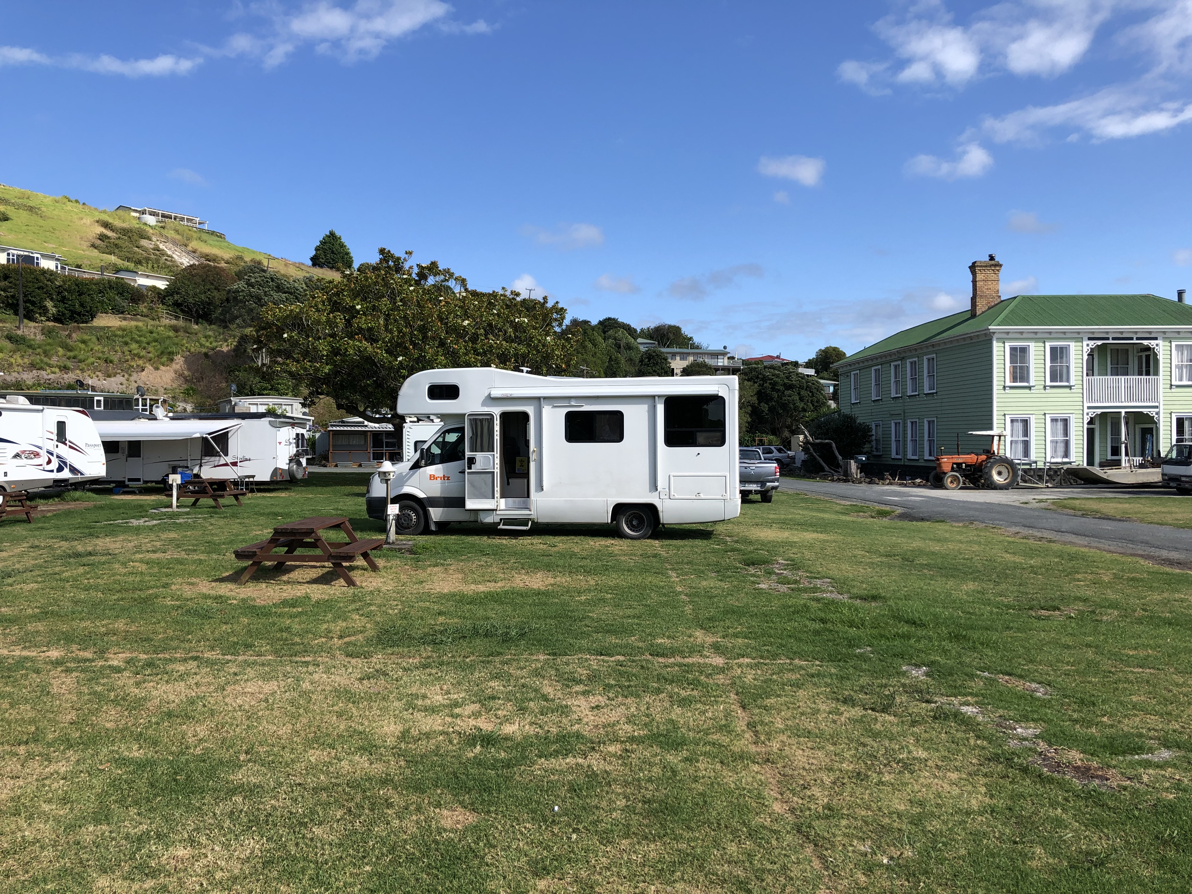
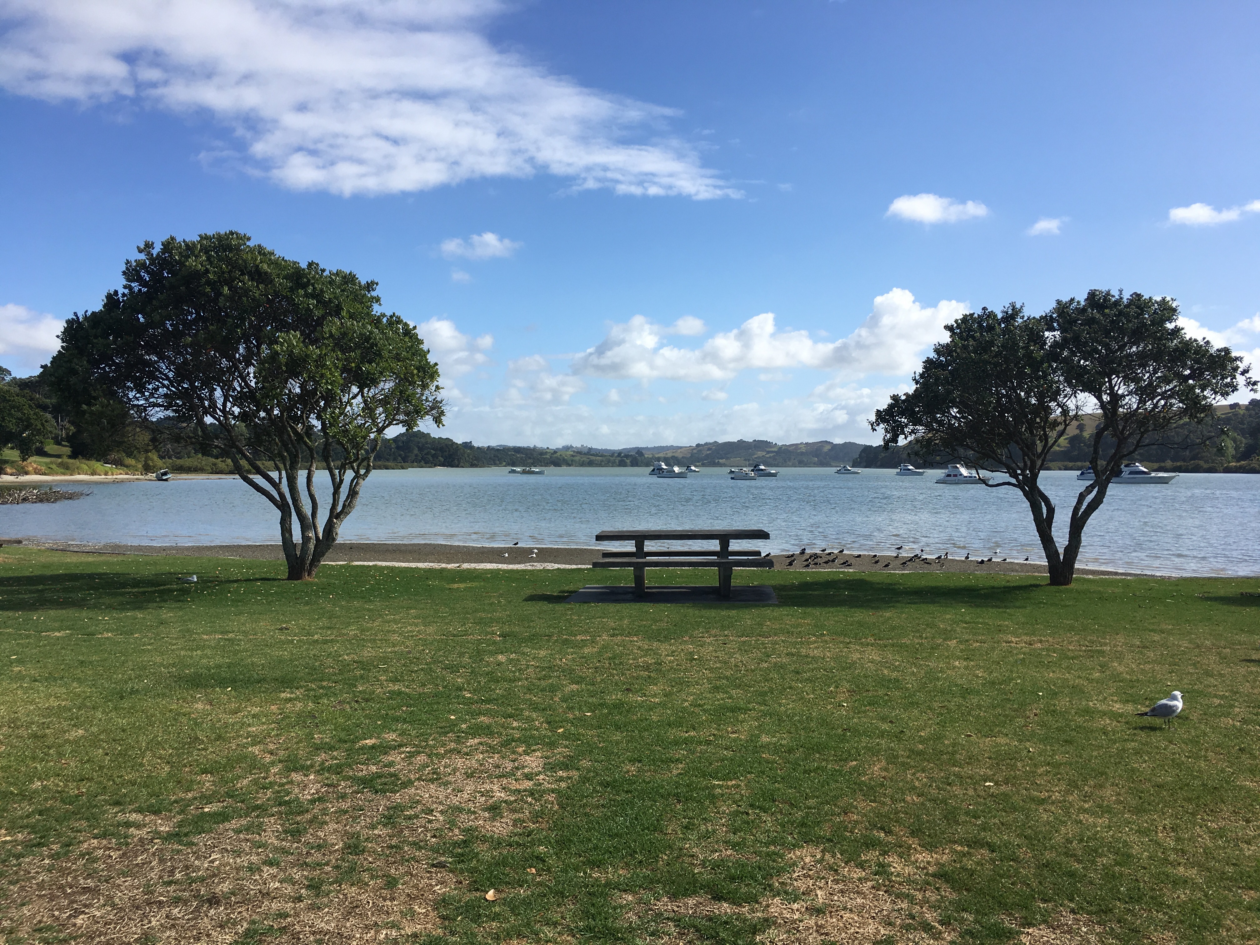
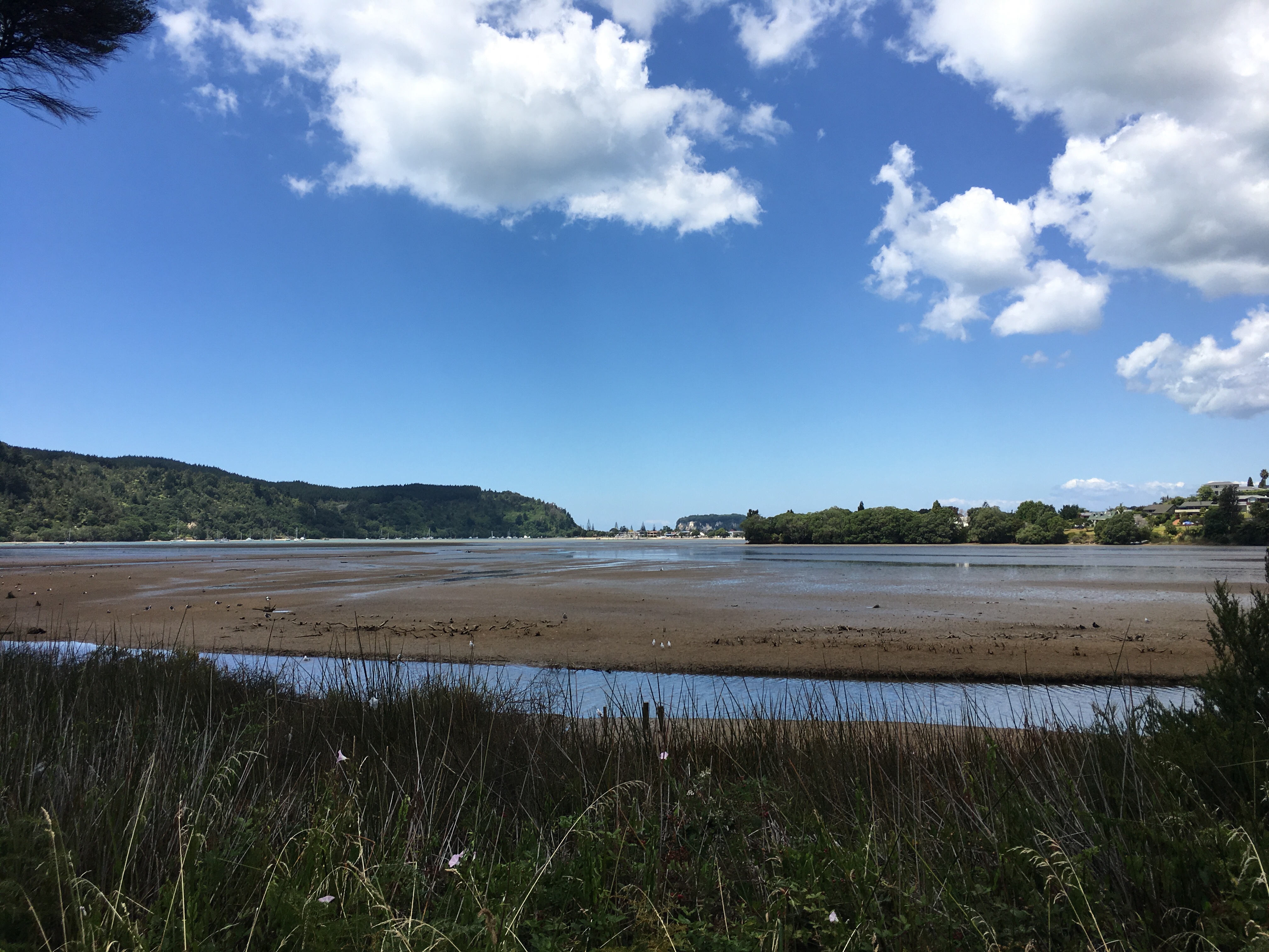
We moved on in improving weather, eventually encountering sea water again at Dargaville estuary, which was brown and turbid. Blue skies started to appear as we headed down the small peninsula which led to our campsite at Pahi Beach. This small site sits in an estuarine valley reminiscent of the lower reaches of the River Dart in Devon – all around were soft green hills and the estuary, which on first impression seemed to be mostly mud, filled right up as the evening went on.
Our friendly neighbours, residents of the Auckland area, called us over for a chat over a glass of wine. They were very friendly, and used to breed Limousin cattle for a living. We asked why we’d seen so few sheep, since they apparently outnumber humans in this country. They explained that sheep farming in some areas had given way to beef and dairy cattle farming, and so there are fewer sheep than there once were – apparently the numbers have halved. The man was keen to talk about St Helens – apparently he was a very keen rugby league player in his youth, and once had a chance to play for them – on their only visit to the UK he managed to achieve his ambition of walking on what he described as the hallowed turf of St Helens’ rugby league pitch!
Motorhome day six: Pahi Beach to Coromandel
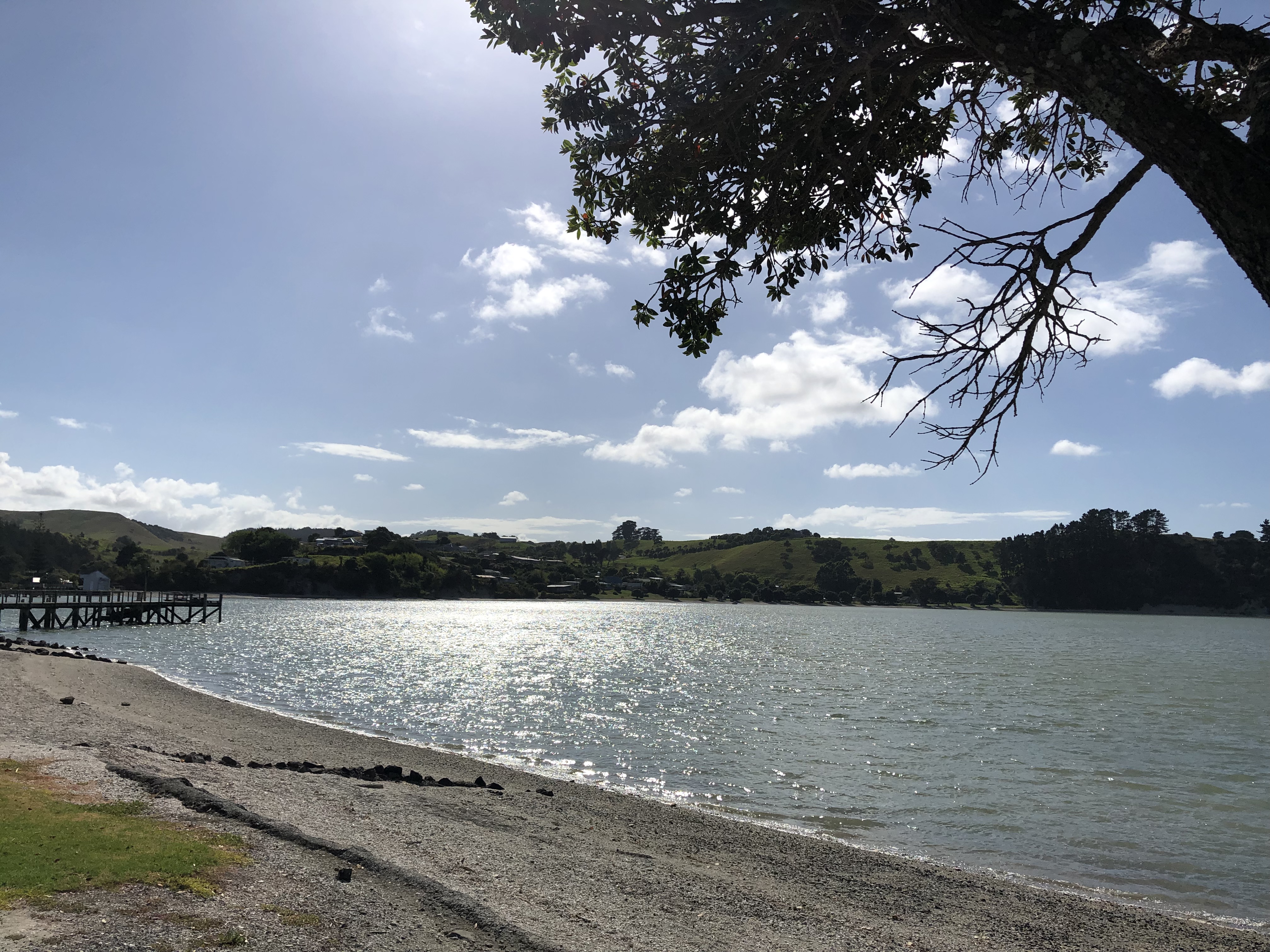
All traces of rain had disappeared when we awoke to the sound of (still mostly unfamiliar) birdsong, and on looking outside we saw that the estuary was full of water. We took the opportunity for some more photography before leaving this lovely site, after only a short visit.
Today was to be a day of transition, as we had to cross the country from west to east and to traverse Auckland too. Initially it was easy driving on minor roads, then it became more busy progressively until we reached the outskirts of Auckland.
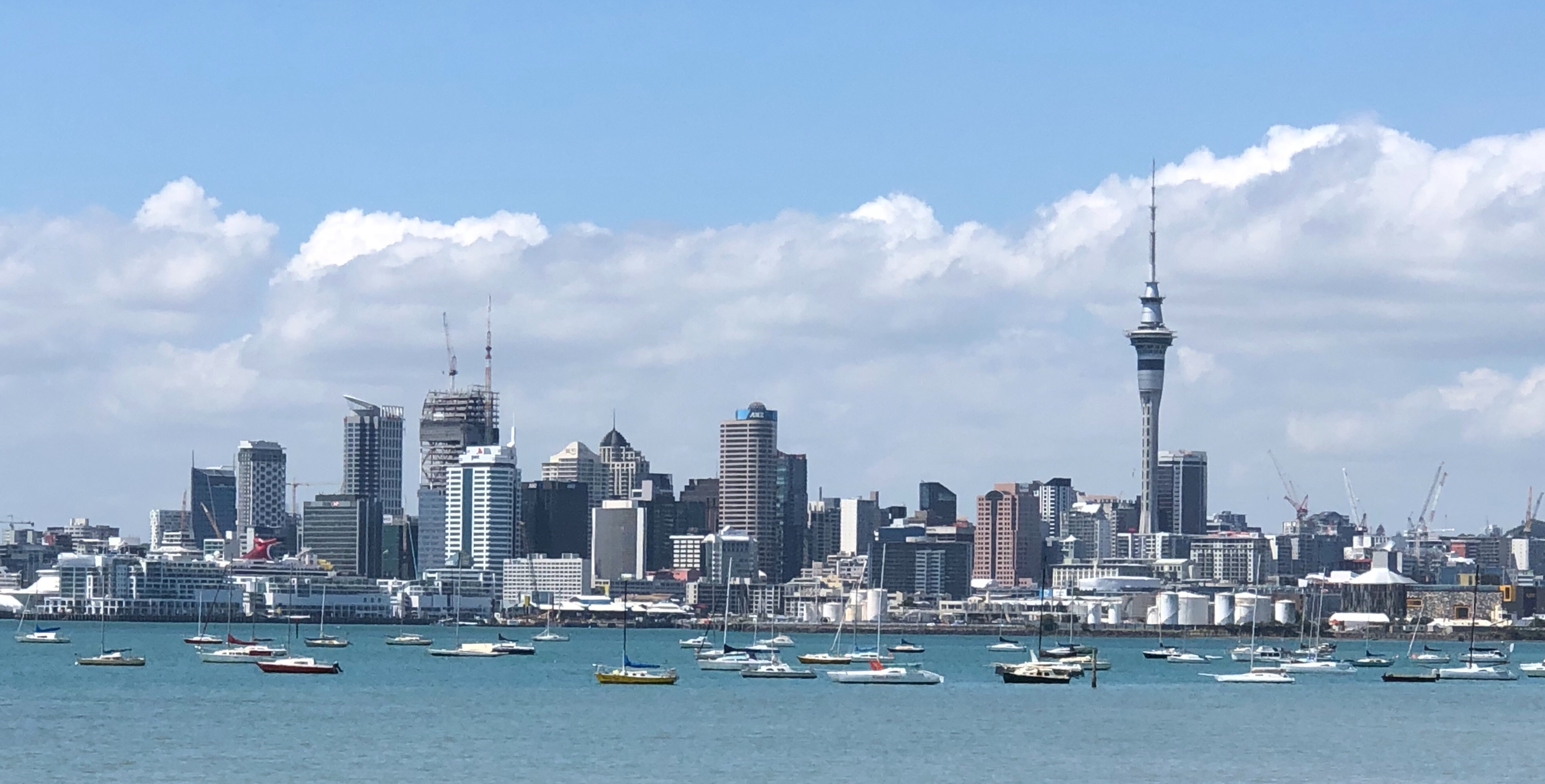
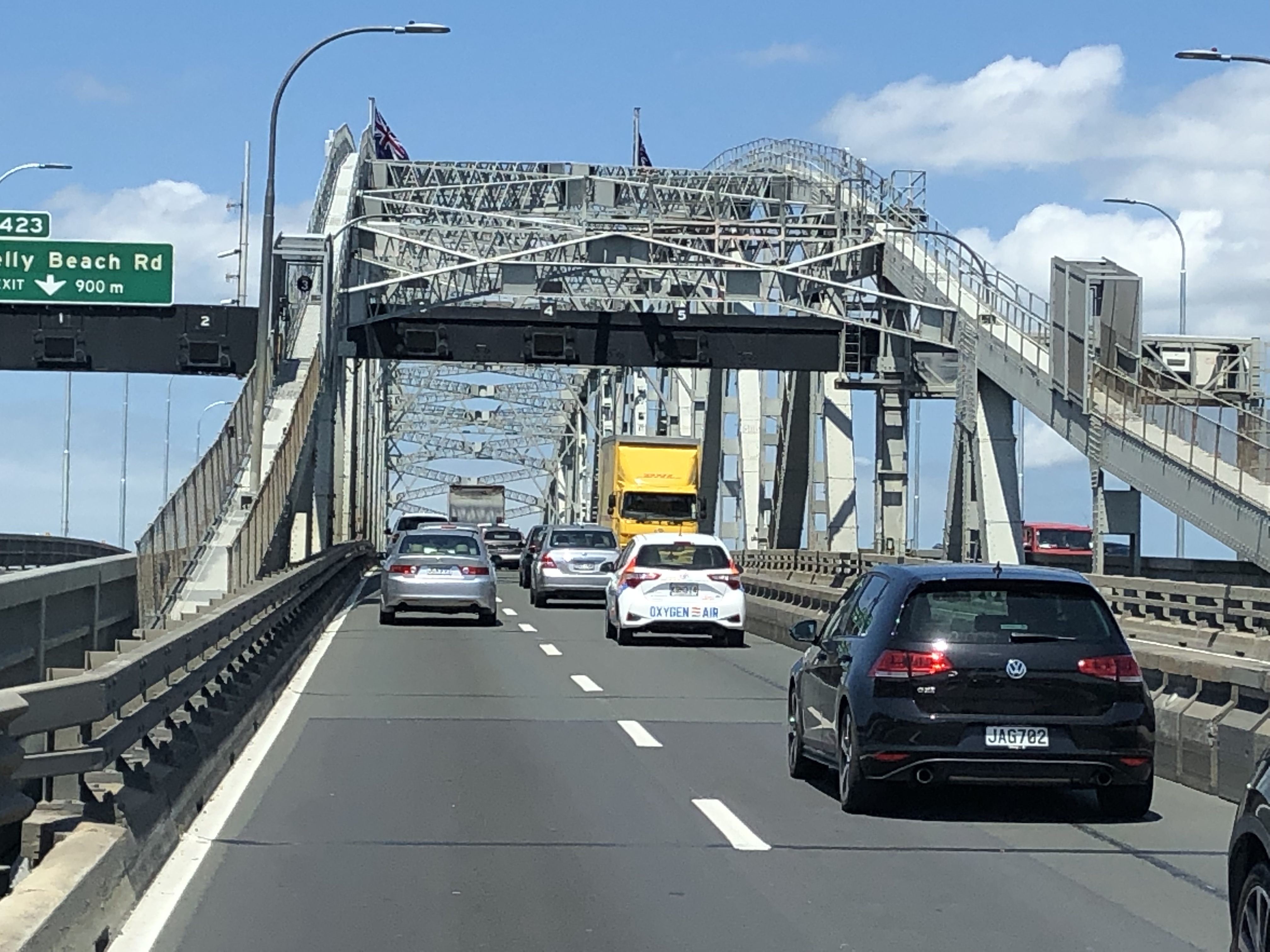
There was some typical aggressive “city-style” driving on the approaches to the city, and it was a relief to get to the other side of town and join the eastward bound roads, which became quieter almost immediately.
We stopped for a roadside lunch at Thames, at the base of the Coromandel peninsula. Thereafter our journey north, on the peninsula’s west coast, involved a glorious sequence of spectacular views. To our right, we could see dense green woodland; sometimes the branches formed a “tunnel” over the road.
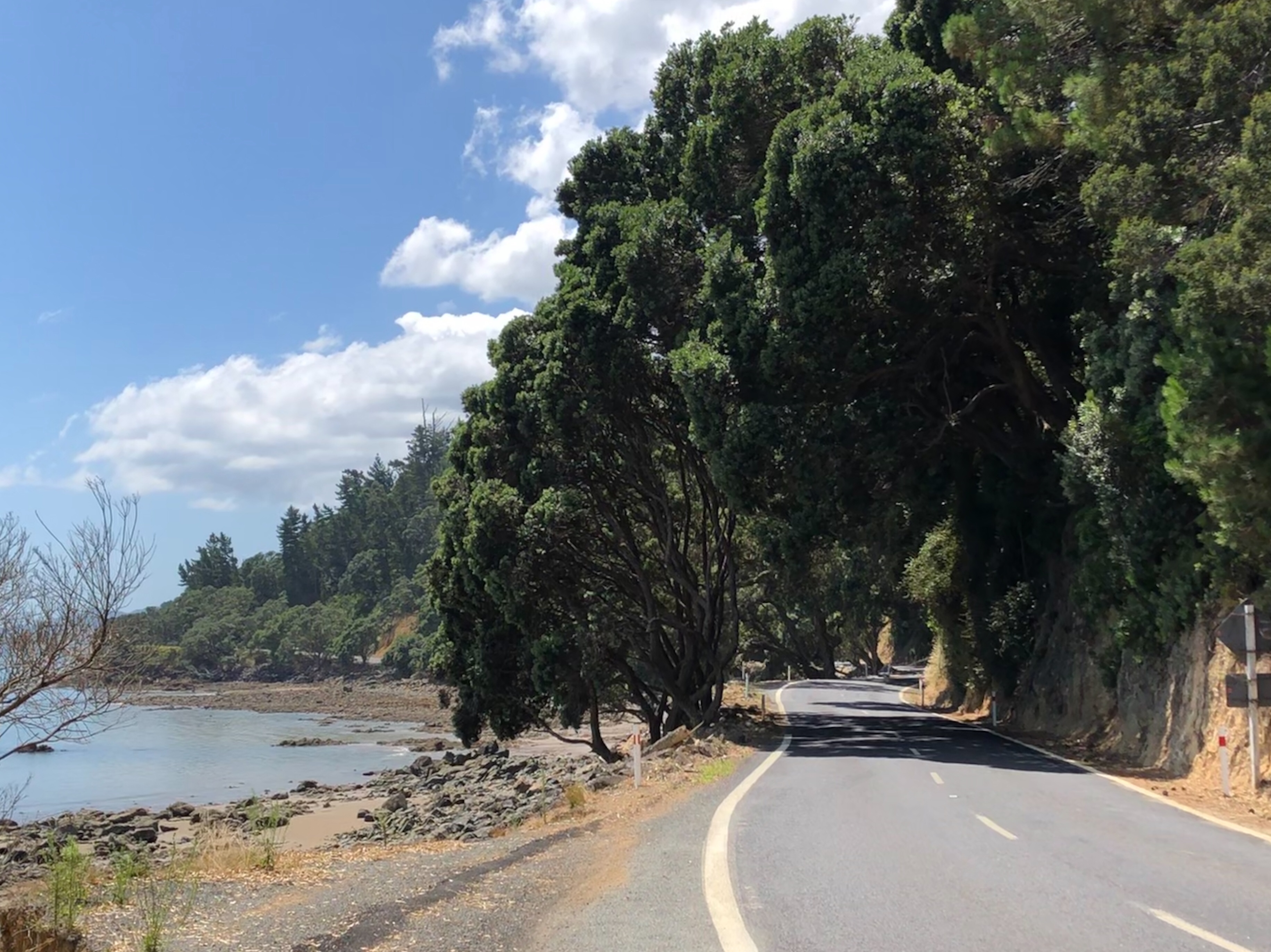
To the left, the view was of the aquamarine coloured shallow bay between Coromandel and Auckland. Occasional glimpses could be had of the Greywacke (sandstone) bedrock and of the volcanic rocks which occupy most of the area. Out in the bay we could see extensive oyster farms.
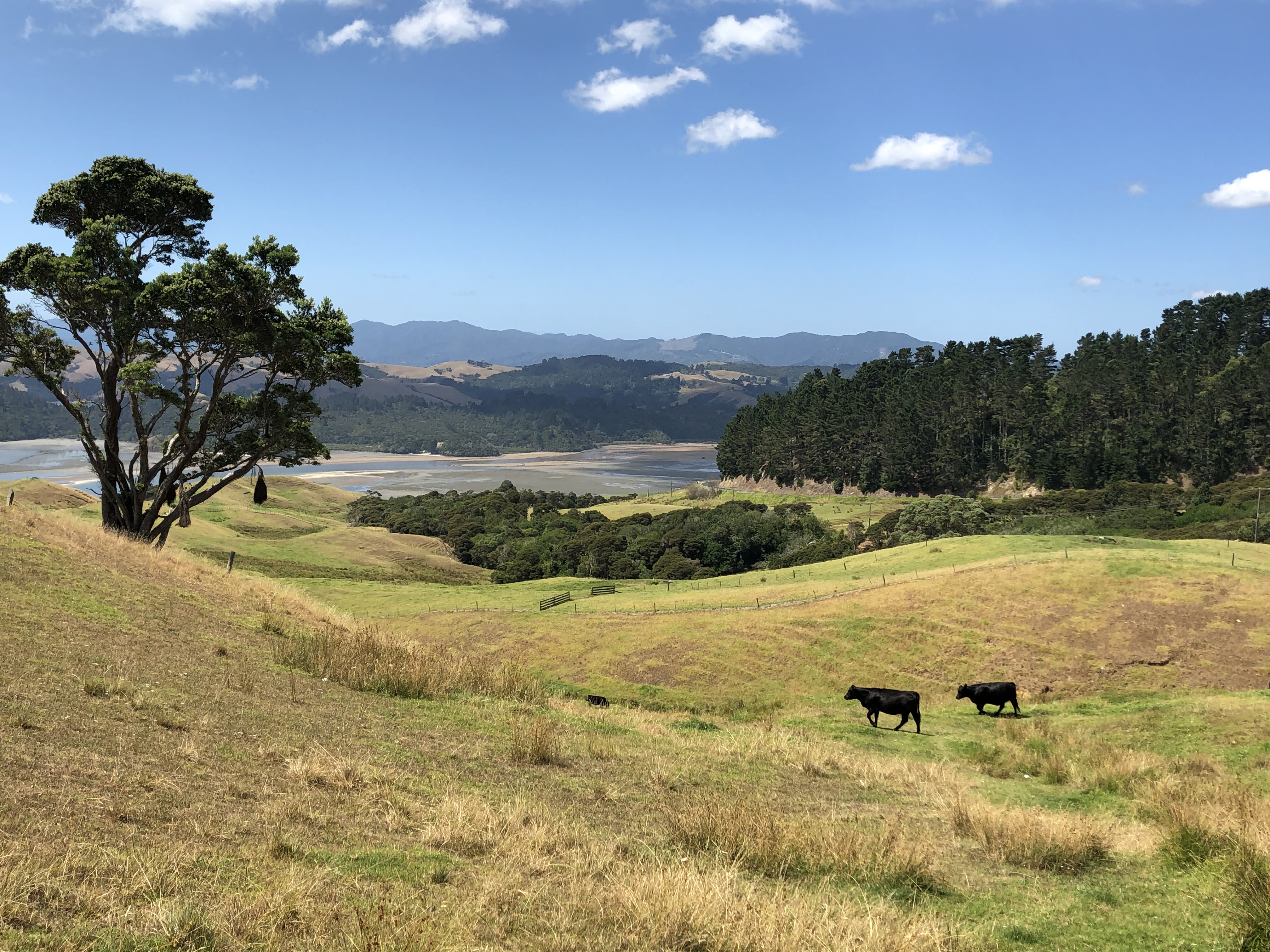
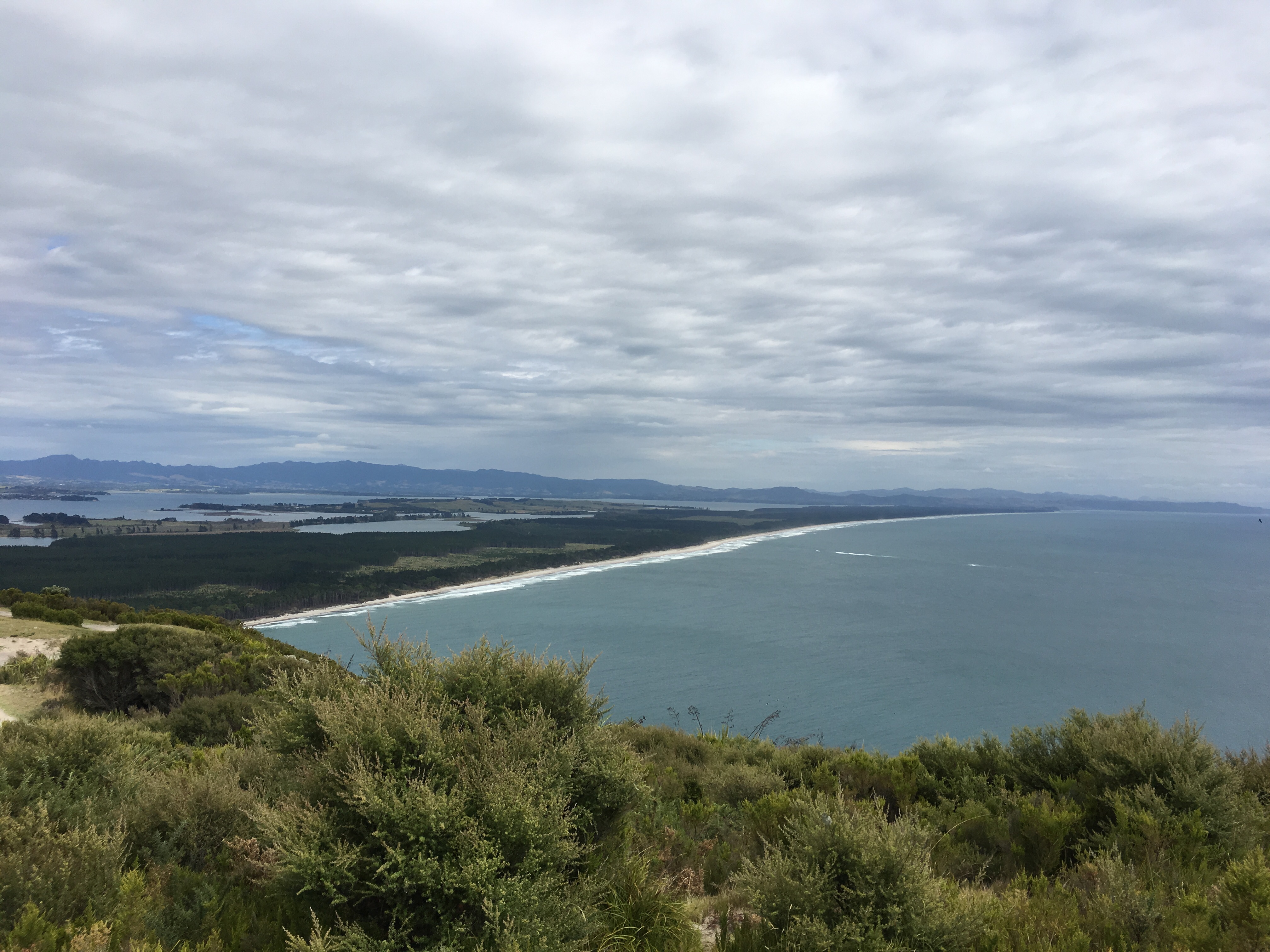
Most of our driving was at sea level, but a climb at Kereta brought us to a viewpoint with spectacular views. Here I took the perfect landscape photograph. I should explain this! We were at an art exhibition in London once, and it was explained to us that the artist in question had said that a perfect landscape painting should contain three cows! Now sadly neither of us can remember which artist is reported to have said this (Ruskin, or maybe Constable come to mind), but we’ve always joked about it since. Anyway, here is my (by definition) perfect landscape photograph!
 There were frequent lay-bys at the side of the road, designed to allow slow vehicles such as ourselves to pull in and let the faster traffic through. We used these whenever necessary and were usually thanked with a cheery wave or a toot of the horn. Finally we pulled into our campsite at Shelly Beach – what a place. We had a pitch next to the beach, which lived up to its name, being covered with bivalve shells.
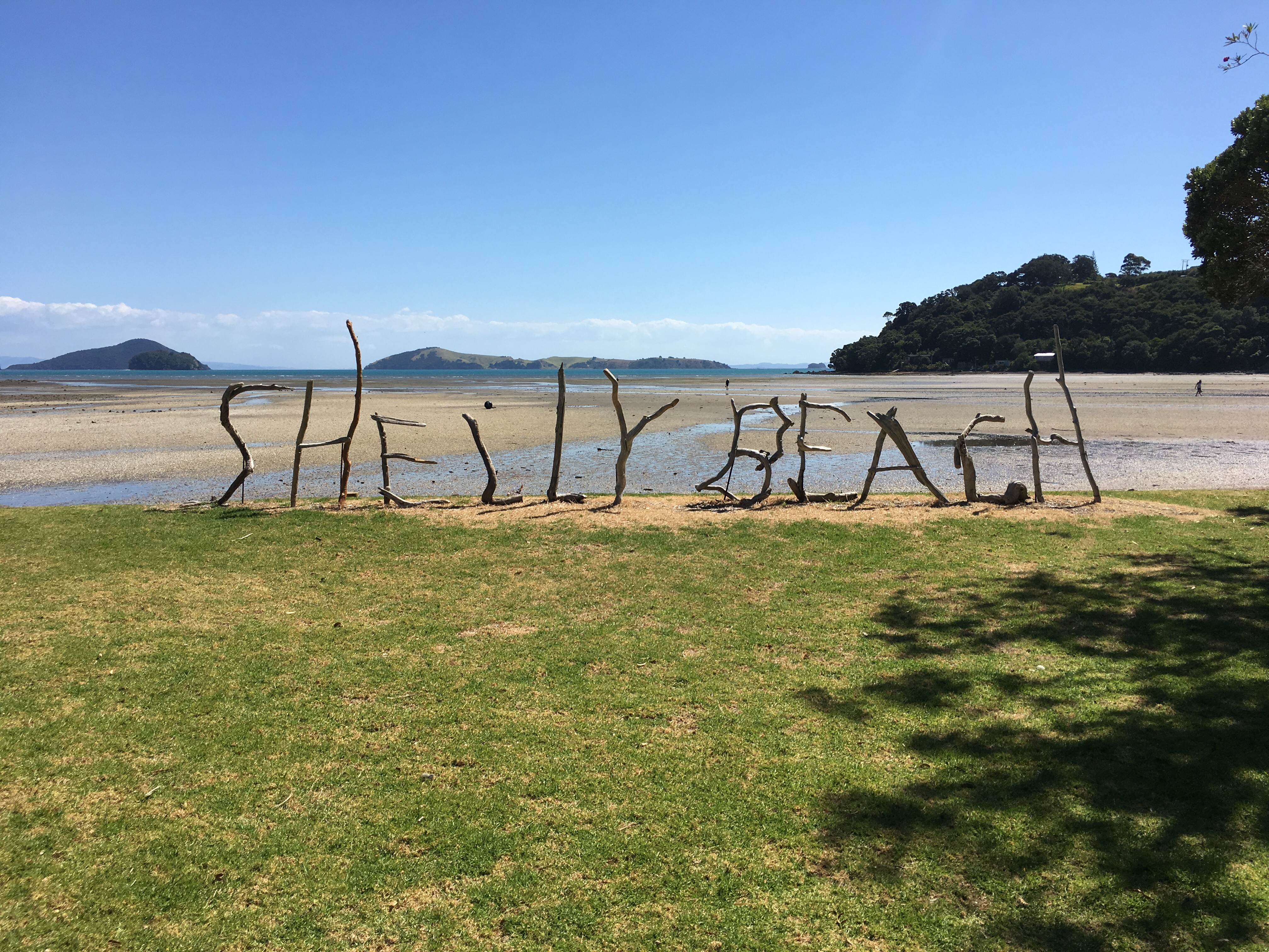
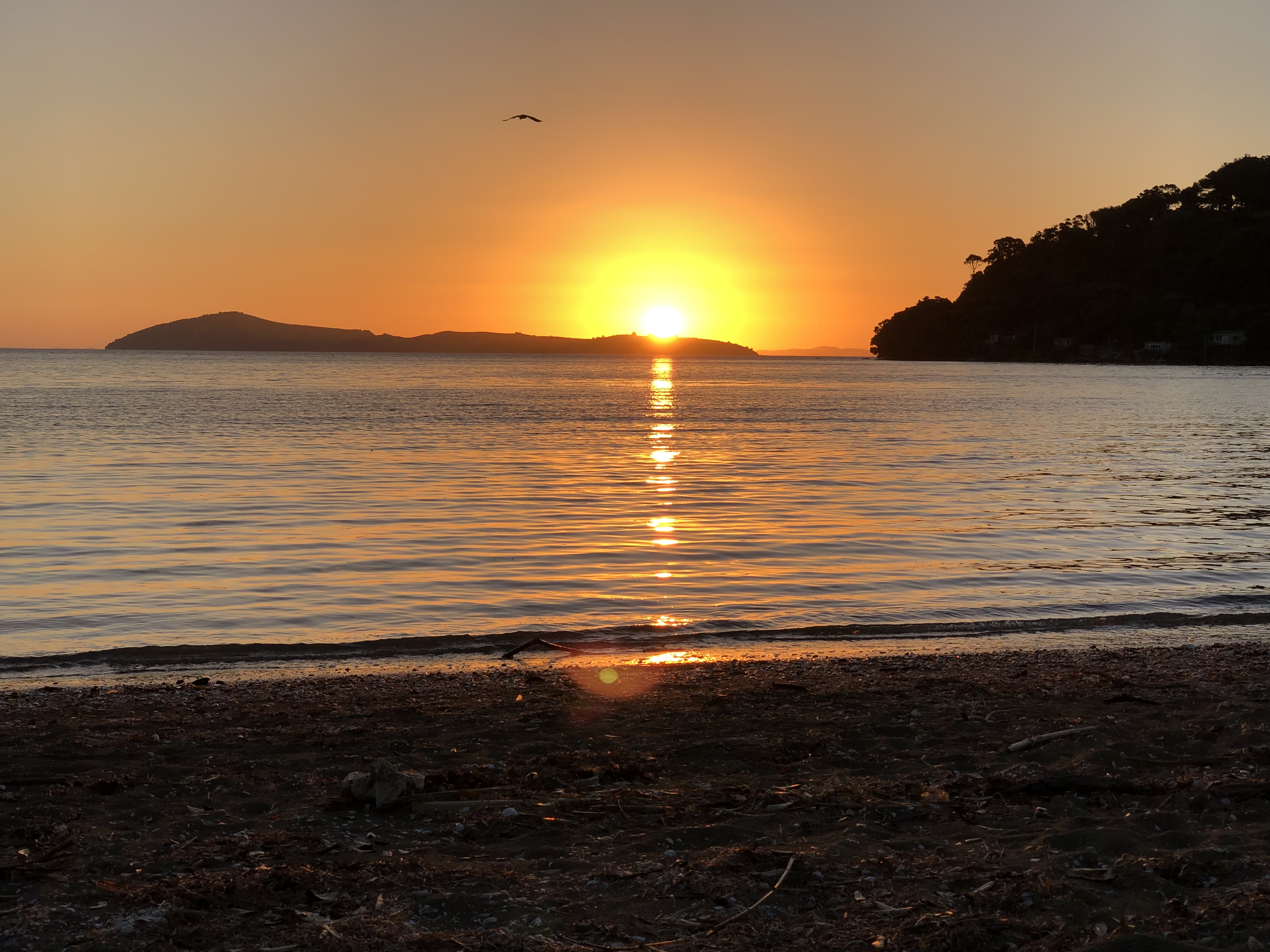
The tide was out on our arrival, then came back in to coincide with a superb sunset. We took our chairs down to the beach and watched the sunset, sitting beside our German neighbours who had chosen to do the same thing. Two paddle boarders, the woman very competent, the man less so, traversed across the bay in front of the setting sun at one point.
Later on, just as we were about to settle in for the evening, we saw the Milky Way, vividly beautiful as we have never seen it before. Much of the country has very low levels of light pollution, and the stars shine very brightly.
Motorhome day seven: Coromandel
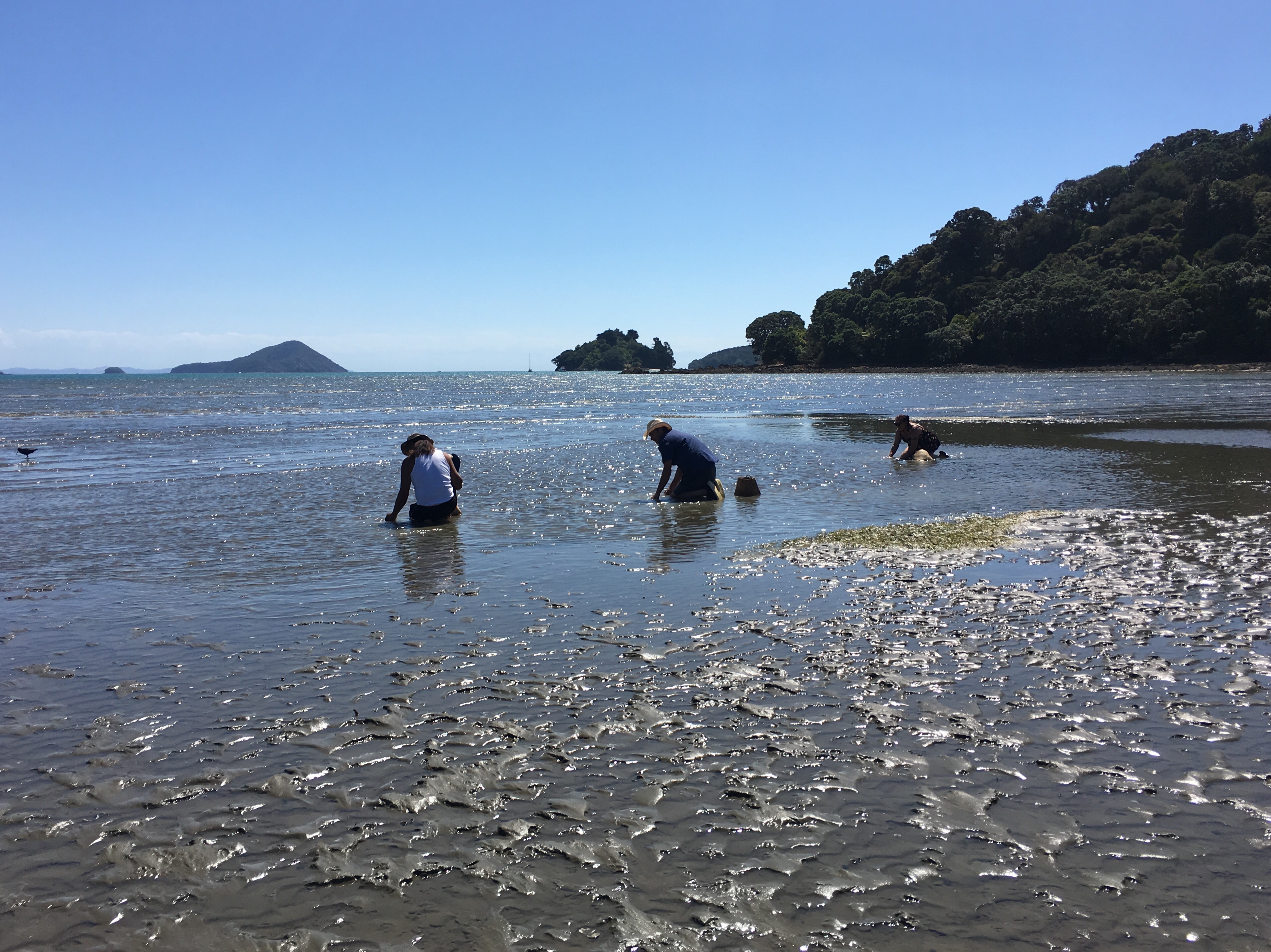
Today was, by design, a lazy day, but a gloriously enjoyable one. We didn’t leave the site except to walk out to the sea, now several hundred metres away. On our incredibly Shelly Beach there was evidence of oysters, mussels and cockles, the latter being collected by three people as we watched.
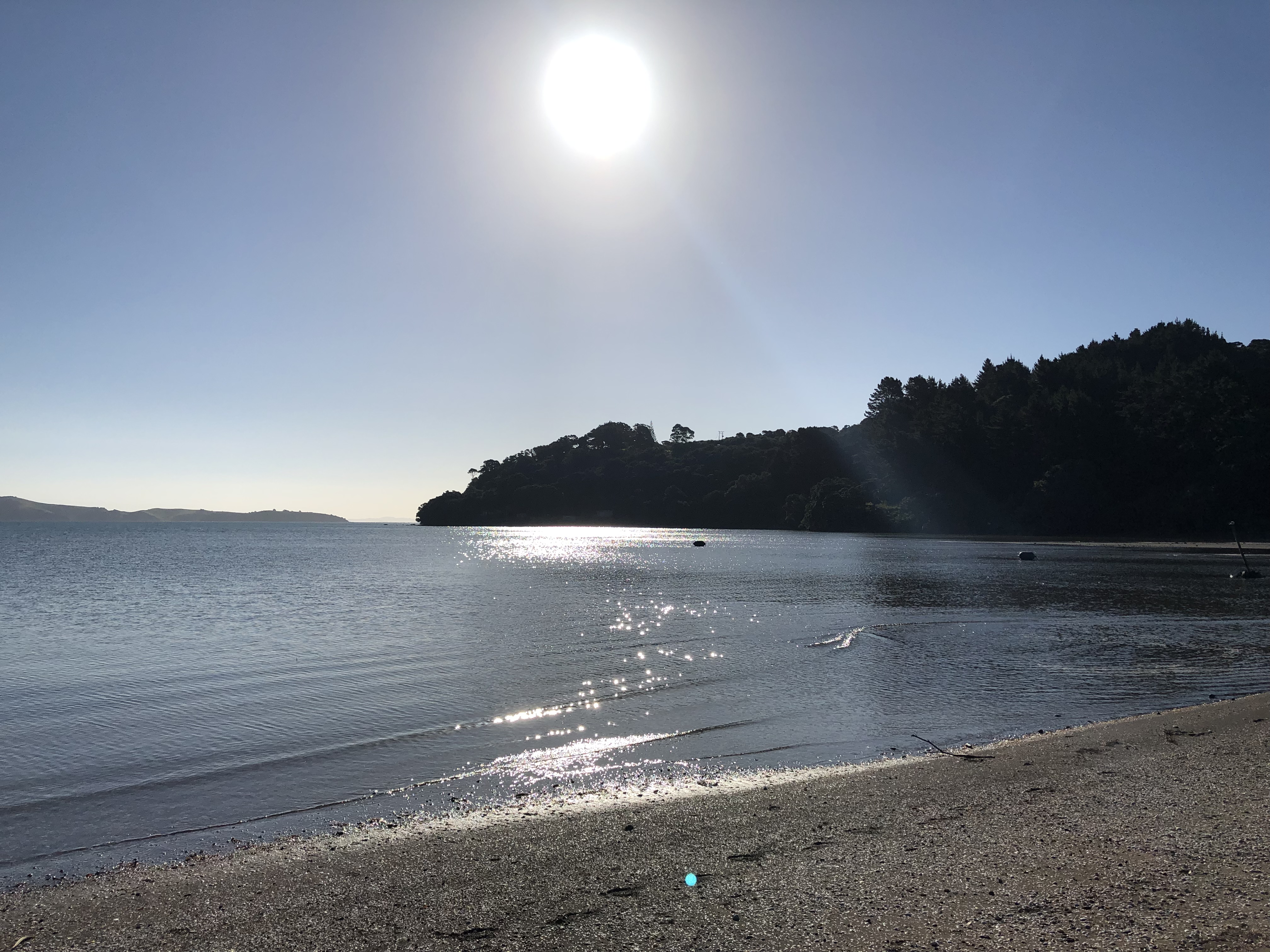 The sand sloped very gently out to sea (when our German neighbours tried to go swimming yesterday yesterday they reported having to walk a long way to get wet).
In the afternoon and evening we took time to book accommodation for our next few nights, ate some delicious corn and a stir-fry, before transferring back to the beach, wine bottle in hand, for an even better sunset. The direction of travel of the sun here takes some getting used to – because it is north of us here it arcs across the sky in the opposite direction to home.
Motorhome day eight: Coromandel to Mount Maunganui
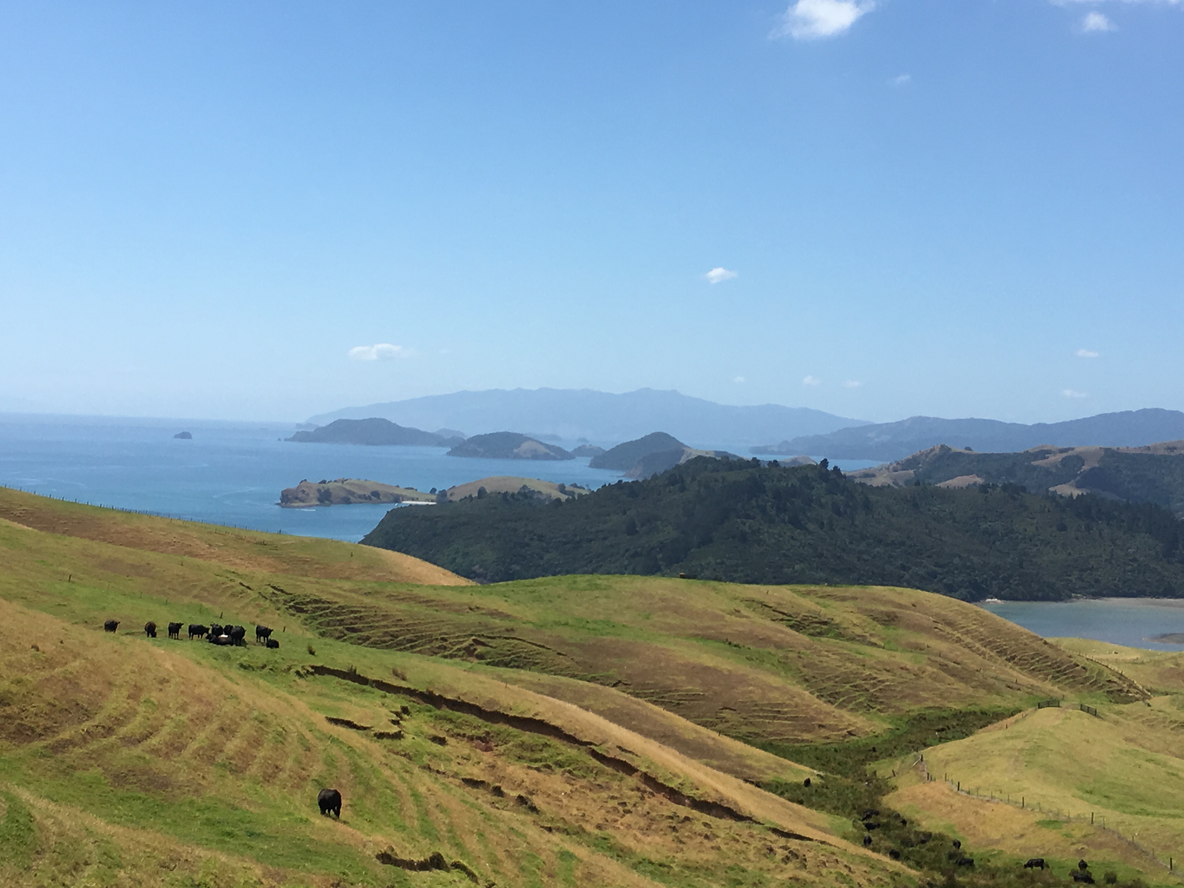
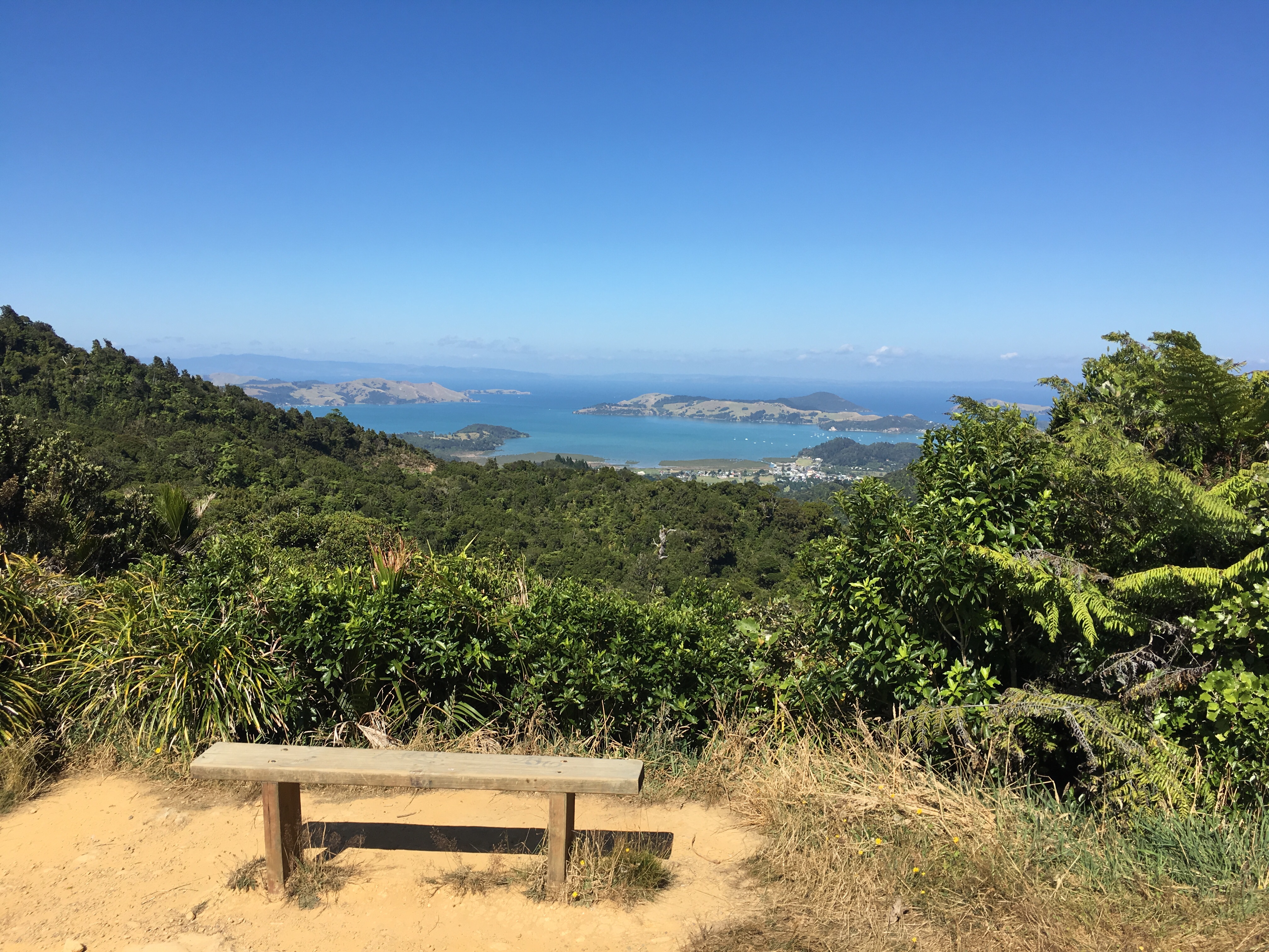
It was a wrench to leave such a beautiful site. Our onward journey began with a crossing of the Coromandel Peninsula from west to east. This involved small winding roads, stunning views, occasionally a viewpoint, always well-populated. At the top of the col we were able to look down towards Coromandel, and could see all of the islands visible from our campsite.
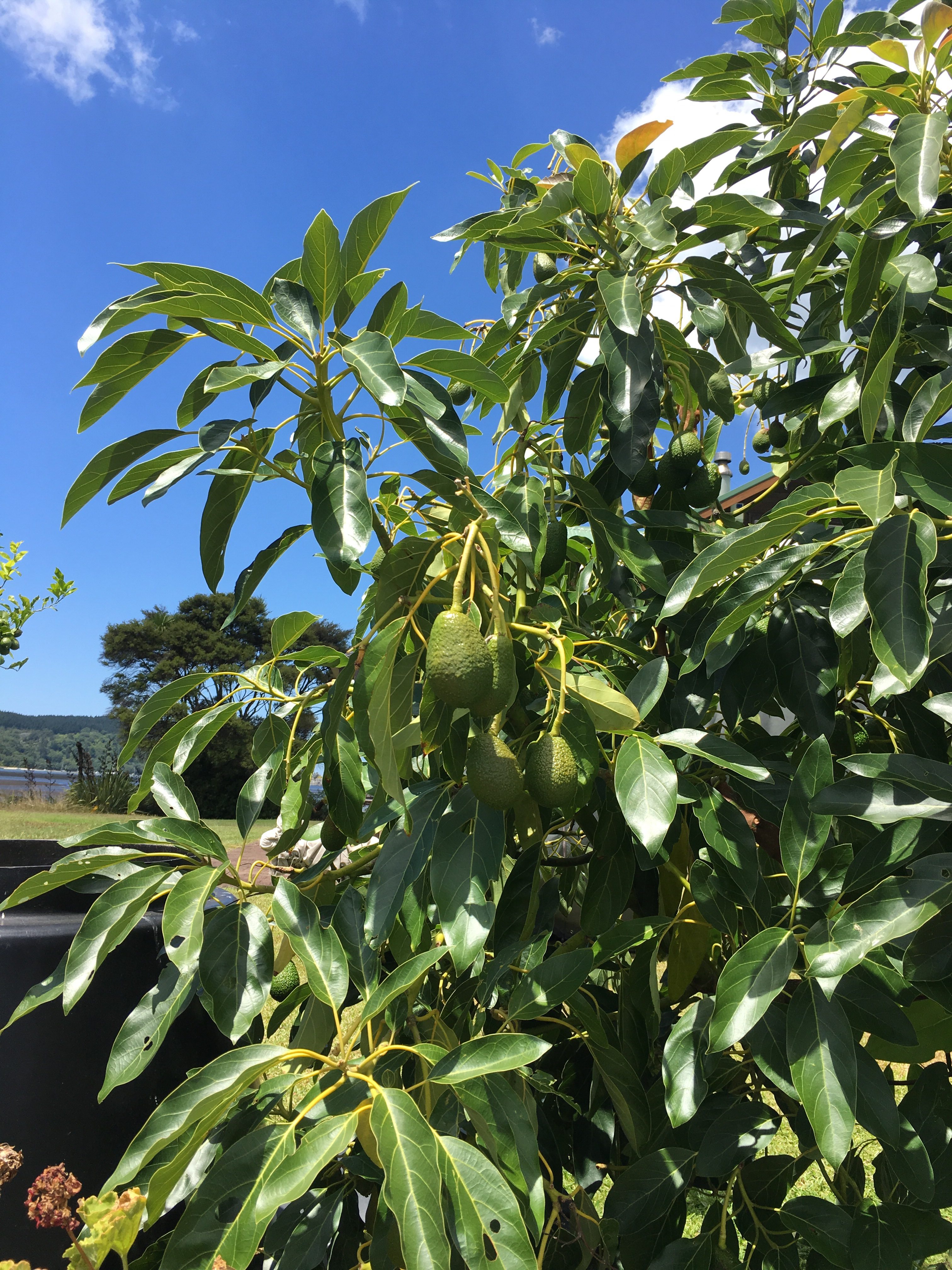
After summiting we descended towards Te Rerenga, then crossed another smaller peninsula, this one pointing north east, before arriving at the lovely harbour of Whitianga. Again we were careful to let faster vehicles overtake, as although the roads are called “State Highways” they are still only a single lane in each direction. We stopped at Whangamata for a lunch of smashed avocados (advertised as “Avos” on roadside boards) on bagels, by the lovely harbour. It was very peaceful, though some small seagulls threatened to pinch our lunch before we chased them off. We spotted some Avos growing by the side of the water.
Eventually we arrived in the Tauranga area, and carried on along the coast parallel to Matakana Island, with Mount Maunganui visible in the distance. We shopped at Tauranga, then drove on, passing a brief area of industrial grot, before arriving at our campsite on the coast near Mount Maunganui.
When letting the water out of the sink today after shaving I noticed water going down the plughole anti-clockwise! I’ve never before seen this demonstration of the Coriolis effect!
Motorhome day nine: Mount Maunganui
Our campsite here is a little cramped, and certainly less scenic than those of recent days. It’s well-run and very well equipped, though, and within striking distance of Mount Maunganui. When Joshua was here he climbed the Mount, then enjoyed the hot thermal pools afterwards, so we decided we should emulate this today.
Mount Maunganui is another volcanic remnant, and sits at the end of a spit of land facing north west, opposite Tauranga.
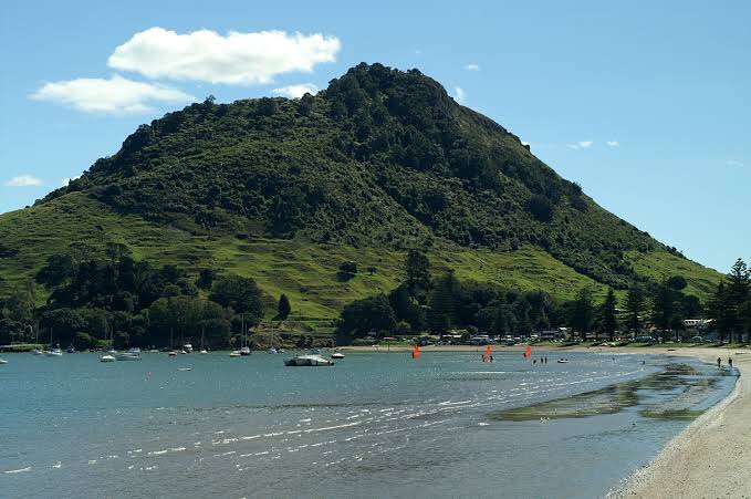
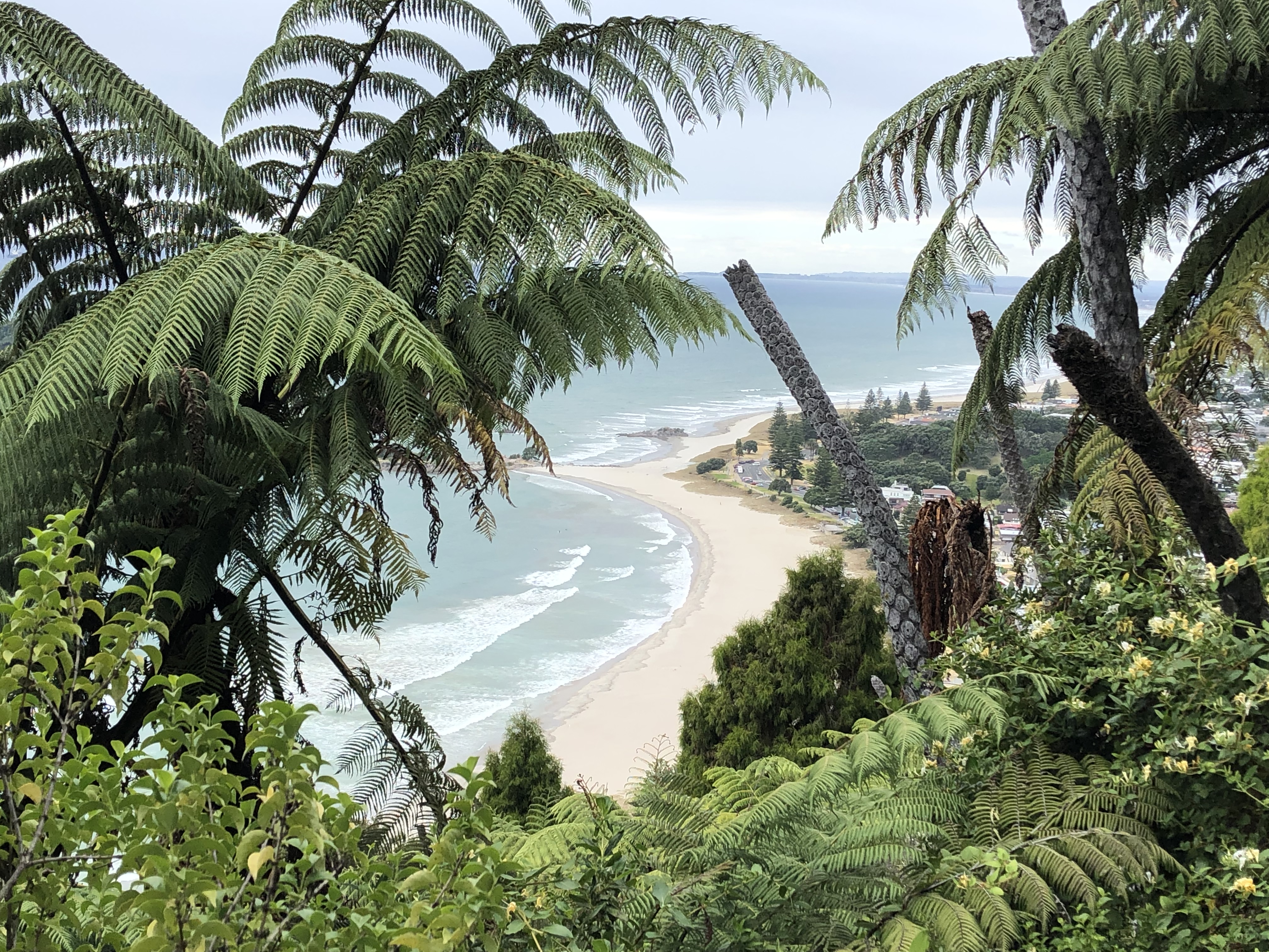
The walk (or run, if preferred) is very popular, with a choice of routes – we chose one involving a lot of steps. We climbed for about thirty-five minutes, mainly in lush woodland, catching occasional glimpses of the coast below, and of Pilot bay, which separates Tauranga from the Mount. It was steep, dusty and dry, but worth every step – a small path can be used to circumscribe the summit, providing views in all directions.
On our way down we scored another first – Clare pointed out how loud the cicadas were (she has to do this, as my tinnitus means they are all but inaudible to me), and suddenly I spotted one. Quite often on our cycling trips in France and Italy we’ve cycled to the accompaniment of this sound, but whenever we’ve stopped to try to see them they have shut up, which means we’ve never actually been able to spot one before.
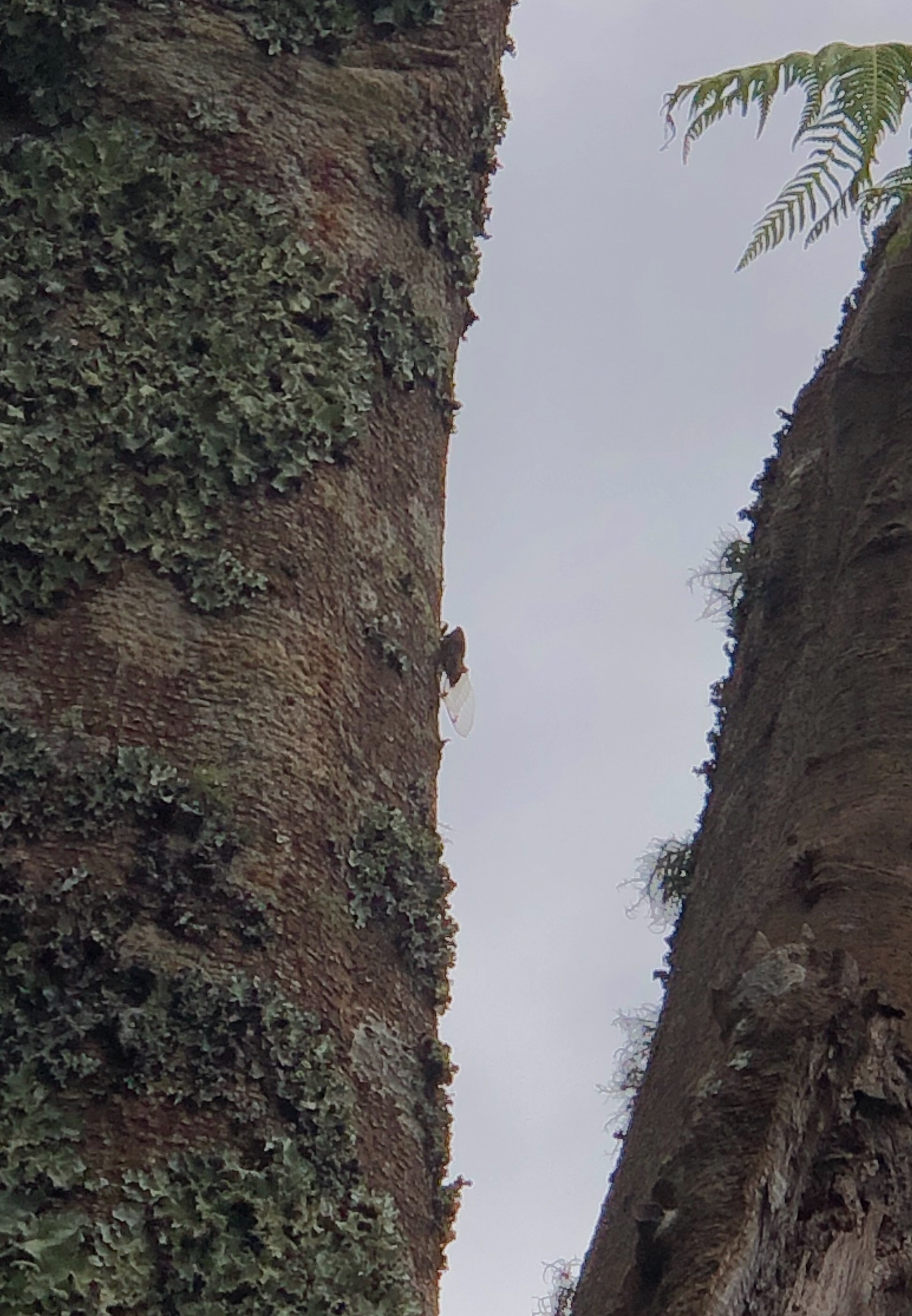
Once we spotted one, of course, we ended up seeing many more. Continuing down to the edge of town we decided to have lunch (a very good one) in a nearby café, before heading for the thermal pools. These were well set up, with pools of varying temperatures, allowing you to adjust gradually to the thermally heated water. It was most relaxing, and soothed our walking muscles. We walked back to the campervan, passing many modern houses built of glass and steel, which seem to be a feature of this area – most of the houses we’ve seen outside of Auckland have been single storey wooden constructions.
Tomorrow we set off for wine country – Hawkes Bay first, then Martinborough. If you want to drink along with us then you need to stock up on a bottle of Pinot Noir from each of these locations!