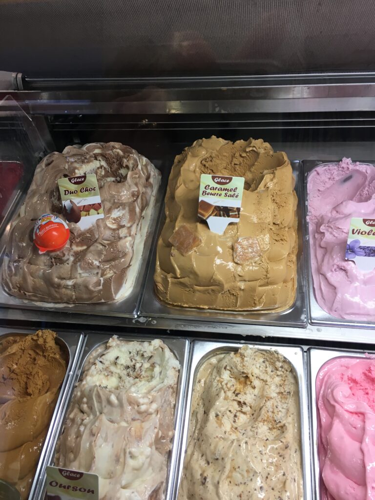
A lovely evening in Honfleur last night, an aperitif in one of the bars right on the harbour edge, and then a walk round to the restaurant ‘Les deux ponts’ by the lock for a leisurely dinner. We’d spotted an ice-creamery on our way to the restaurant, so we passed on dessert at the restaurant in favour of an ice-cream on the walk back to the hotel. And they had ‘caramel au beurre salé’, fantastic.
It was raining when we woke up this morning, disappointing but expected, so donning our rain jackets after breakfast we set off west out of Honfleur and up the first gentle climb. It didn’t rain for long, fortunately, and it was still warm. We could see the ever-widening Seine estuary, and remembered that the lady in the hotel had pointed out the beach for us on her town map, but had told us not to swim in it, because “it’s not the sea, it’s the Seine”. The road wound through a series of picturesque and beautifully kept villages, with the sea (the actual sea, not the Seine!) on our right now.
At Trouville we dipped inland briefly to cross an inlet via the bridge, and cycled through the town centre, across a series of paved squares (well, more ‘circulars’, really) and out again on a road right by the beach. There were houses between us and the beach for the most part, but occasionally there would be a break through which we could see sand and waves and sometimes the remains of a World War II bunker, grey concrete up to three feet thick in places.
At Villers we set off inland again, but this time climbing steadily. Not much to look at, so just heads down grinding upwards until we reached the top and struck off on a delightful tiny road. Which fairly quickly became a gritty track. And then grass! We turned around, retraced our tracks and took the road instead, a long, long descent into Houlgate. We followed a second inlet inland, crossed over the bridge and then headed into Cabourg for lunch. Strange place, it looks like a spider’s web on the map, although it doesn’t feel like that on the ground. The ‘spoke’ we went in on was full of shops and restaurants, so we parked up the tandem and went into a creperie for a delicious lunch.
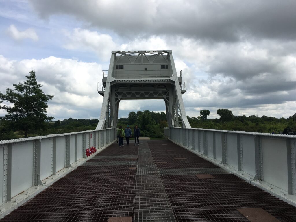
The skies cleared whilst we were inside eating, and when we emerged, fortified for the afternoon, it was actually sunny, hurrah! We chose the next ‘spoke’ round the Cabourg wheel to escape and quickly found a good cycle path to take us onward. We were headed to ‘Pegasus Bridge’, famous for the exploits of an enormously brave bunch of British glider pilots and their crews, who flew silently in to the fields right next to this strategically vital bridge under cover of night.
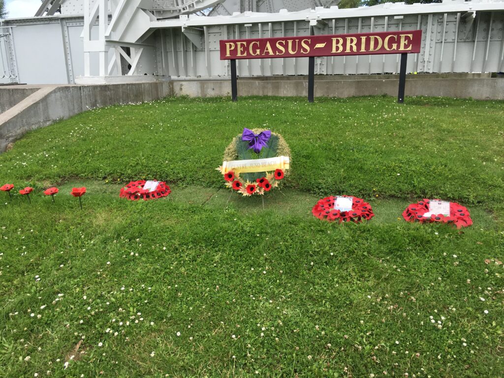
This tiny bunch of British forces captured the bridge from the Nazis before they could fire the explosives they had packed it with in case of just such an attack, and held it for the Allies until reinforcements arrived. There was a very well put together museum explaining it all, with a reconstruction of one of the gliders (and a nearly complete hull of one of the actual gliders). There were lots of artefacts, and amazing first-hand accounts from some of the British troops, including pictures of them then and in recent years and information about what they’d done in the rest of their lives. We spent about an hour there, then cycled across the bridge itself, and on towards the first of the Normandy landing beaches.
At Ouistreham we stopped again at the ‘Museum of the Atlantic Wall’, an enormous concrete bunker five stories high, built by the Nazis as part of their defences in this area. Absolutely extraordinary, and a huge contrast from the Pegasus Bridge museum with its tales of Allied bravery and success. The bunker was full of reconstructions of the various activities carried out by the German soldiers who manned it, with their original equipment still in place, the radios marked with reminders that ‘Feind hört mit’, or ‘the enemy is listening in’. A good view ‘from the other side’, as it were, and an excellent view out to sea from the top level. The bunker was captured by British forces during the D-day invasion.
With just 5km to go we headed off west again, and cycled right along the first of the landing beaches we’ve encountered, ‘Sword’ beach. A beautiful sandy stretch with clear seas now, this is where some of the British forces landed as part of the D-day invasion on June 6th 1944. Difficult to imagine now, but it must have been terrifying.
So here we are in sunny Lion-sur-Mer. Tomorrow we’re cycling just as far as Arromanche, where we plan to visit the museum to learn more about the landings.
Click here to see today’s track.