Distance: 59.55 miles
Time: 4 hours 52 minutes
Average speed: 11.6 m.p.h.
Distance from Lands End: 663.99 miles
Distance to John o’Groats: 356.01 miles
Number of Scottish counties we cycled in today: 2 (Dumfries and Galloway, Ayrshire)
Number of cattle grids successfully negotiated: 3

We had a lovely room last night, at a B&B just a little way out of the centre of Dumfries. A huge bed, an excellent shower, and more cushions than we knew what to do with. The owners had not long been in Dumfries, having previously farmed at Lockerbie, but the new wood-burning power station there had made them decide to move on. The power station had originally been designed to burn willow grown by local farmers, but with wheat and barley prices now sky-rocketing, it was apparently proving difficult to find people willing to grow willow instead.
We had an enjoyable meal at Bruno’s, a short walk from the B&B, although it was quite a muggy evening and the restaurant was warm. Our poor waiter looked like he was melting. By the time we came out, the evening had cooled off a little, though, and we slept really well in the enormous bed.
We’d always been a little concerned about today, even during the planning stages, as our route would take us out of Dumfries via the Nith Valley, and there didn’t look to be many options for places to stay without our having to do an enormous mileage. We’d settled on Dalmellington as our destination, but yesterday several people who asked about our route on into Scotland looked quite dubious at the idea of anyone staying there. The more furrowing of brows and sucking of teeth we saw, the more worried we became! So we decided to get an early start, to give ourselves as many options as possible, and at 9am we were out of the starting blocks and onto the bypass.
At Newbridge we switched onto the quieter roads, and started up the first of the day’s three climbs. It was long and unrelenting, but not a tough gradient, and we ground our way up slowly, happy enough in the middle gear ring. After a drink at the top, and now sporting our arm-warmers in the cooler temperatures, we coasted down the other side, and along a flatter section to Moniaive and beyond. The second climb started as we rode through the first forest of the day, a natural forest with a canopy which cut out almost all of the sun and a lot of light, making it feel pretty cool. All we could hear was birdsong and the sound of our own breathing as we gradually gained height.
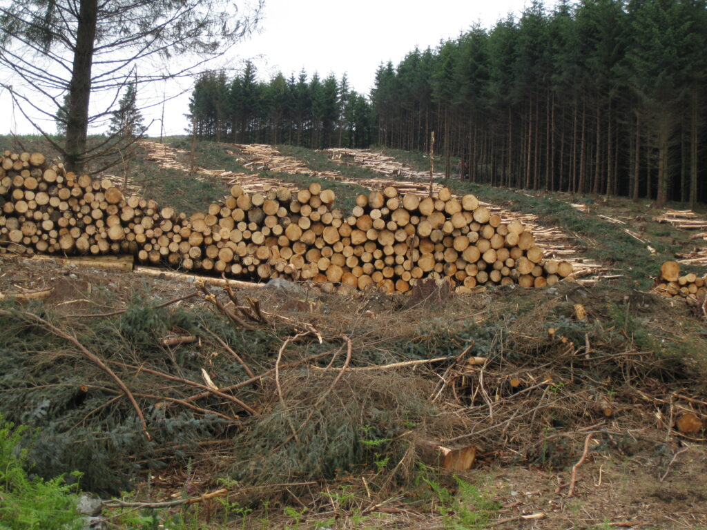
After the natural woodland we hit Auchenstroan Forest, a huge managed pine forest, with the road winding through sections of trees in various stages of maturity. In some places, where the trees had clearly been harvested in recent years, it looked as though the replanting was a more natural mixture of trees, but there were also great swathes of tiny pine trees. We eventually came through the area where the current logging is taking place, and it was a scene of some devastation, almost like the aftermath of a forest fire. The great piles of logs were striking, though, and the smell was lovely.
We ‘topped out’ at over 1000 feet, for the first time since the third day (between Wadebridge and Okehampton). After a break for biscuits, we started down, a glorious gentle descent which went on for several miles, and brought us out of the forest. We saw a bird of prey circling above at one point, with a wingspan which must have been several feet across, and crossed the Southern Upland Way, a long distance walking route.
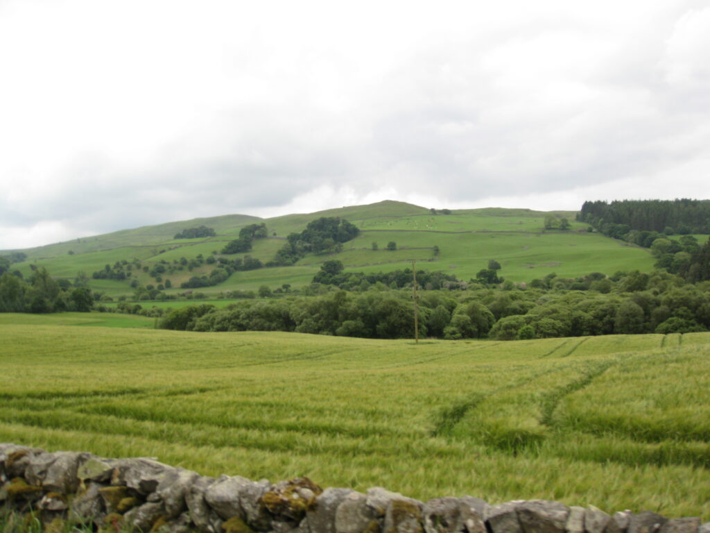
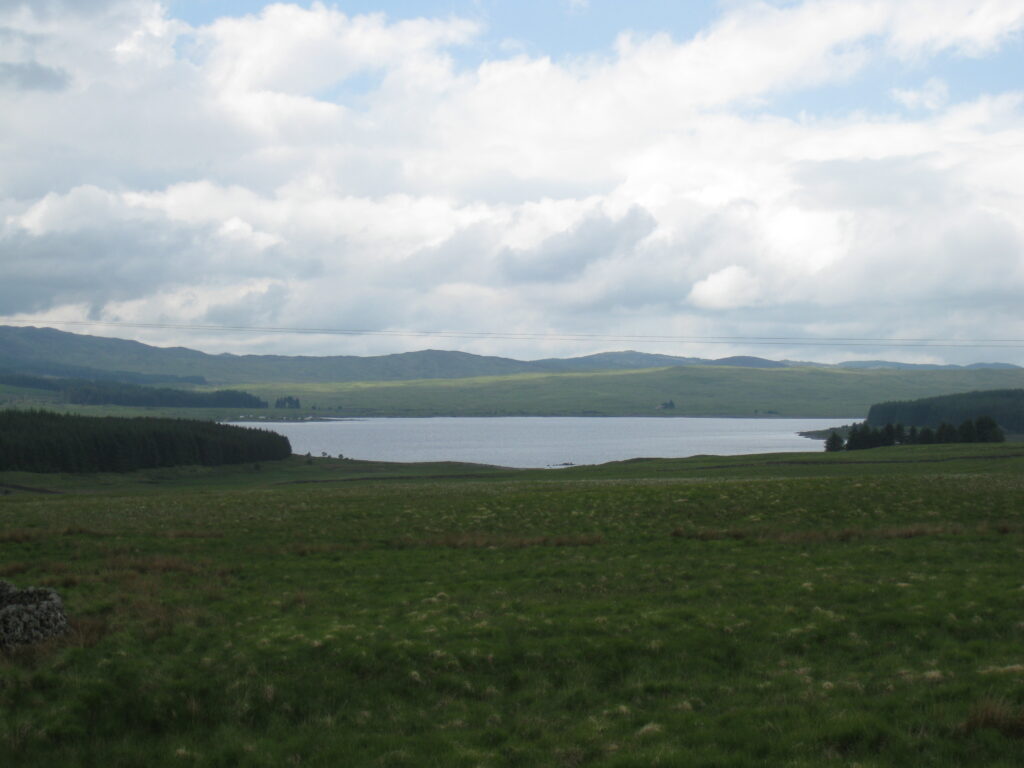
We stopped for lunch at a tea-room in Carsphairn, wondering where all the pubs are in Scotland. There just don’t seem to be rural pubs serving food in the little villages so far. Perhaps it’s just this area. Fortified by toasted sandwiches, we headed out, and onto the third climb of the day. We hadn’t lost all the height we’d gained on the second climb, so although we went up and over 1000 feet again, it wasn’t a hard climb. As we went over the top, we had a lovely view of Loch Doon, and then crossed into Ayrshire.
It had been a day of climbing so far, which was a big contrast to the last several days. You might think that would be less enjoyable, but we reckoned that without the climbing, you just don’t get the views, and of course you certainly don’t get the lovely gliding descents. Yesterday, the scenery along the Solway Firth was beautiful, but without gaining any height all day, we didn’t get any spectacular views of it, really.
We were also starting to think that all the people who cast doubt on our staying around here were wrong. The hills and lochs made a great panorama, and even though the forests were pretty much all man-made, the surroundings were lovely to look at. As we descended towards Dalmellington, though, on a truly dreadful road surface, we caught sight of the open-cast coal mine, and the very utilitarian housing, which presumably was built to house the mine-workers. We passed Dalmellington, planning just to carry on on tomorrow’s route until we hit somewhere we liked the look of. It was only 2:30, so our early start had paid off. We rode on towards Drongan (at whose mention there had been an awful lot of brow-furrowing), and, looking over towards the coast at Ayr, were amazed to see the sea, and behind it what must have been the mountains of Arran.
Drongan was much like Dalmellington, and after a brief chat with a lady at the cemetery, we homed in on Coylton as a possibility. We already had a number for a farmhouse B&B in Coylton, and having phoned ahead, we turned off-route to find it.
It was a good decision. We’re probably a couple of miles off-route, but it’s a beautiful peaceful spot, and the room is lovely. We’ve also now developed a new technique of isolating our shoes in the wardrobe, which seems to be working well!
Tomorrow we have the exciting prospect of arriving at the foot of Loch Lomond (we’re aiming for Balloch). This of course means that we first have to negotiate Glasgow and cross the River Clyde.