Time: 3 hours 10 minutes
Average speed: 14.0 m.p.h.
Distance from Lands End: 604.44 miles
Distance to John o’Groats: 415.56 miles
Number of international borders crossed: 1 (hurrah!)
Kind donation from the custodian of the TSB museum, Ruthwell: £5
We liked Carlisle: it is a handsome town with a fine red sandstone castle and cathedral, and some elegant terraces. We met Peggy (Jonathan’s mum) last night for a good Italian meal and some convivial chat over a bottle of Barbera. A good time was had by all, and it will be the last time we are able to meet friends and family on this trip, so we really appreciated Peggy driving over to see us.
Once again we awoke to blue skies, and our host described to us the delights of Carlisle, the Solway Heritage Coast, the life of Robert Burns and the history of this part of the world. When he moved onto the iniquities of wind farms we made our excuses and left. Seriously though, we were well looked after, and the bacon sandwiches this morning were first-rate.
Before leaving Carlisle we paused to take pictures of the Cathedral and Castle. The original route we had planned was a circuitous one, designed to avoid A-roads, but the A7 looked quiet enough, and we set off towards Longtown at a cracking pace. Today was the only day in our itinerary which was almost completely flat – no hills above 100 feet, so we were able to maintain a good pace all day.

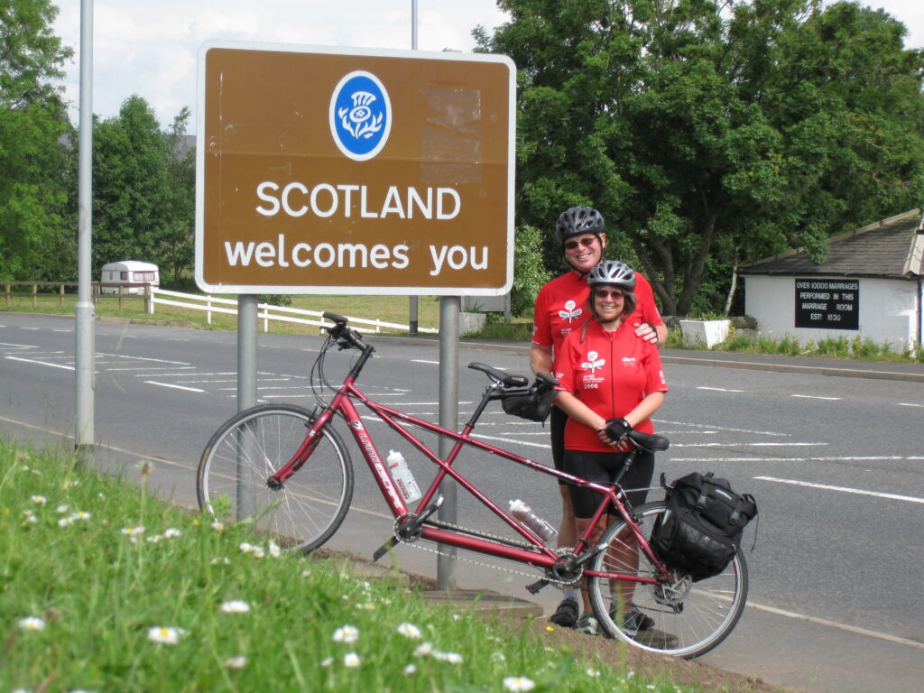
At Longtown we turned left towards Gretna, and four miles later we reached the Scottish Border. We had been polishing our appalling comedy Scottish accents in preparation, and now deployed them to good effect. Loud cries of “Ye’ll have had yer tea” rang round the neighbourhood (apologies to our Scottish readers)! It was though, a good moment, it felt to us that we’d already travelled a long way and this was a major milestone. We didn’t stop to celebrate for too long, as a look at the map reminded us that Scotland is a big country.
From Gretna we continued west towards Eastriggs, home of a major munitions factory during the First World War, set up as an emergency measure when the troops at the Somme began to run out of ammunition. A roadside sign advertised the “Devil’s Porridge Museum”, the porridge being a combination of TNT and cotton waste used to fill the ammunition shells. We rode on to Annan where, thirsty in the warm temperatures, we stopped for a tea break, but chose not to try the deep-fried pizza offered on the menu…
A few miles after Annan we reached Ruthwell, an interesting place. Here the small church contained a massive Anglo-Saxon cross, so tall it had to occupy a hole in the ground. The other side of the B721 had a museum marking the spot where in 1810, the Reverend Henry Duncan set up a bank to help his poorest parishioners save for times of hardship. This later became the Trustee Savings Bank, now Lloyds TSB. Finally, on the outskirts of the town was the Brow Well, a rather murky spring-fed well. Here the dying Robert Burns drank the water in an attempt to cure his illness, then immersed himself in the cold waters of the Solway Firth. This rather unsuccessful cure for rheumatic fever led to his death a few days later.
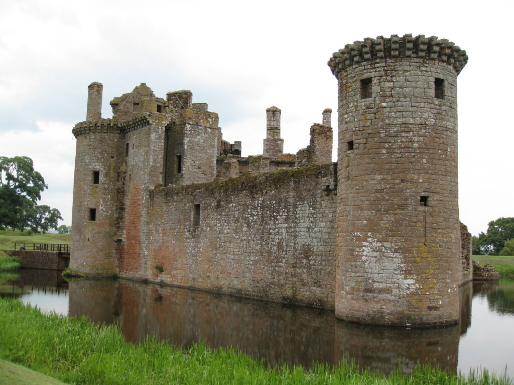
Culturally refreshed but seeking refreshment of a more tangible kind we moved on. A right turn at Bankend would have taken us swiftly to Dumfries, but we knew a small detour south would take us to Caerlaverock Castle. We have to confess that we were attracted initially by the castle’s tea room, but what a place!

A magnificent moat-encircled red sandstone castle, with a history of almost repelling English sieges (sorry again, Scottish readers). After taking refreshment at the excellent tea room (great scones!) we spent a good hour looking around in the sunshine. There was a huge and impressive trebuchet, and in the video room a very young-looking Tony Robinson told the story of the castle.
We were delighted, being fans of “Monty Python and the Holy Grail” to find that this was the second castle in the neighbourhood. The first one was built on a swamp. Like “Swamp Castle” in the aforementioned film, it fell down and sank into the swamp… Well, what the sign actually said was that there “was evidence that the ground was damp and boggy, and the buildings gradually collapsed”. That’s good enough for us!
As we left, we had a good chat with a local couple, whose advice was to ensure we had plenty of midge-cream for the remainder of our journey. Fortunately we stocked up this morning, to protect ourselves against the fearsome Scottish midges. Or is it midgies? We’ll let you know on that one.
Our journey continued around the peninsula and alongside the spectacular Nith Estuary, where we once again turned north towards Dumfries. Again we set a fast pace (by our standards) and soon arrived at the water-front Tourist Information office in Dumfries, where we secured accommodation for the night as a few raindrops started to fall.
Tomorrow’s destination has yet to be decided – there’s a fair amount of uphill to negotiate, so we may stop in Dalmellington or, if we’re not too tired, we may push on towards Ayr.

