Motorhome day twenty-nine: Te Anau to Milford Sound
We slept very well, exhausted (in a good way) by all the excitement of the Doubtful Sound trip and our early start. It rained all night again, but this is a good thing – the Sounds are apparently never more beautiful than when a lot of rain falls and then makes its way down the walls of the gorges in long silvery waterfalls. Of course you’d prefer not to have a long silvery waterfall trickling down the back of your neck whilst you’re in a boat on the Sound, so the ideal must be rain the day before and then sunshine as you step onto the boat. Fingers crossed.
The drive from Te Anau to Milford Sound was only 120km, but it has been designated a ‘World Heritage Highway’ for its natural beauty, so we knew it would take way more than the two hours predicted by the sat-nav. To begin with it skirted Lake Te Anau, which was looking serene in the morning light, but with a rather threatening band of cloud down one end which seemed to chasing us.
Our first stop was the very scenic bay at Te Anau Downs, just before the road left the coast and the phone signal disappeared, plunging us once more into disconnection from the world. As at Doubtful Sound, there is no mobile communications infrastructure at all from Te Anau Downs to Milford Sound. In this modern age it seems strange to be so completely cut off, but we knew it was coming, so it was no surprise.
The bay was tiny, and as we stood looking at the view the threatening cloud caught us up and turned the scene into one of brooding malevolence. Well, the sky got a bit dark.
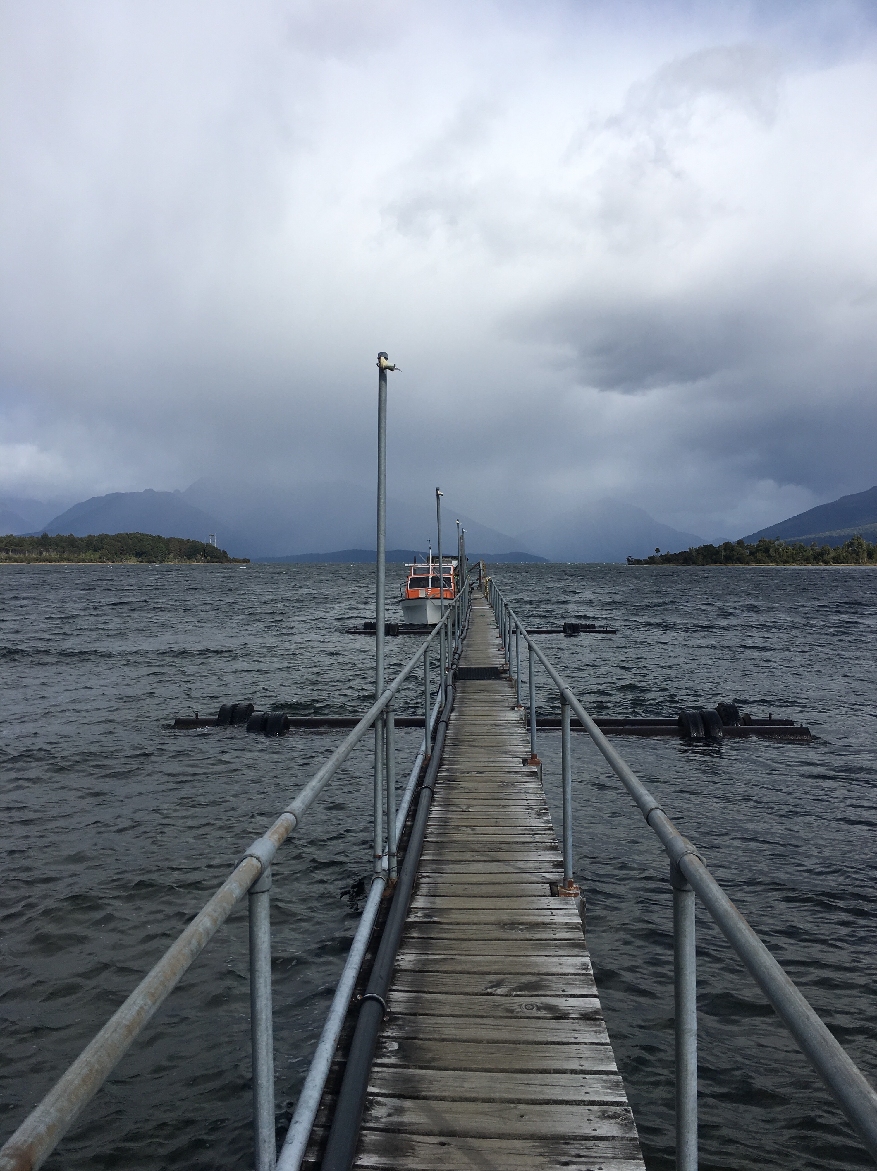
The little pier allows hikers to board a boat to take them to the start of the Milford Track, a footpath which leads from Lake Te Anau all the way to Milford Sound. It must be quite something to arrive there on foot.
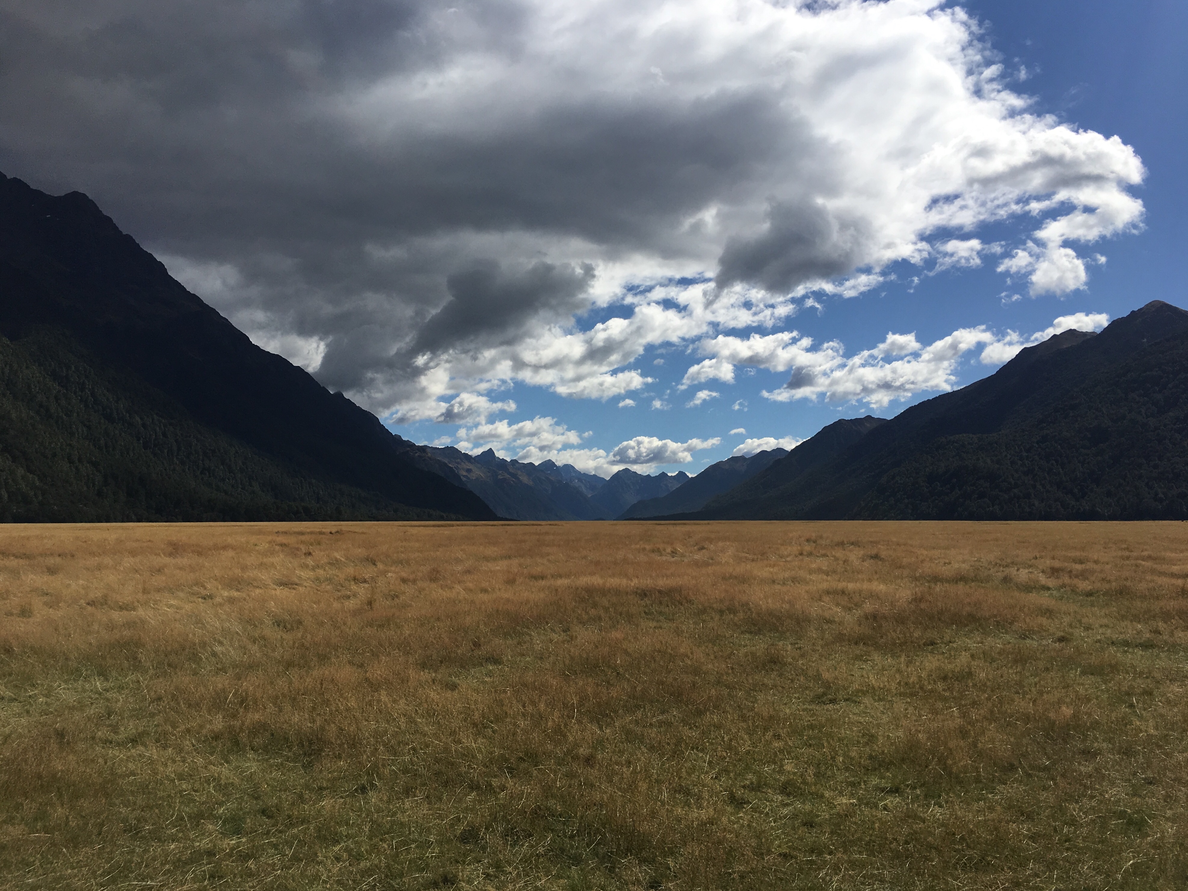
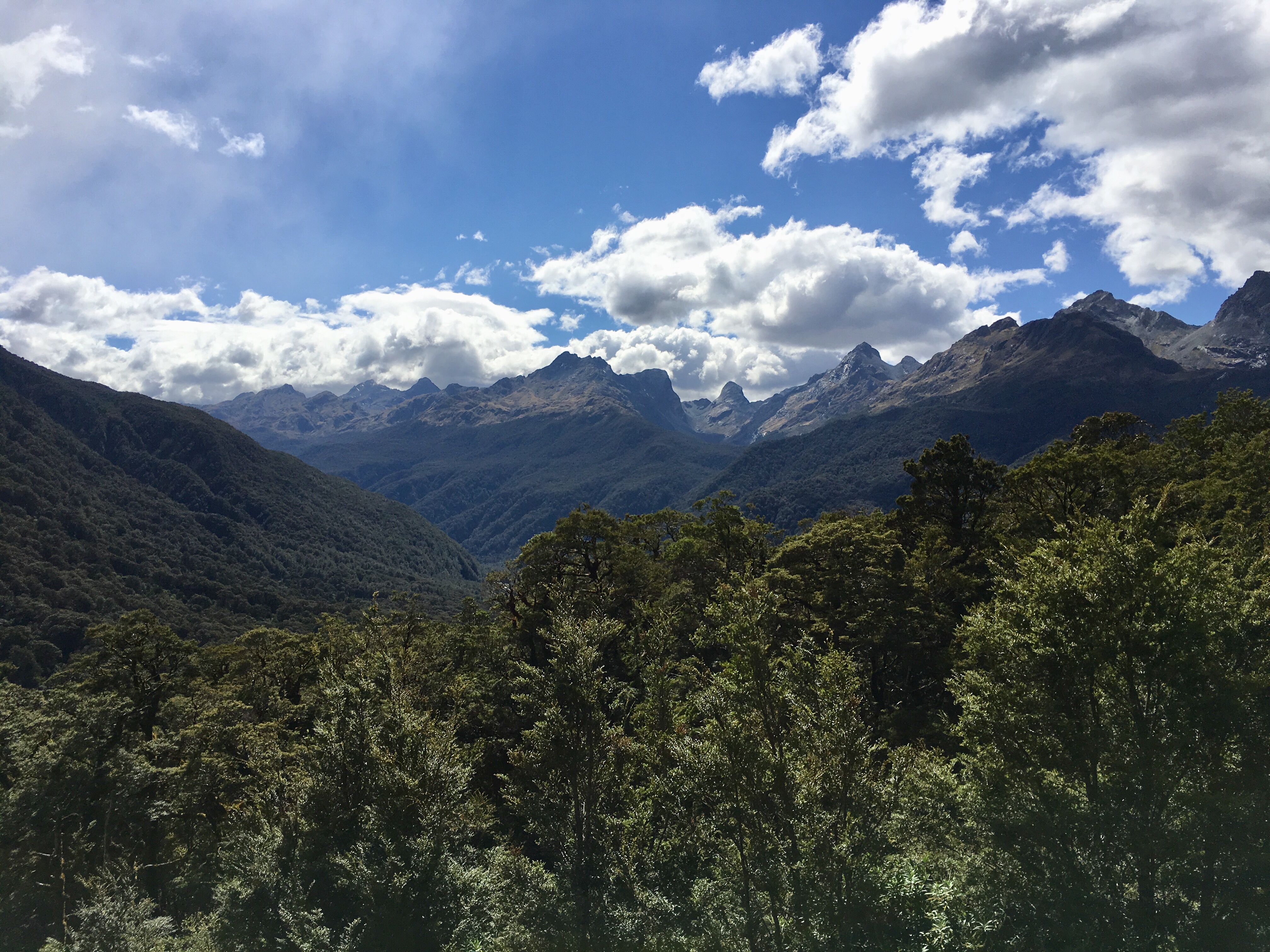
Hopping back in the van we raced ahead of the clouds and into the valley of the Eglington river, a pastoral plain between two high ranges of peaks. Descriptions of this area always use the word ‘gouged’ to evoke the creation of the valley by glaciers, and it definitely had a rugged, wild feel.
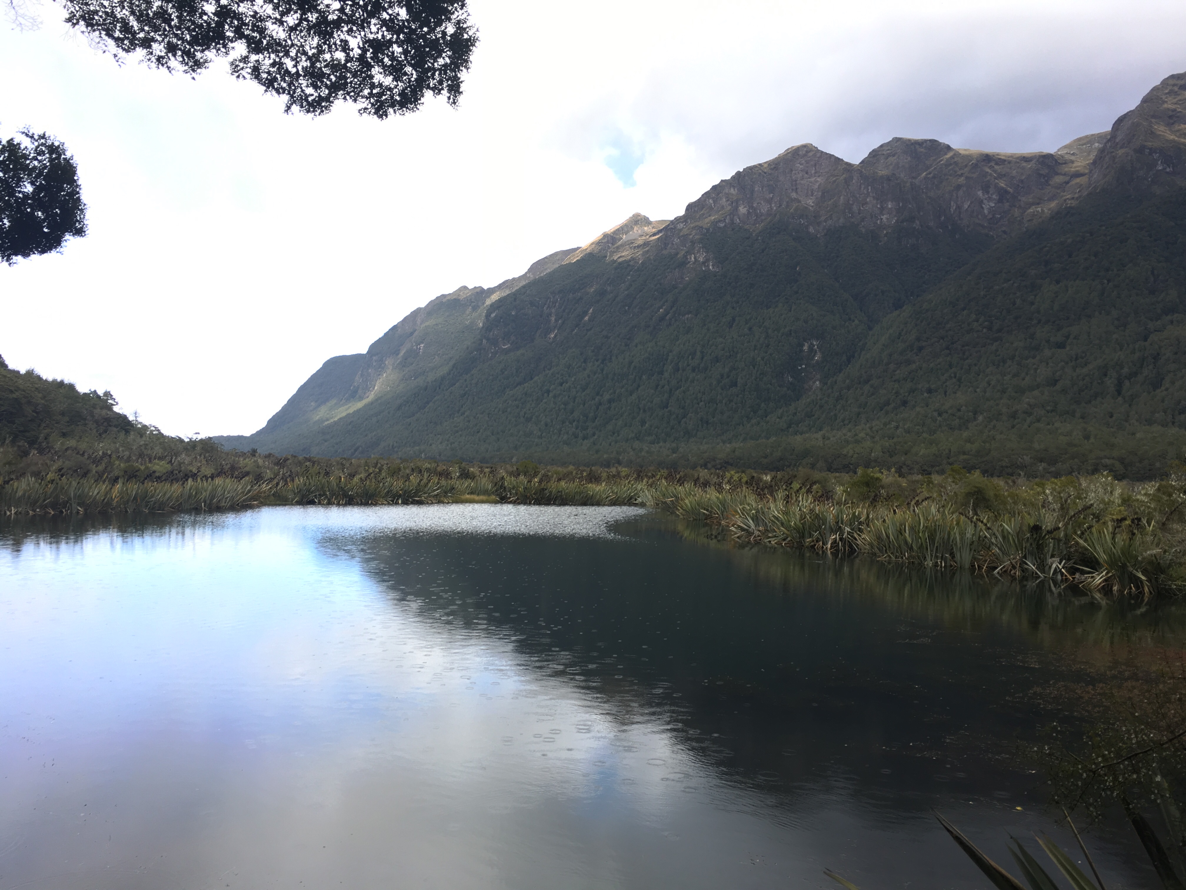
We stopped again at the Mirror Lakes, where the water reflects the mountains above, if you catch it on a clear, sunny day. It was raining slightly by this time, but it still wasn’t half bad.
We drove up Lake Gunn, surprised to learn than we were already at an altitude of nearly 500m. After Lake Fergus, we crossed The Divide, and then stopped at an extraordinary lookout. On one side craggy peaks were holding on to vestiges of winter snow and collecting new frosting from the clouds. On the other side there were green swathes of trees going off into the distance as far as it was possible to see. The sense of space, air, altitude, and the lack of any visible human intervention were almost overwhelming.
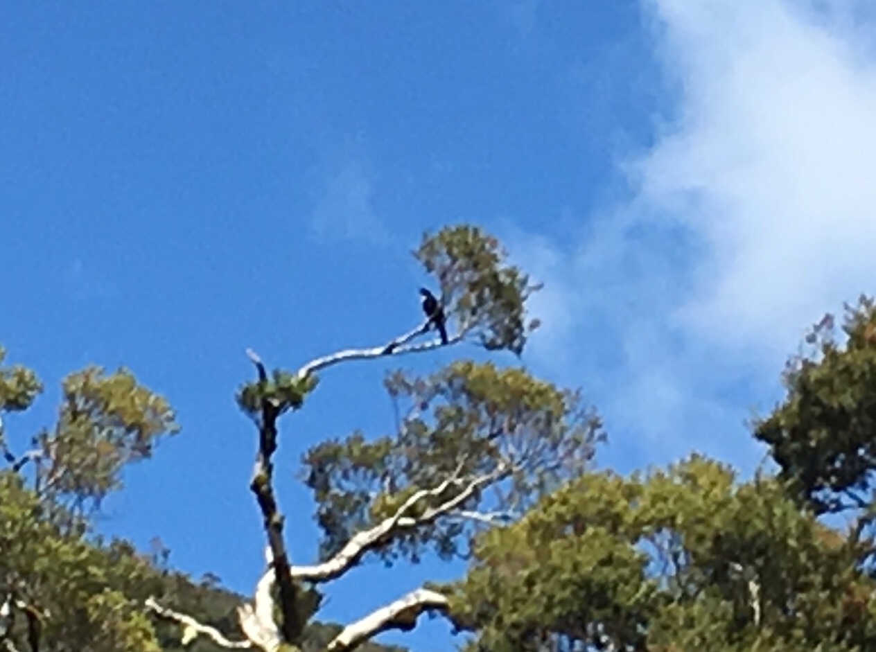
There was the road we drove in on, of course, but nothing else that nature hadn’t conjured up. A pair of tui sat high up in one of the nearby trees, burbling away in the sunshine. A kea flew across as we arrived, but we didn’t see it again.
The lookout was at the peak of the crossing, and the road descended quite quickly after the lookout. The clouds caught us again, overtook us and suddenly we were right in a rain shower which completely changed the outlook. More brooding malevolence (the sky went a bit dark again ????).
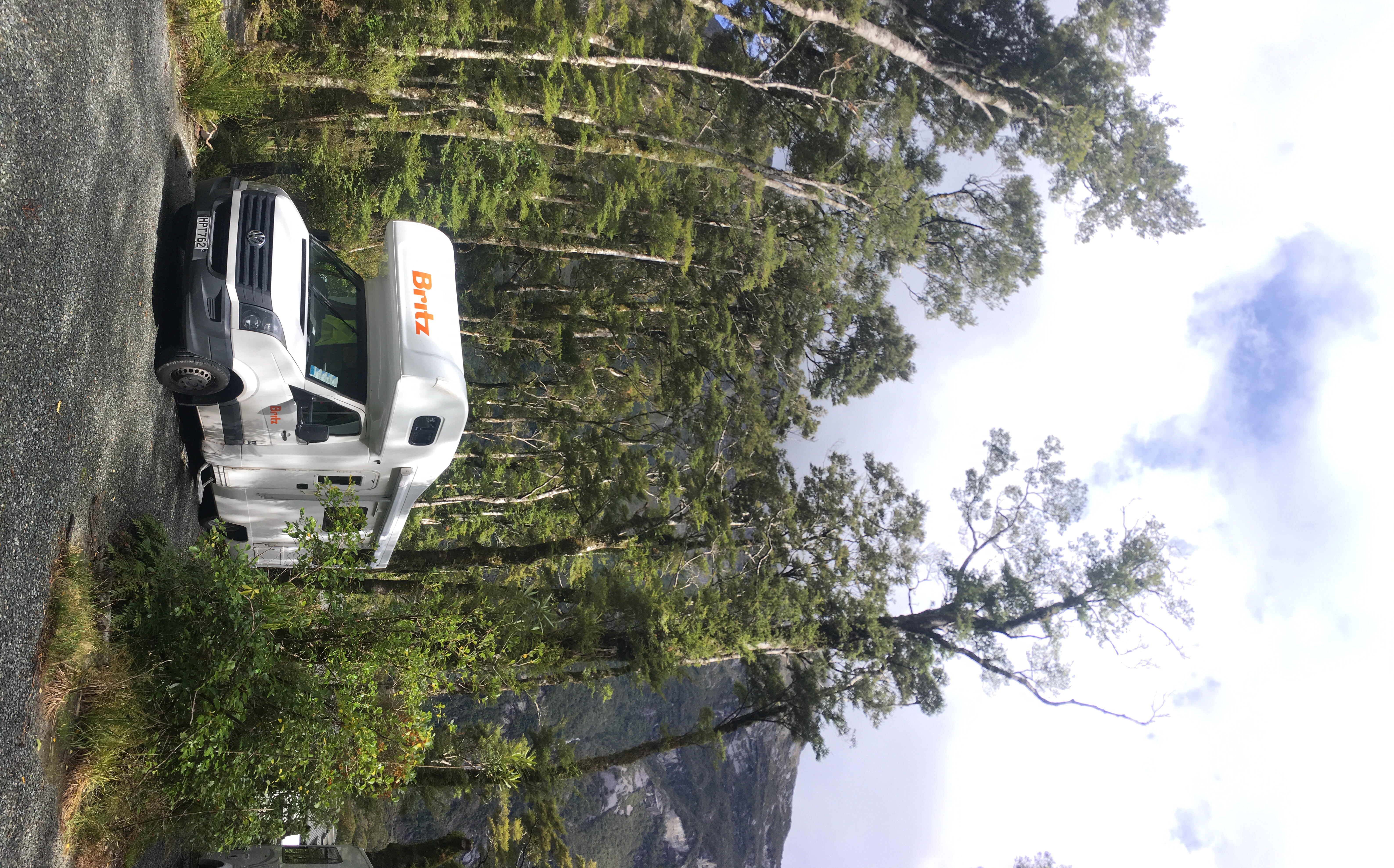
There was a short tunnelled section, the Homer Tunnel, started in 1935 but not completed until 1954, and then a series of hairpin bends, descending steeply. No-one had mentioned not driving a motorhome on this road, and there were plenty coming back the other way, so we guessed it would be OK.
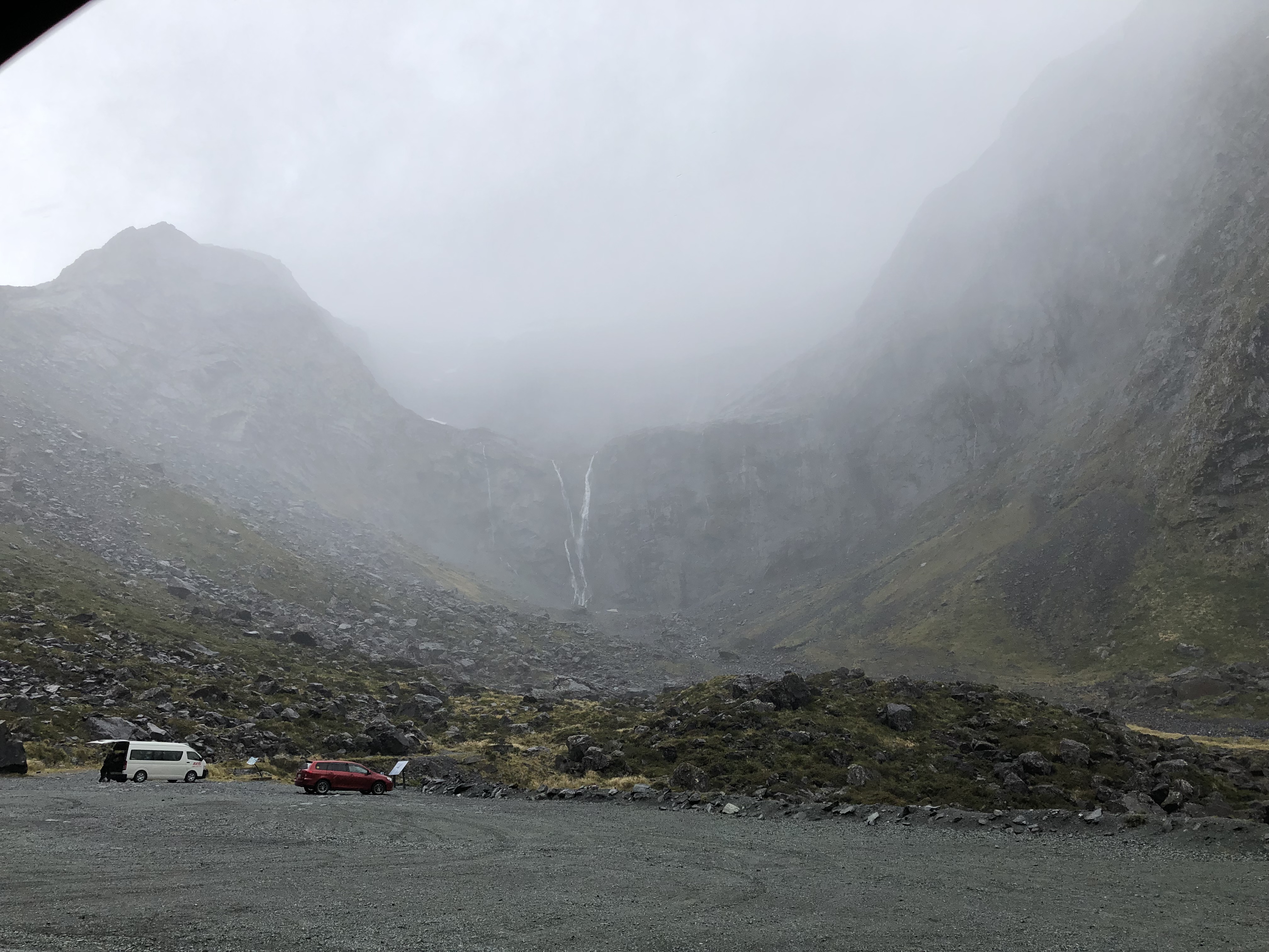
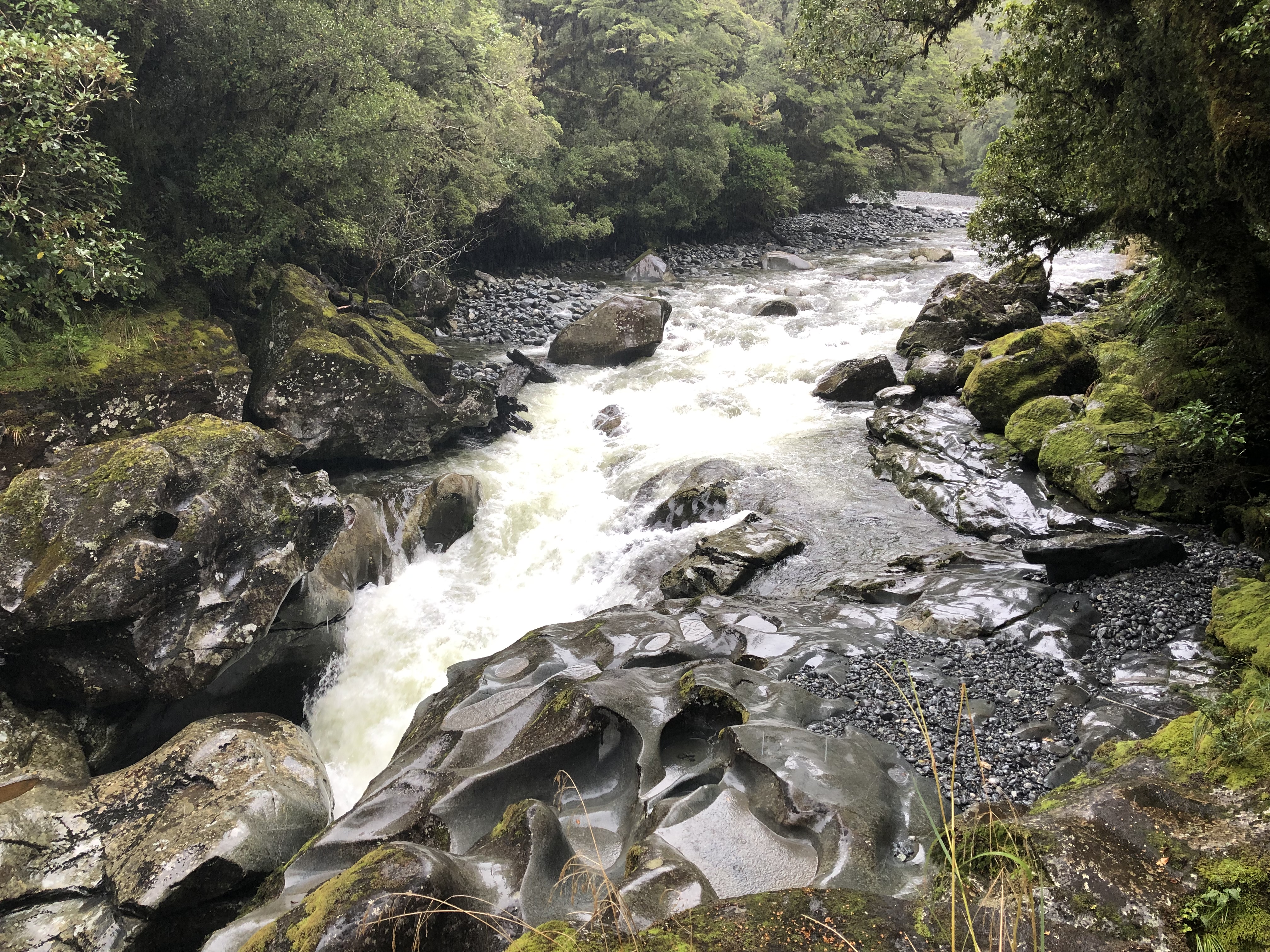
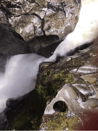
We stopped at ‘The Chasm’, because it sounded intriguing. Especially if you say it in a Hollywood horror film trailer voice. (Go on, you know you want to…) The Cleddau River** drops 22m here in a very short distance, forcing a way through narrow gaps between rocks. The noise was incredible. By the time we got back to the van we were both soaked – it was raining quite hard now and water was cascading down the steep slopes of the gorge in long trails.
At Milford Sound Lodge we were greeted with the news that the package we’d booked, a boat trip on Milford Sound tomorrow morning, included breakfast, and much to our surprise also dinner tonight. Which was nice! Not only that, but the young man behind the counter told us that it’s going to be a beautiful day tomorrow!
** shouldn’t this be in Wales?
Motorhome day thirty: Milford Sound to Queenstown
Dinner was lovely, served in a sort of mountain chalet, lots of interesting choices, which seemed remarkable when you considered the sheer difficulty of getting raw materials to the place over that huge mountain pass. This morning’s breakfast was just as good. Most of the staff were those from last night, and we speculated that they might do a seven days on seven days off shift, again because of the remoteness of the location.
We set off promptly after breakfast for the Milford Sound carpark, and found a little Park and Ride bus to get everyone to the boat terminal. It all seemed much more, well, commercial than the Doubtful Sound operation, there were lots of sizeable boats waiting to take groups on different types of trips, and a large cruiser dropping off people with overnight bags from their trip.
We’d booked a ‘nature’ trip, with a visit to the Discovery Centre included, and just had time to take a few early morning pictures around the harbour as Mitre Peak warmed up in the sun.
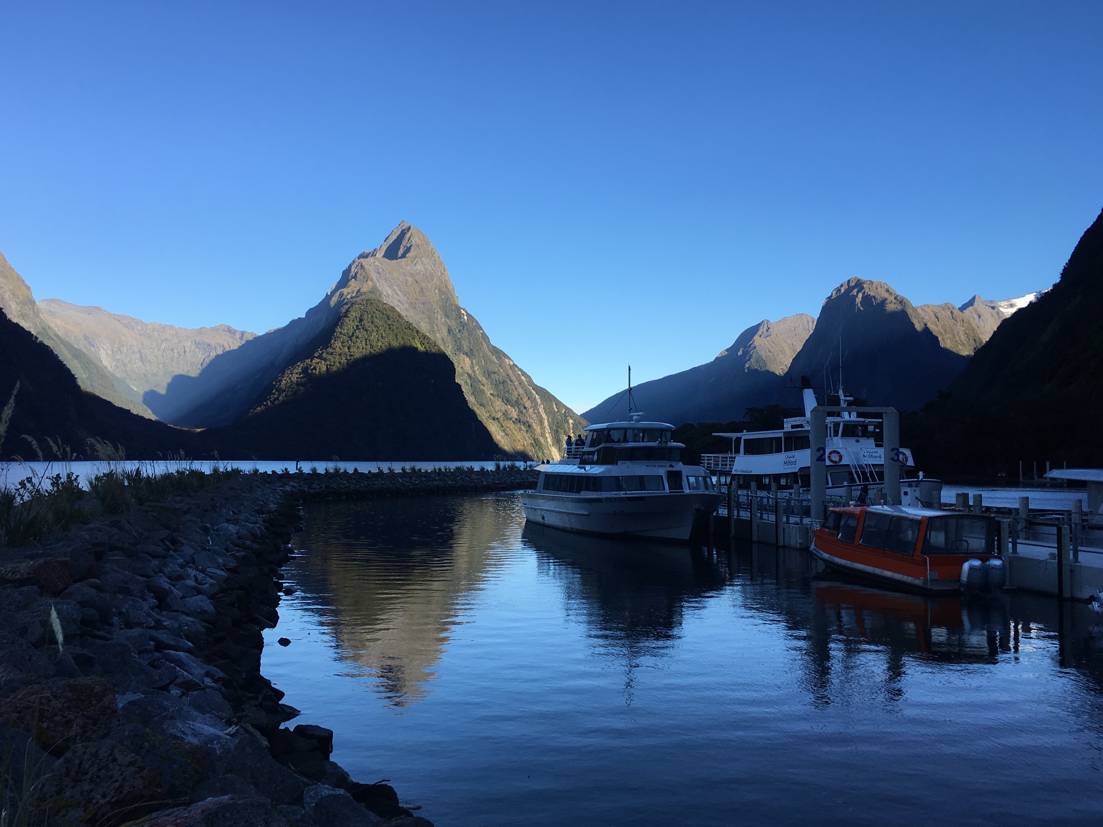
It was really pretty cold, and we were slightly under-dressed, probably, but we were hoping that once the sun got up over the ridge it would feel warmer. You couldn’t see much of the Sound itself from the harbour, but it was already clear that it was much more rugged and higher than Doubtful Sound. We boarded a large-ish vessel with Damian the tour guide at the microphone, and set off.
Almost immediately Bowen Falls came into view, gushing spectacularly from the rock face. Damian wandered around the boat, giving information about what we were seeing as we moved through the water. There was a hanging valley, with a glacier still clinging on to the peak behind it.
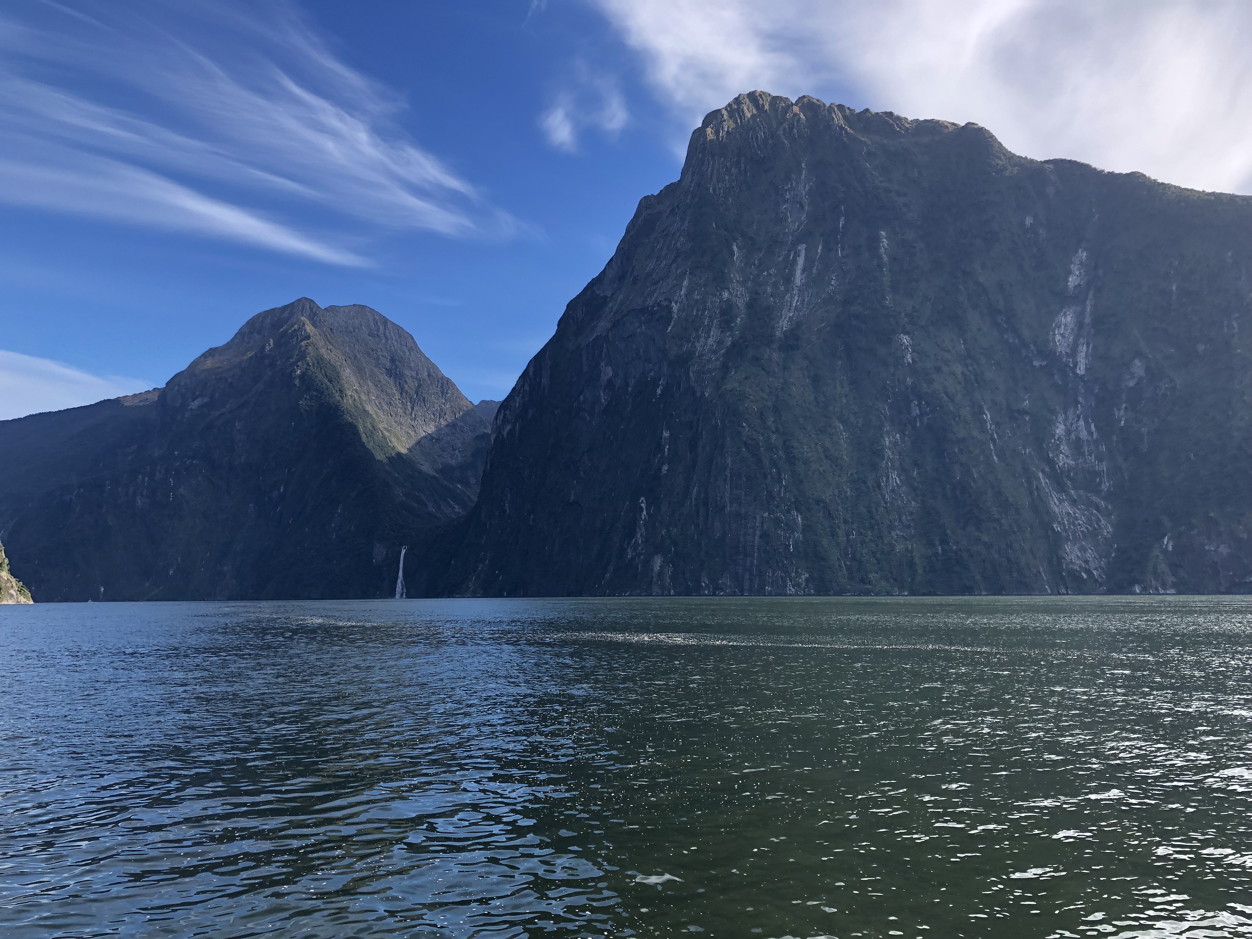
The Sound (actually a fiord, as Damian explained, since it was carved by glaciers) became wider and then narrower as it wove its way out to the Tasman Sea, and the views up the steep sides were stunning.
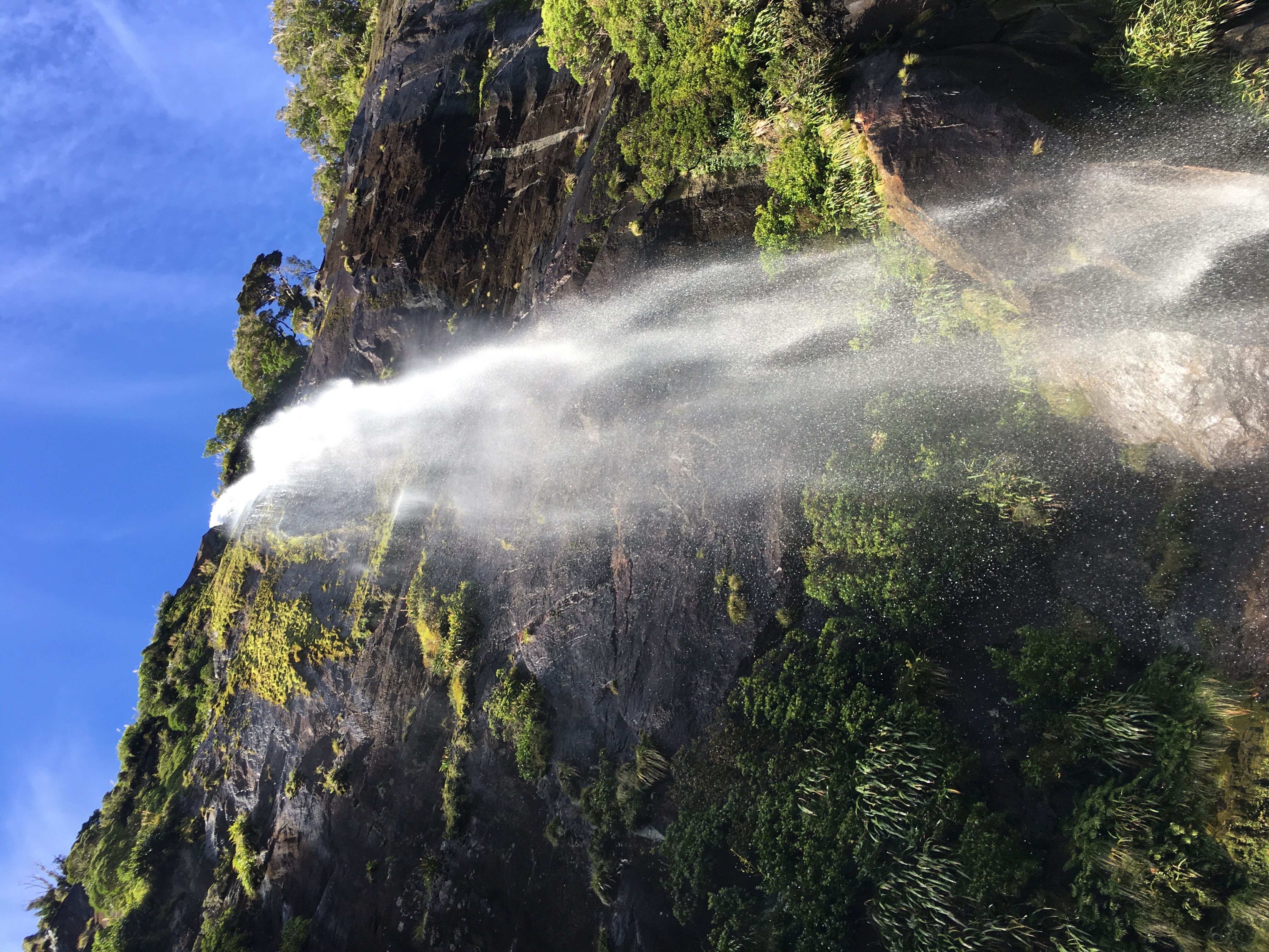
It was still pretty cold, but we were braving the viewing platform at the bow when Damian announced Fairy Falls. This one is not always running, but after the rain of yesterday it was in full flow, and as we got closer we could see rainbows in the fine spray generated by the cascade.
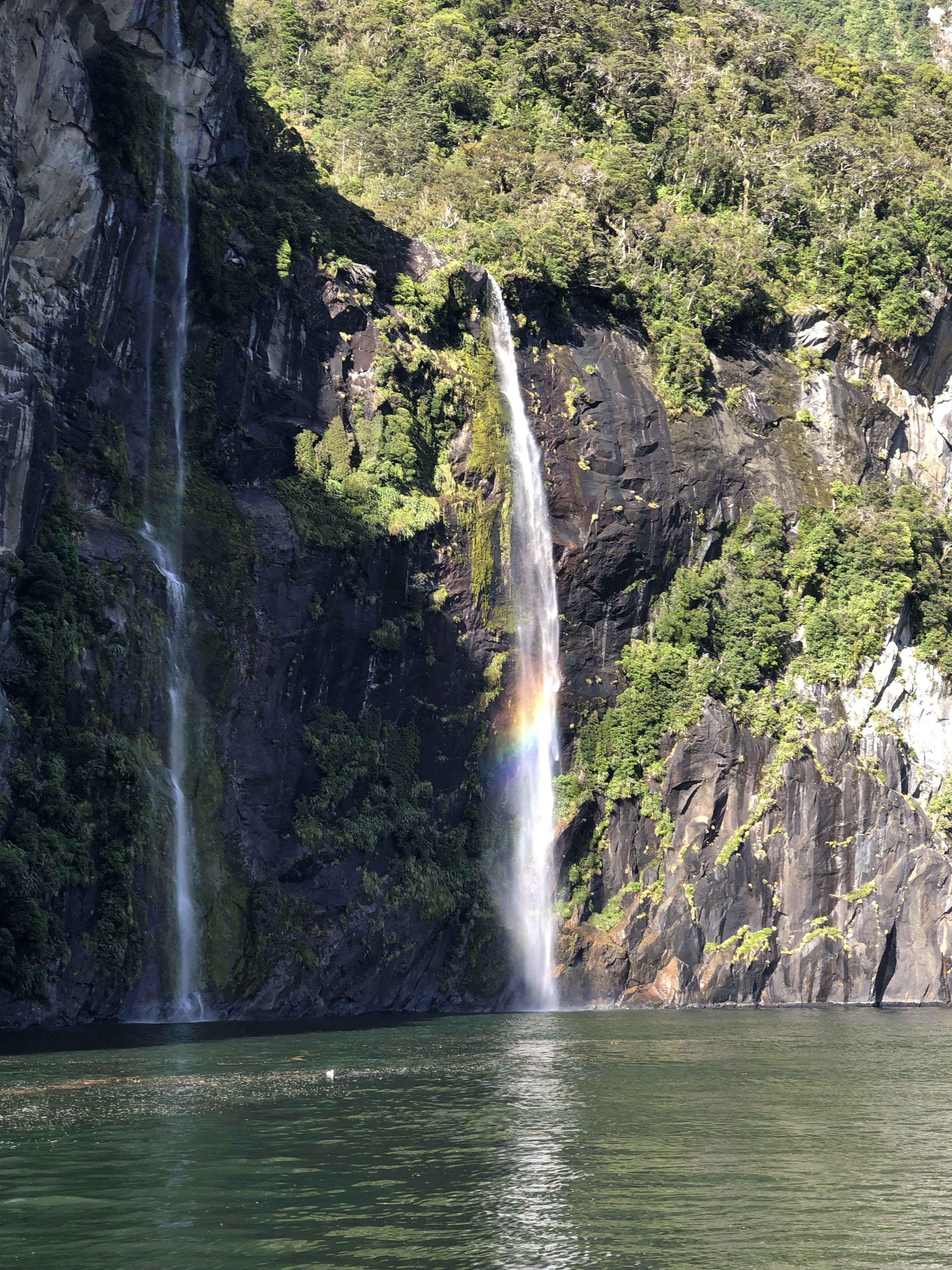
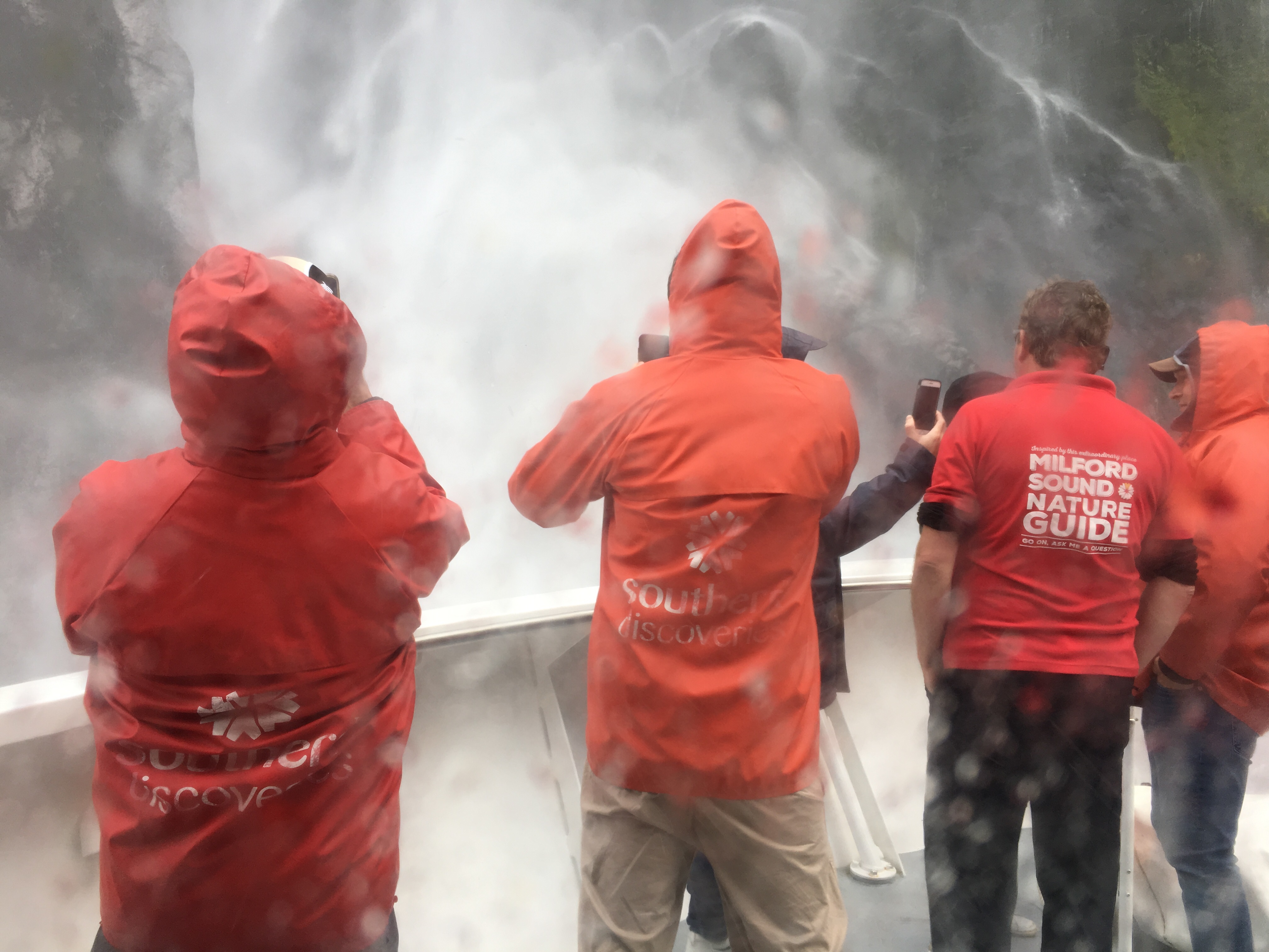
Another crew member appeared on the bow, carrying a tray of glasses which he placed on the shelf at the front, and Damian announced that the Captain was going to fill the glasses from the waterfall so we could taste the purity of the rainwater and the glacial melt. There was a bit of a stampede for the inside as the bow got closer to and then actually underneath the waterfall! I did not make it inside. I got some good pictures, though!
When we withdrew, the water in the glasses was incredibly clear, extremely cold, and delicious. Probably the cleanest natural water we’ll ever sample, parts of it last in liquid form thousands of years ago…
We moved on through the gorge, spotting rock formations and more waterfalls as Damian pointed them out. All too quickly we were at the sea – Milford Sound is just ten miles long, but the entrance cannot easily be seen from the sea, we were told. We made a wide loop in the mouth of the sound, and then turned back towards the cove. On the way back, we saw fur seals basking on a rock, and then a pod of dolphins, albeit from quite far away.
Next it was Stirling Falls, and another immersion for the bow. Damian instructed those who were brave enough to don something from the boat’s sou’wester collection and head to the bow. A few brave souls followed his instructions, and the Captain plunged the bow right into the waterfall. Damian stood impassively in the middle of it, dressed only in a T-shirt!
After all that excitement (I stayed indoors this time) we turned into Harrison Bay, a beautiful natural harbour we’d not spotted on the way out, and there was the Discovery Centre. It’s an amazing building, like a reverse aquarium, sunk below the water to a depth of ten metres. It’s tethered to the rock rather than built into it, and allows visitors to see the marine life of the Sound without having to dive.
Milford Sound, like Doubtful, has a layer of fresh water above the seawater, and three factors have contributed to the sound’s ‘deep water emergence’. This term means the habitation of the waters at ten metres deep by species which would normally only be found below forty metres down. It’s made possible by the cold, the calmness of the Sound’s waters, and the fact that the fresh water layer is stained by tannins collected as it makes its way in through the vegetation on the steep sides. This staining means the fresh water layer is dark, mimicking the conditions much deeper and allowing the deep water species to live happily much higher up.
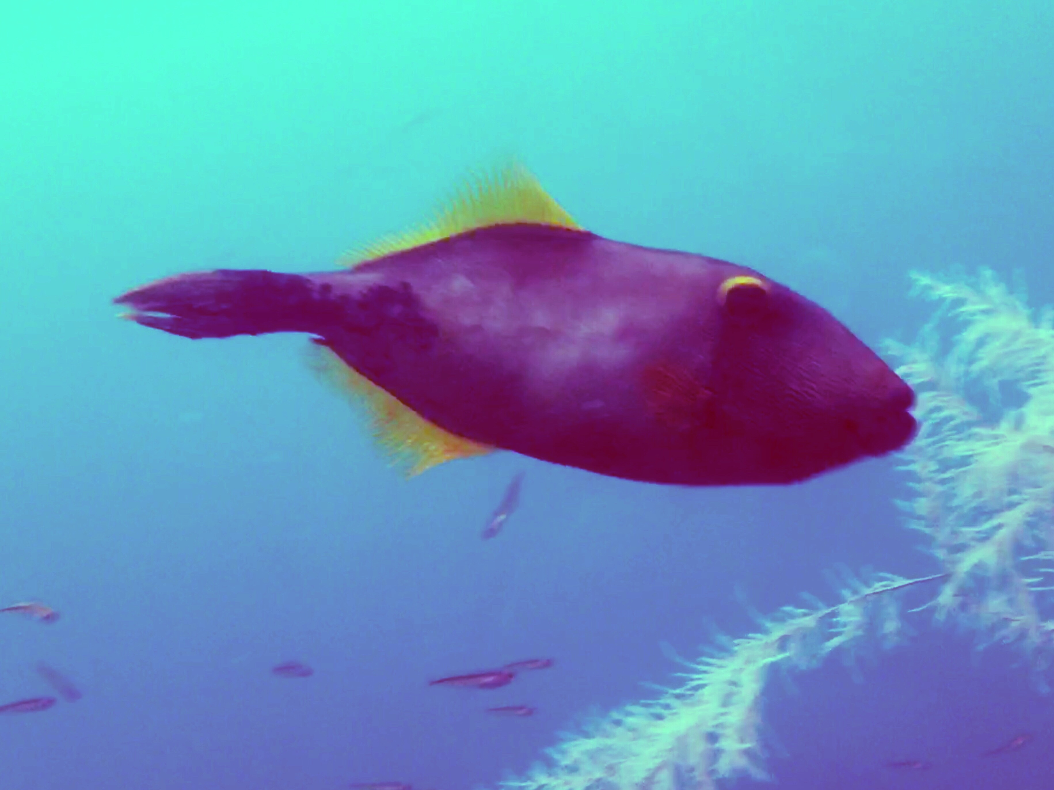
Our guide, Emma (from Newcastle, so not ‘Imma’ this time), explained all this before we headed down a spiral staircase into the viewing area. There’s a reef down there which they seeded with black coral, but everything else has grown or visits naturally. The black coral is in fact white – the black stems are its detritus, but the living polyps themselves are white, and very beautiful, delicate and fine. There were also anemones, mussels, and lots of fish. It was difficult to take photographs because the glass and perspex construction gives everything a very green cast if you’re a camera. To the human eye, though, it was a wonderfully colourful scene.
After the deep visit, another boat collected our party of fifty, and took us back to the cove where we began.
It had been a very different experience to the Doubtful Sound trip. Milford Sound is much less extensive, but also a much deeper gorge. The cut is therefore deeper, and more bereft of plant-life at the top, where the peaks are very craggy. The glaciers which cut the fiord are still visible in places, and the Discovery Centre is an excellent way to see below the surface.
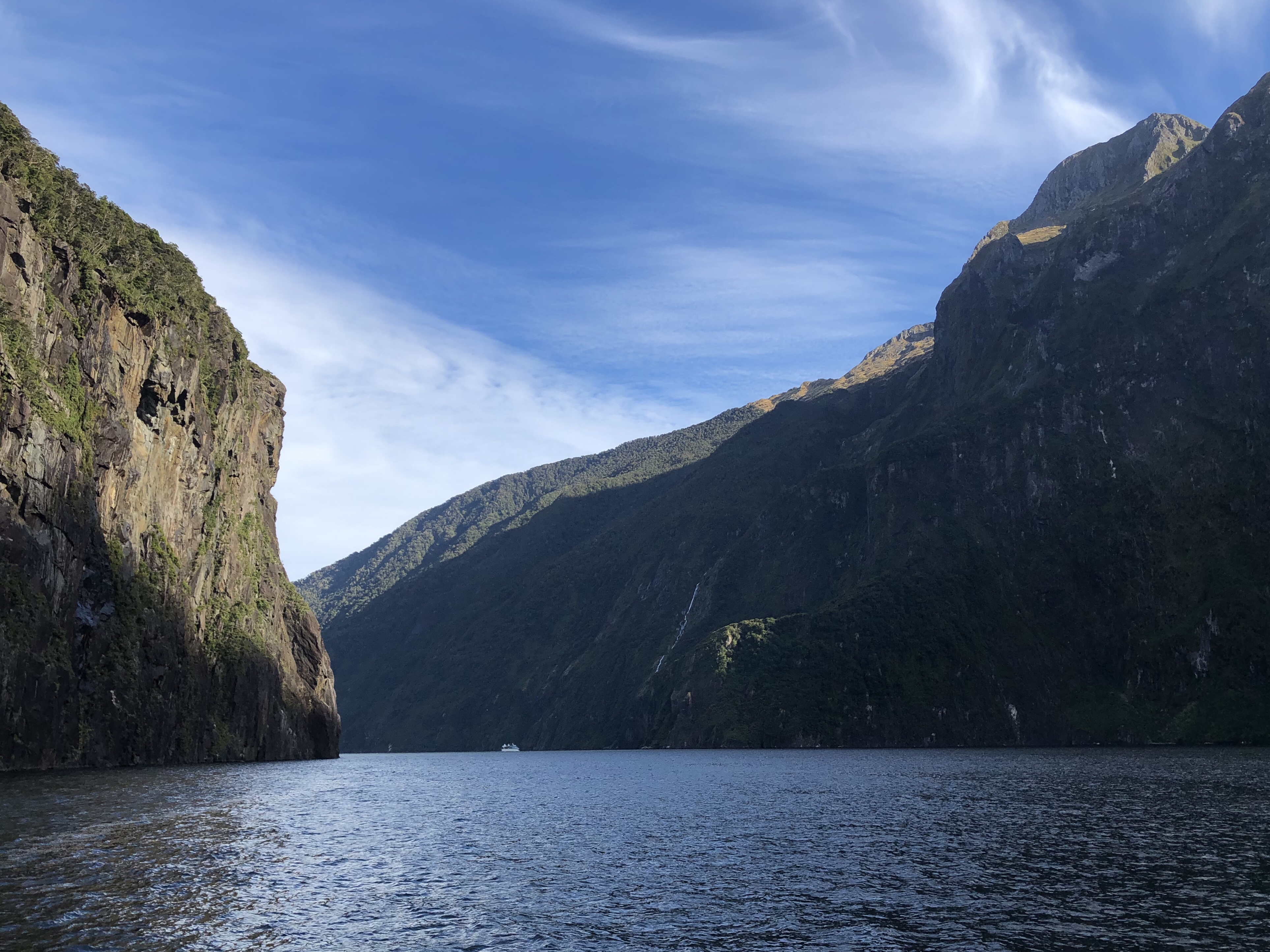
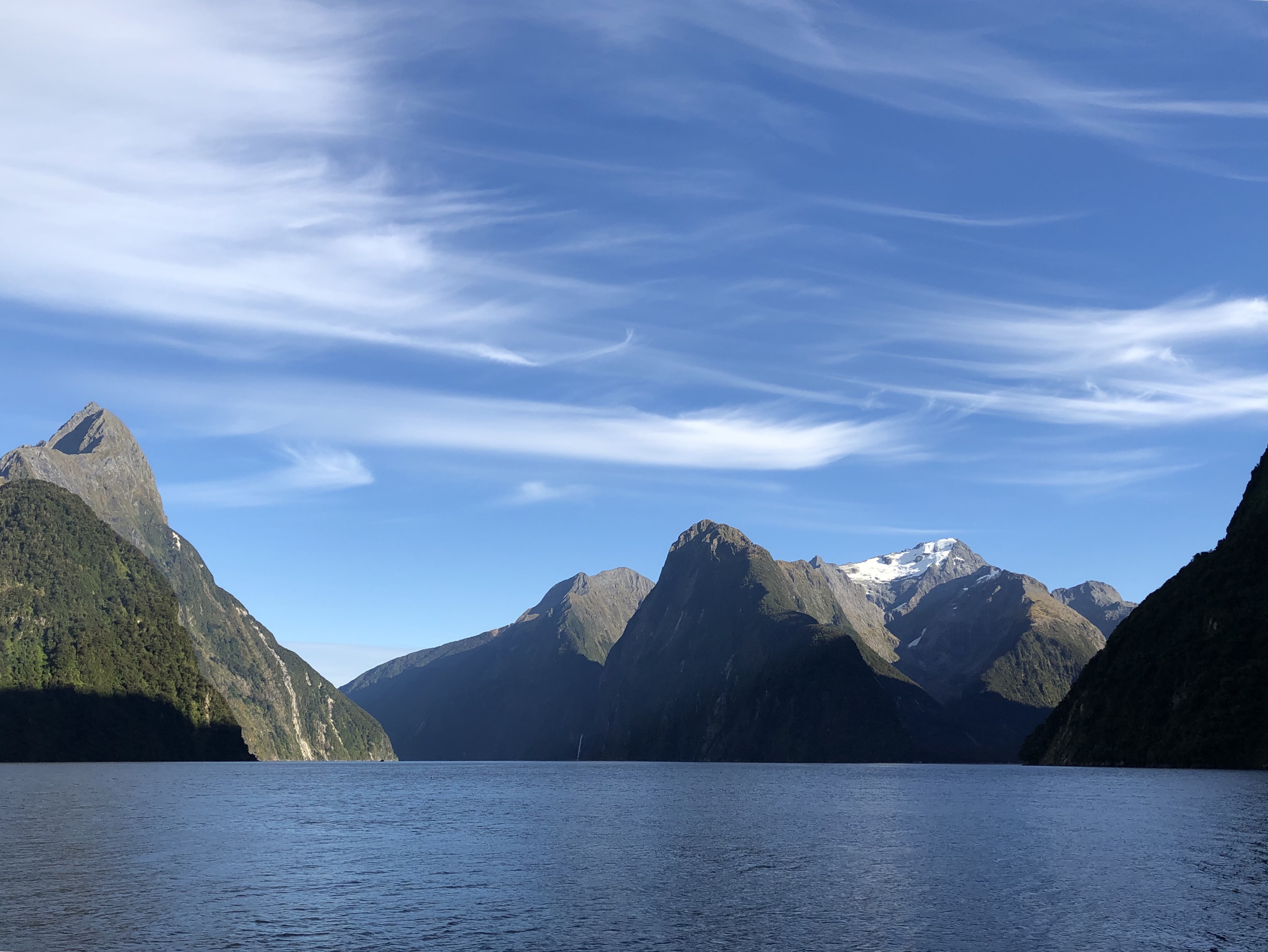
An awful lot of people go through on short trips, though, and although it is extremely well organised and not at all rushed, we both felt that we’d had a much more intimate and personal engagement with Fiordland at Doubtful Sound. Although our overnight cruise boat there was small, there were so few of us that there was hardly ever anyone on the same part of the boat as you, and you could wander around freely selecting your own spot from which to view its beauty. Doubtful Sound has so many arms and coves that you rarely see another boat, even on a near twenty-four hour trip. Milford Sound has a spectacular road route in, though, which brings you through the high, difficult terrain of the mountains, especially in a rain storm like we had experienced.
At the end of it all, we felt very happy and enormously privileged to have been able to experience both.
We drove back to Queenstown, rather than staying at Tapanui as we’d originally planned. Tapanui had been chosen mostly to avoid retracing our steps too much on the way to Lake Tekapo, but it was a bit of a ‘middle of nowhere’ place, we weren’t sure how much gas we had left for cooking, and the roads between Milford and Queenstown had been easy and picturesque. We arrived in good time, noticing snow on the peaks of the Remarkables. Our campsite neighbours told us it had been only 2 degrees Celsius there last night. And no heating of any kind in their campervan!
Motorhome day thirty-one: Queenstown to Fairlie
We left Queenstown in sunshine, back the way we’d come in when we arrived the first time from Wanaka. All the snow on the tops of the Remarkables had already melted. It was to be another transition day, to place us near Lake Tekapo ready for our flight over Aoraki (Mount Cook) and the glaciers.
As so many of these ‘driving days’ have been, though, it was surprising, enjoyable, scenic and interesting. Initially we were on familiar roads, past Roaring Meg and Gentle Annie, but then taking the east shore of Lake Dunstan.
We went back over the 45th Parallel and on into the Lindis Valley. We were to cross the Lindis Pass, and as we climbed the terrain became more and more arid, full of rounded mounds and spurs of tufty yellow grass and not much else. We stopped at the summit, where there was a lookout with views down both sides. It was still sunny, and warm even at almost 1000m.
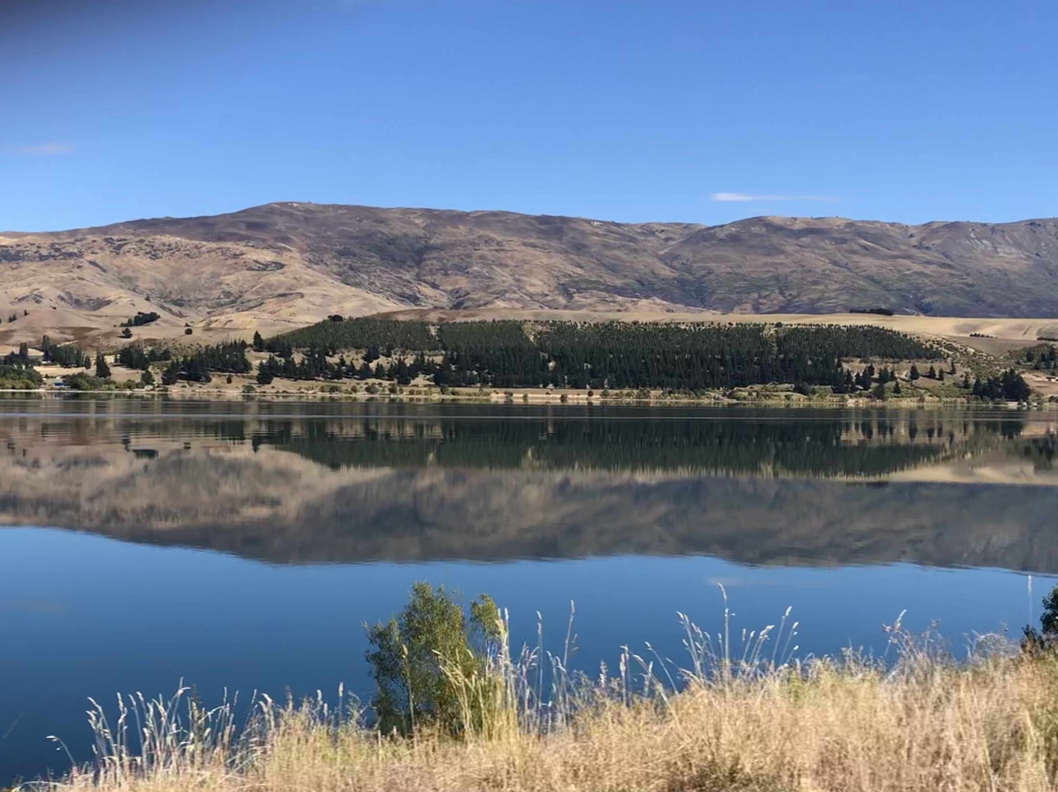
The long, gradual descent took us down to Lake Ruataniwha where we pulled up and had some lunch. The water of the lake was bright turquoise, but very clear. There were strange canals leading in and out of it. A mountain range was visible in the distance, and we’d been playing ‘spot Mount Cook’ as we’d got closer to the lake.
As we left, a huge white peak suddenly appeared – yep, that must be it! It was our companion for the rest of the journey to Lake Tekapo, gleaming white against the blue of the sky, practically cloudless now. We stopped a few times to take photographs of it from various angles.
We drove past the tiny airport from which we’ll take the flight tomorrow and then cruised through Lake Tekapo’s little town. This lake too was clear turquoise, and we realised it must be rock flour again, but settled out a little bit.
Finally we landed in Fairlie, refuelled and swapped the very light LPG bottle for a nice heavy new one. It must have been running on fumes for breakfast this morning!
It was a lovely site, quiet and peaceful, a warm welcome, and we enjoyed sitting in the sun next to our pitch until it was time for showering and dinner. And obsessive checking of tomorrow’s weather forecast – please let it be fine for the flight!
Motorhome day thirty-two: Fairlie
Up betimes, and on opening the blinds, a heart-sink moment to see only cloud. But wait. Not cloud! Just a bit of fog. Phew. We drove back to the airport in good time for our 11am flight, and the lady in reception told us it’s always foggy in Fairlie in the mornings!
The previous flight came back and disgorged six passengers beaming from ear to ear.
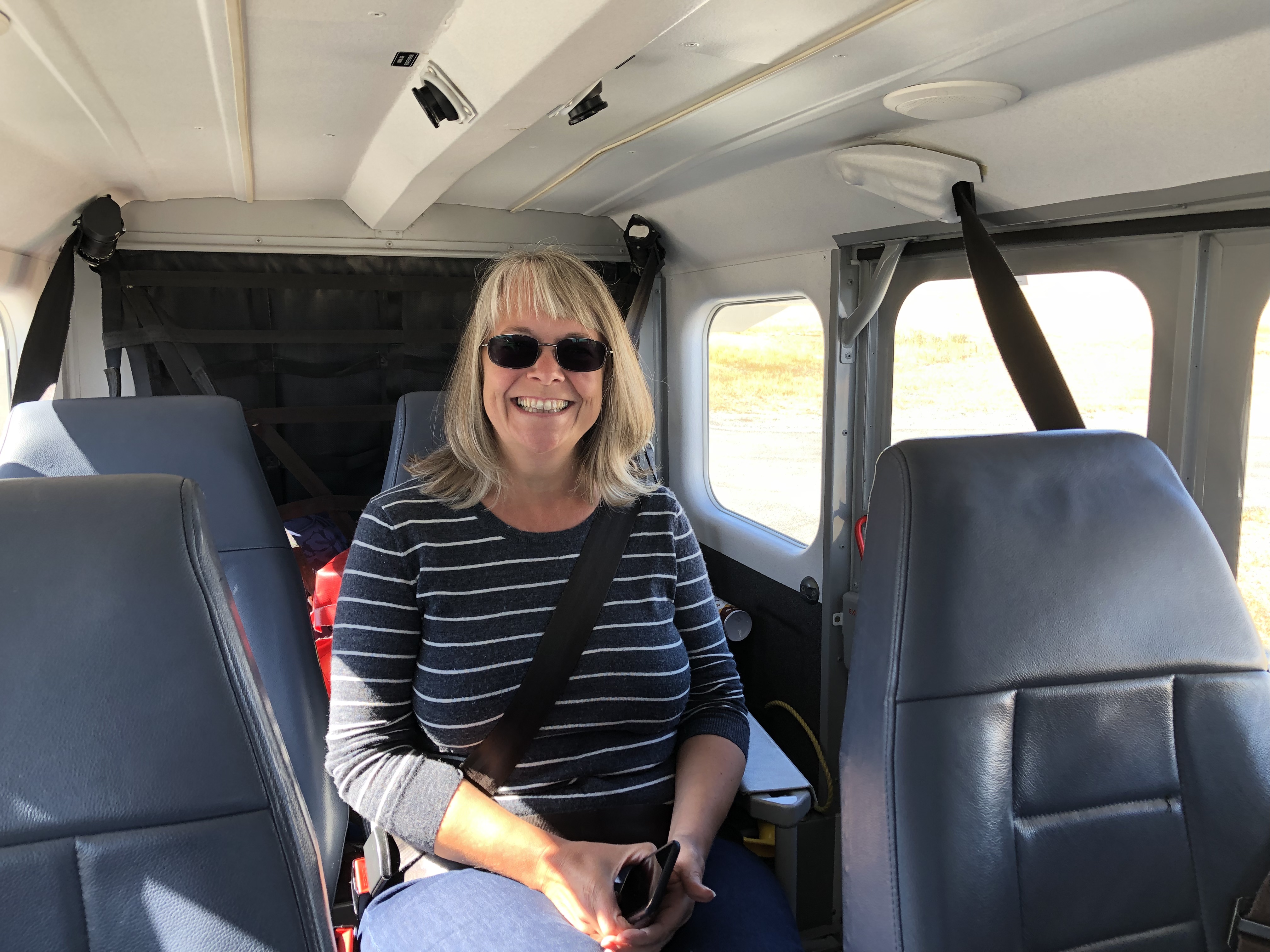
Our pilot, Justin, came to fetch us and took us out to the tiny plane.
As it turned out we were the only takers for this flight, so we had the whole thing to ourselves. Well, I say the whole thing – this is pretty much it:
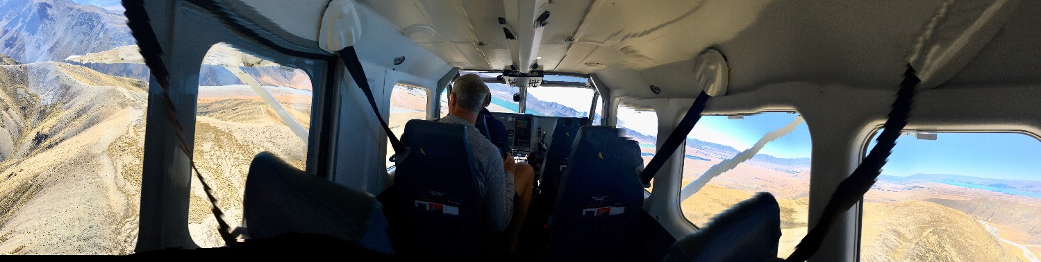 A quick safety briefing, a short trundle down the runway and we were in the air. We flew north over Lake Tekapo, which is the first in a series of lakes connected by canals in a huge hydroelectric scheme, we were told. That explained the canals we saw yesterday at Lake Ruataniwha, one of the lower lakes. Next to Lake Tekapo was Lake Alexandrina, a freshwater lake as opposed to a glacial lake, and the colour difference was striking.
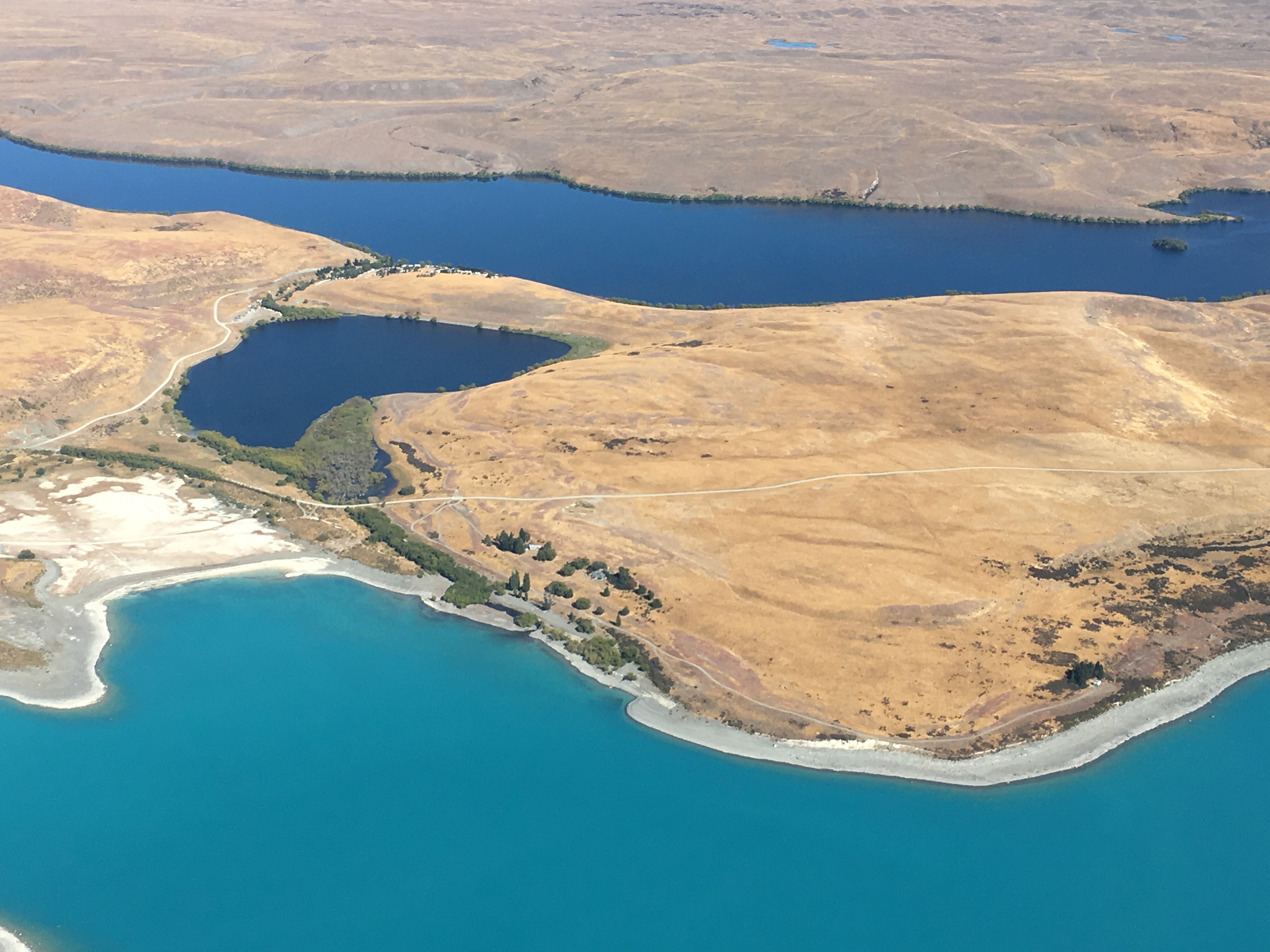
To the right were the fells of two enormous sheep stations, where the tough little Merino sheep spend their summers. At the top of the lake you could see the Godley River which feeds it, looking from the air eerily like veins.
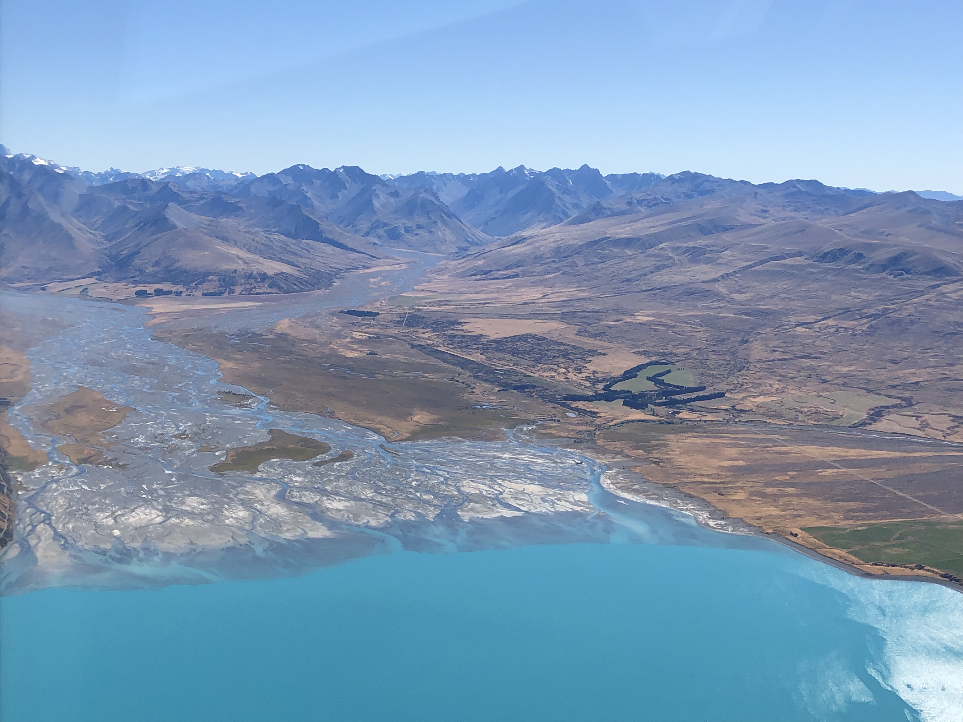
At its headwaters we saw the first glaciers, Godley and Murchison, and then the Tasman Glacier, the longest in New Zealand. Much of it is black towards the snout, covered in fallen moraine from the rock walls beside the glacier.
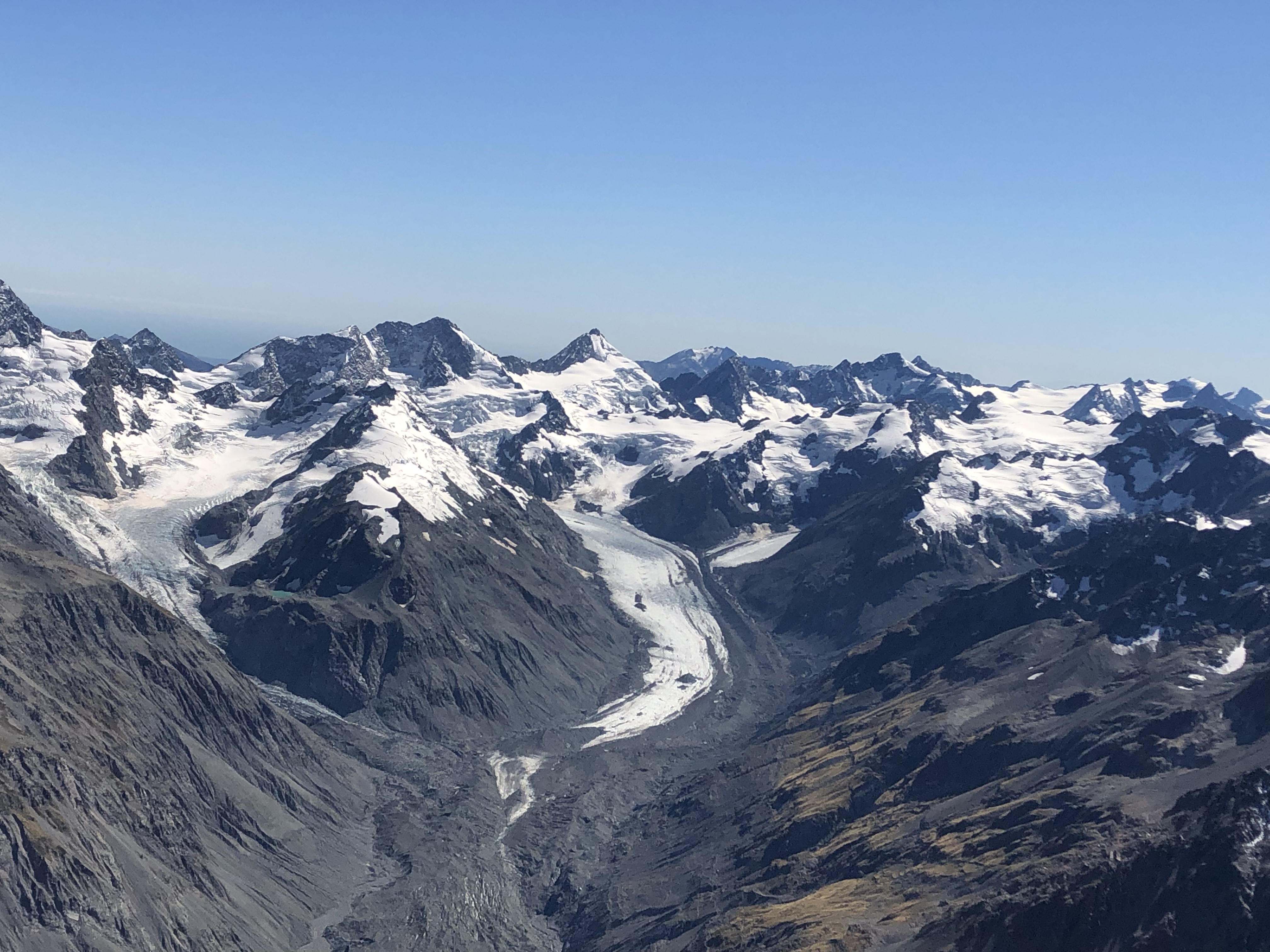
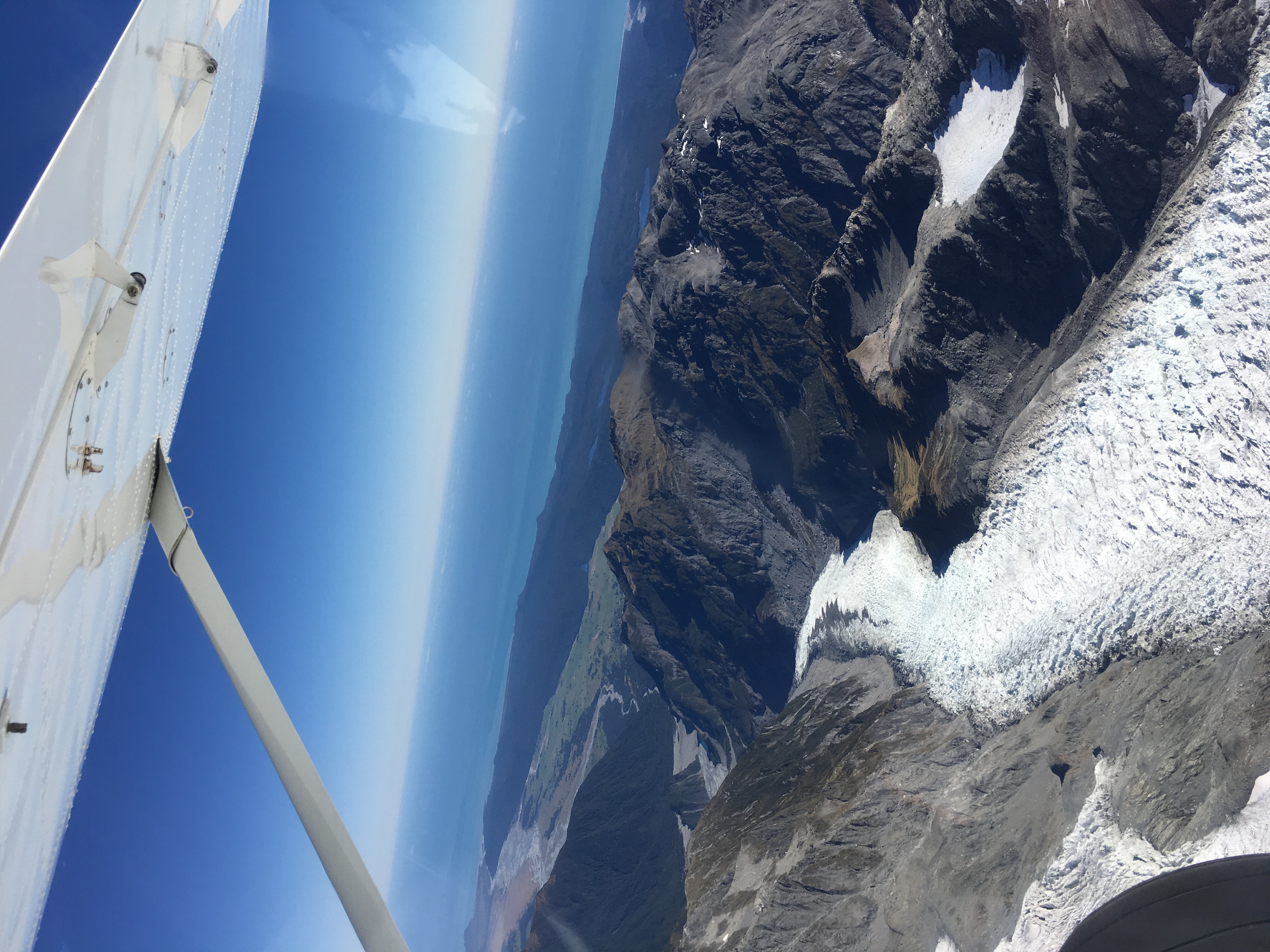
We slotted through what felt like a tiny gap and there was the top of the Franz Josef Glacier. We could see exactly where we’d walked up two weeks ago to look at it from the bottom.
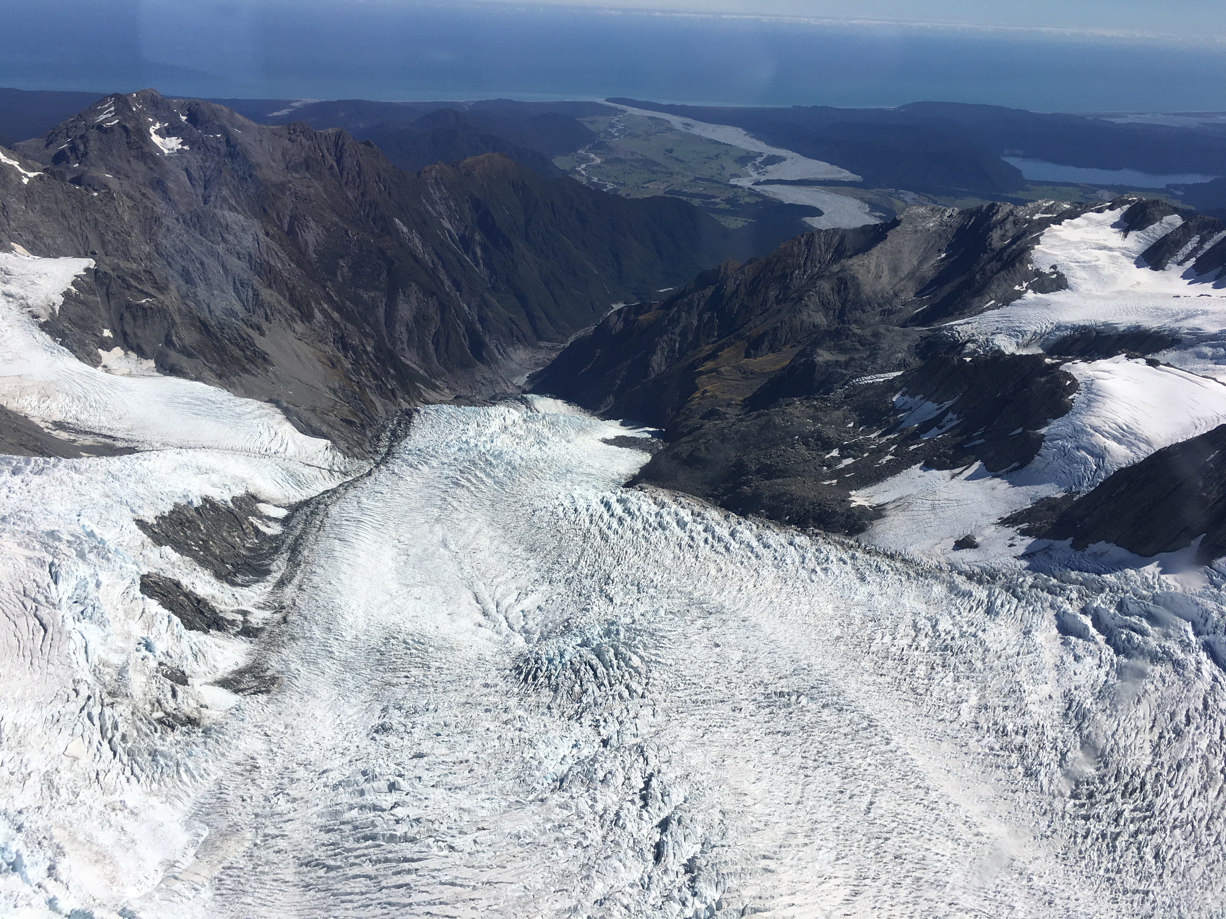
The row of spiky seracs at the top, where the glacier falls slowly over the cliff, were as striking from the air as they had been from the ground. Beyond the glacier it was possible to see all the way to the coast, past the ‘west coast rainforest’ and out to sea – we’d been so, so lucky with the weather.
And then, of course, right next door, was Fox Glacier, much easier to see from the plane than from the walk-in down below.
On our left now was Mount Tasman…
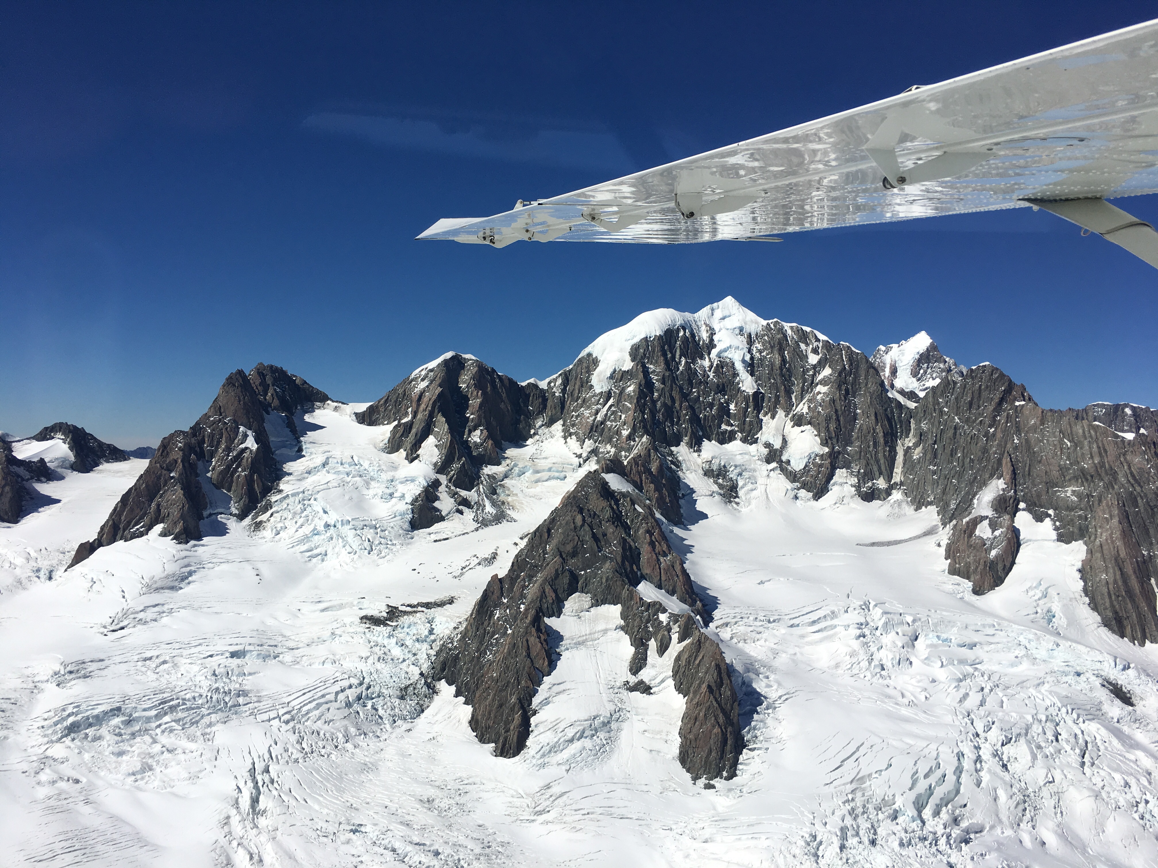
…and then the star of the show, Aoraki, in Māori ‘cloud-piercer’, also known as Mount Cook.
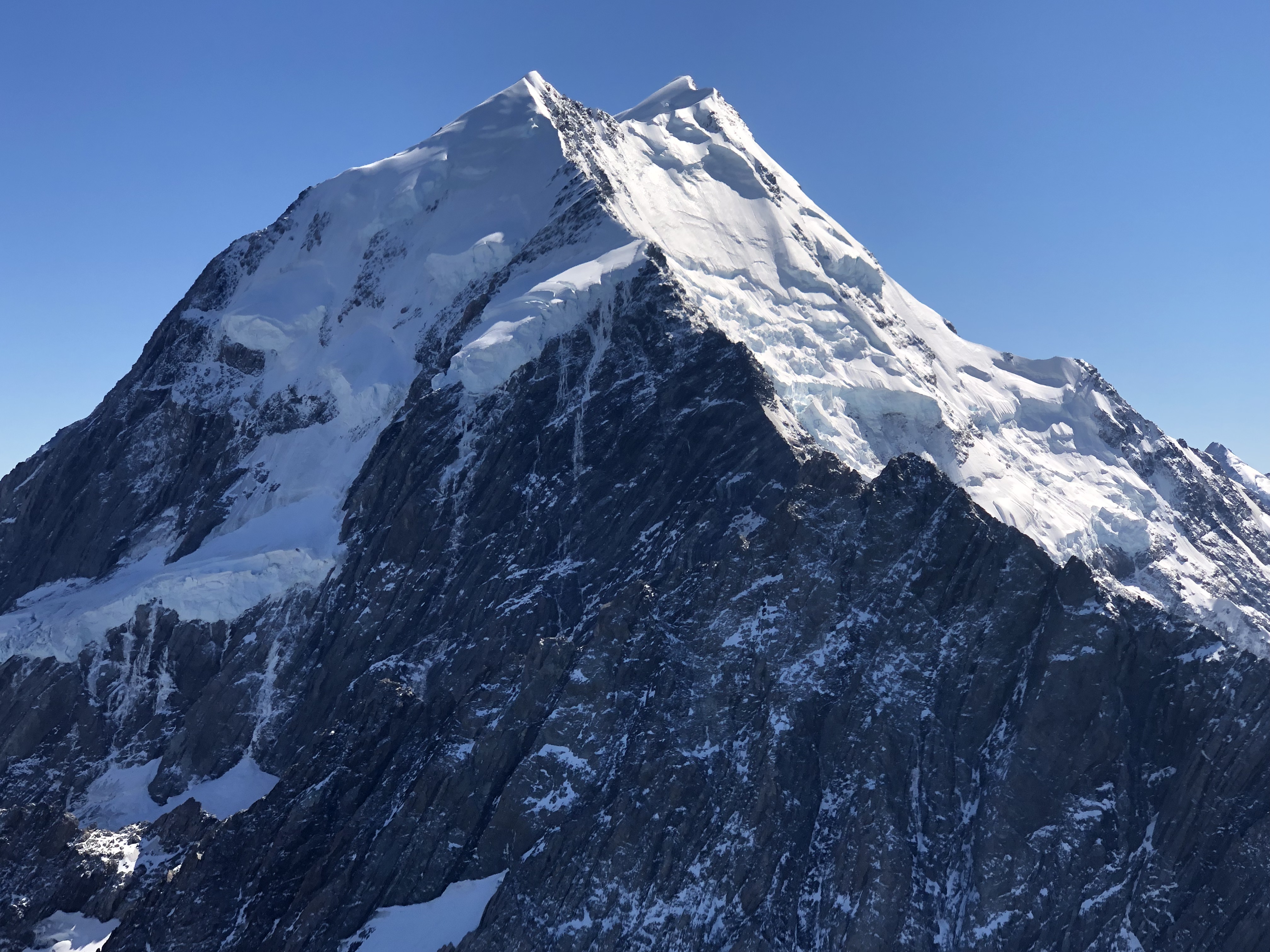
It felt like you could reach out and touch it, it was so close, although Justin told us later that we were at least 2km from it, there’s an exclusion zone to protect it. We flew right round it, and on its other side we could could see the Tasman Glacier again, but all of it in one view this time.
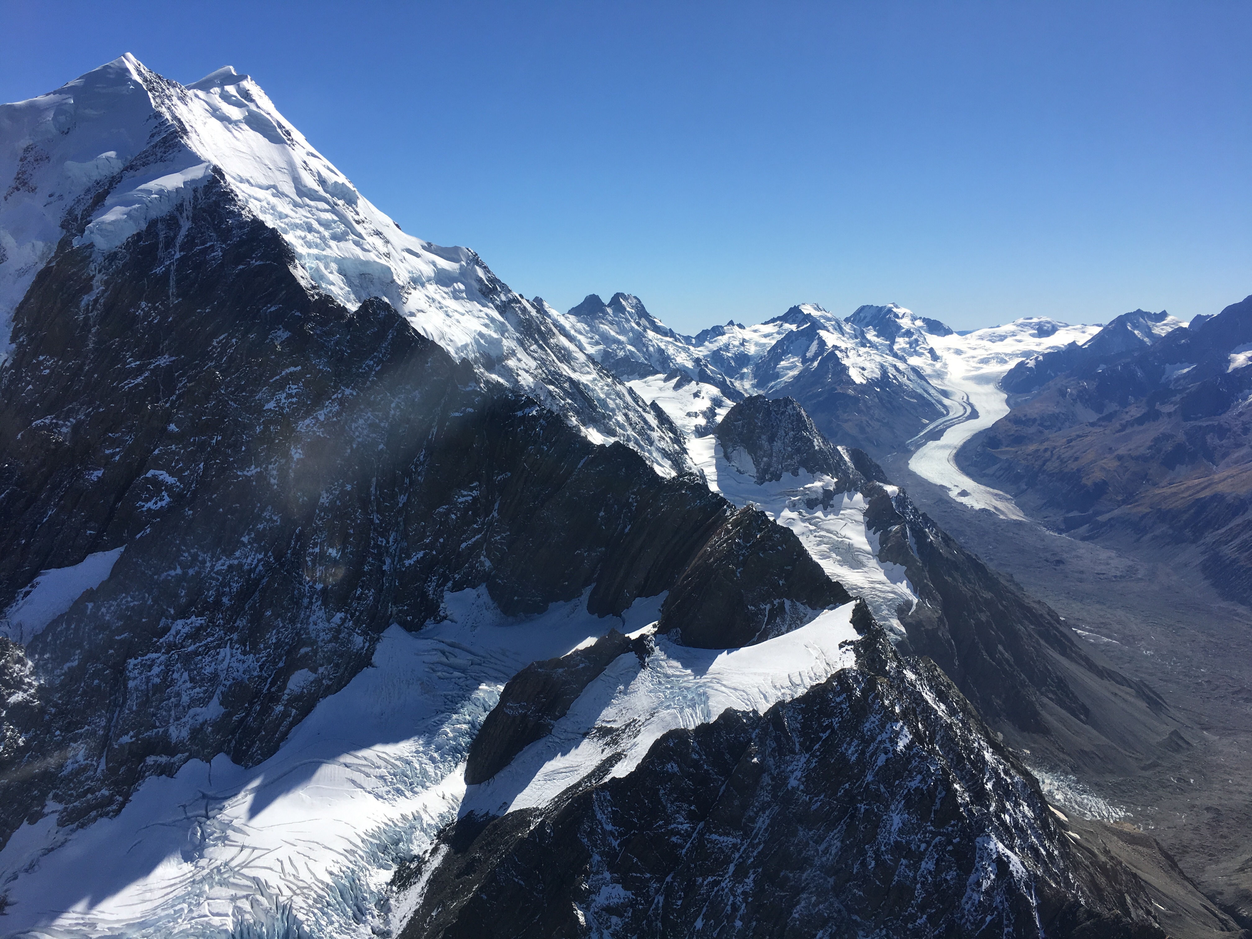
At its ice-face the lake was completely opaque, and full of icebergs which had calved from the snout of the glacier. It looked like a chocolate milkshake full of ice cubes!
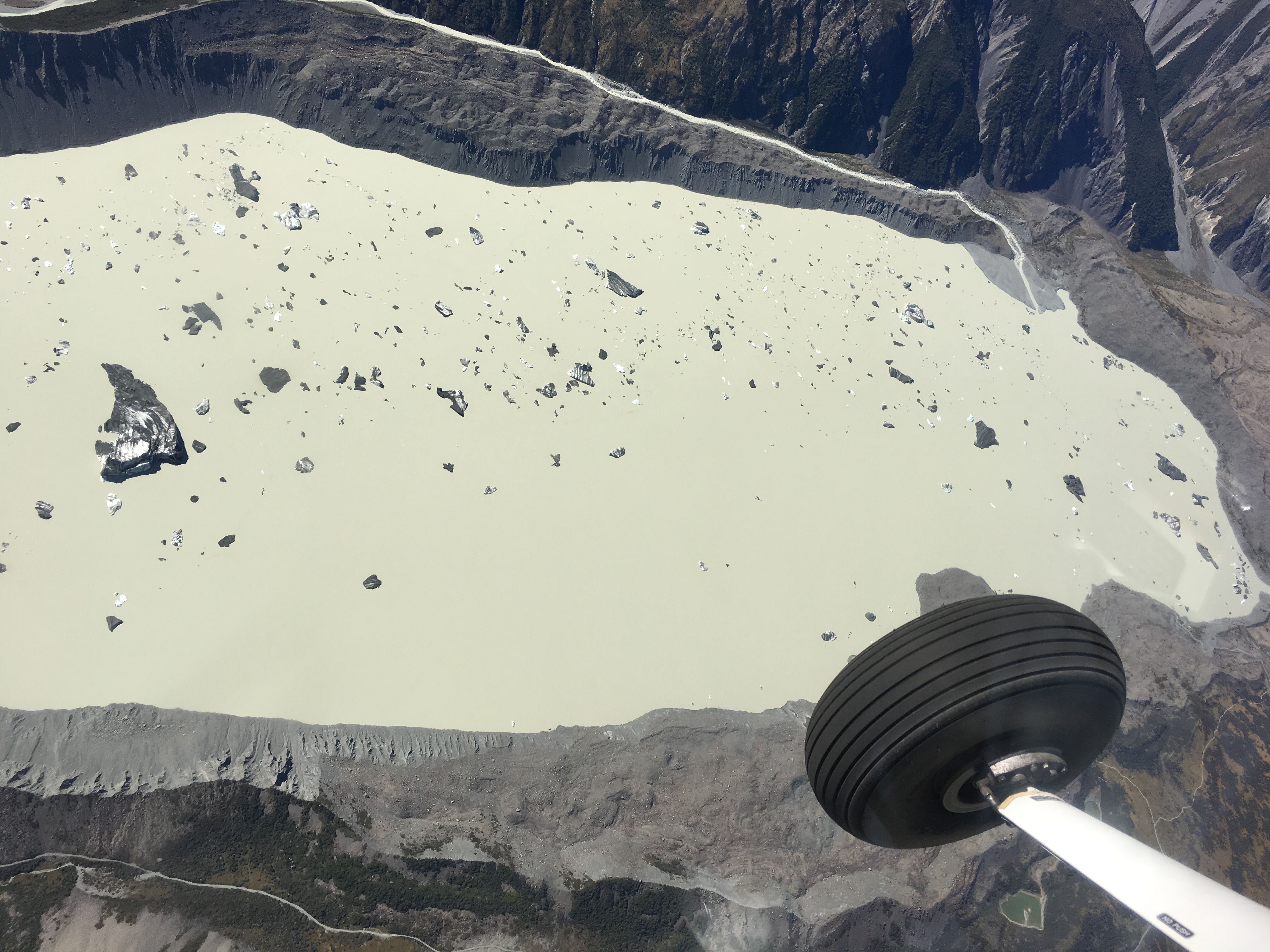
The guide we were given mentions that these icebergs have taken 500 years to make their way from the very top of the glacier to their current positions. Under the lake the ice is 200m thick.
We descended towards the airport, one last fly-past of Lakes Tekapo and Alexandrina, and onto the runway. We got out, both feeling a bit speechless after everything we’d seen. And beaming from ear to ear, of course.
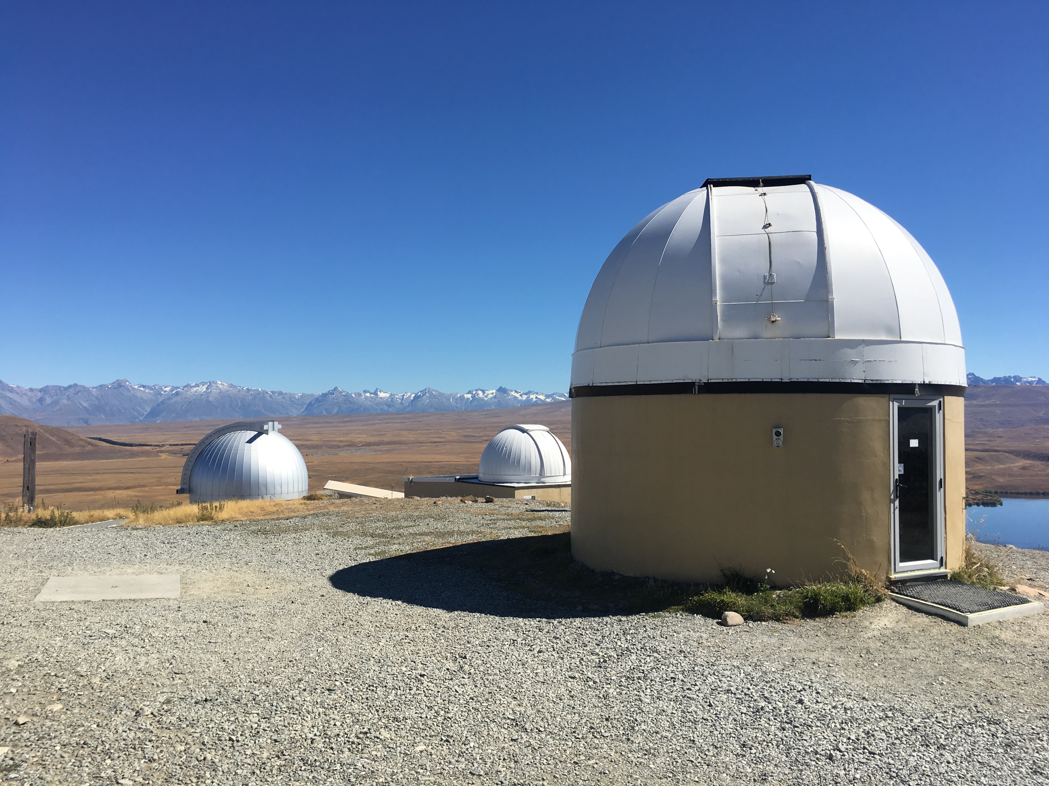
On the way back to Fairlie we popped in to the Mount St John observatory, situated on the top of a roche moutoneé, a very hard rock the glacier just couldn’t grind down. This area is designated a ‘dark sky reserve’, and there were five or six domes containing huge telescopes for astronomical research.
After lunch in Tekapo and a bit of merino shopping we were ready to drive back to Fairlie. Where, we were delighted to find, all the fog was long gone.
All looks amazing. Good job you’re keeping a record, so many experiences to remember. And Clare on a boat!!
Not only that, Clare on a boat with choppy waves! She coped admirably… You’re right about keeping a record – India seems a long time ago. Xx